
| Memorials | : | 4 |
| Location | : | Uttoxeter, East Staffordshire Borough, England |
| Phone | : | -1.87175 |
frequently asked questions (FAQ):
-
Where is Uttoxeter Cemetery?
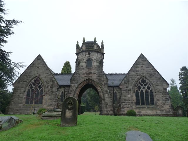
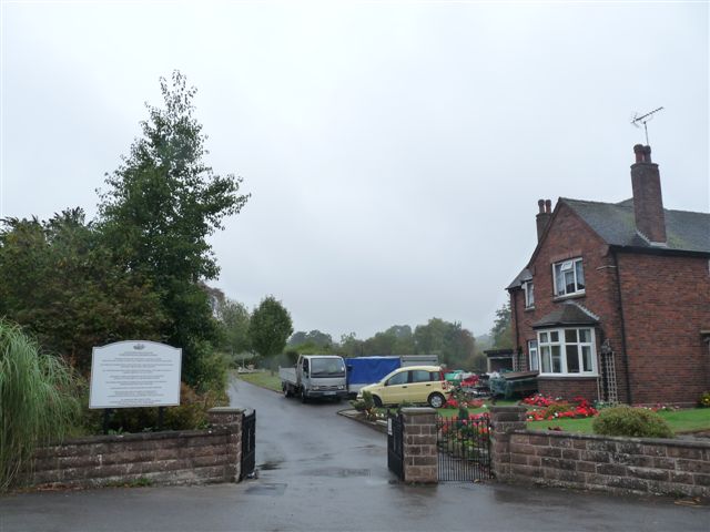
Uttoxeter Cemetery is located at No GPS information available Add GPSStafford Road Uttoxeter, East Staffordshire Borough ,Staffordshire , 52.89443England.
-
Uttoxeter Cemetery cemetery's updated grave count on graveviews.com?
4 memorials
Nearby Cemetories:
1. St. Leonard's Churchyard
Blithfield, East Staffordshire Borough, England
Coordinate: 52.8465144, -1.6519844
2. Saint Peter's Cemetery
Ellastone, East Staffordshire Borough, England
3. All Saints Churchyard
Leigh, East Staffordshire Borough, England
Coordinate: 52.7809957, -1.7236464
4. All Saints Churchyard
Rangemore, East Staffordshire Borough, England
Coordinate: 52.7958170, -1.6968150
5. Needwood, Christchurch
Tutbury, East Staffordshire Borough, England
Coordinate: 52.8963900, -1.9106400
6. Priory Church of St. Mary the Virgin
Tutbury, East Staffordshire Borough, England
7. St. James' Churchyard
Barton-under-Needwood, East Staffordshire Borough, England
Coordinate: 52.8630944, -1.9115108
8. RAF Fauld
Hanbury, East Staffordshire Borough, England
Coordinate: 53.0302050, -1.7650989
9. St Mary Churchyard
Hanbury, East Staffordshire Borough, England
Coordinate: 52.7960899, -1.6230323
10. St Werburgh's Church
Hanbury, East Staffordshire Borough, England
Coordinate: 52.8987700, -1.8624100
11. St John Churchyard
Marchington Woodlands, East Staffordshire Borough, England
12. Rolleston Cemetery
Rolleston-on-Dove, East Staffordshire Borough, England
Coordinate: 52.7844140, -1.7909000
13. St. Mary's Churchyard
Rolleston-on-Dove, East Staffordshire Borough, England
Coordinate: 52.8465144, -1.6519844
14. Chapelry of Tatenhill
Tatenhill, East Staffordshire Borough, England
15. St. Mary's Churchyard, Dunstall
Tatenhill, East Staffordshire Borough, England
Coordinate: 52.7809957, -1.7236464
16. St. Michael and All Angels Churchyard
Tatenhill, East Staffordshire Borough, England
Coordinate: 52.7958170, -1.6968150
17. St Lawrence Churchyard
Bramshall, East Staffordshire Borough, England
Coordinate: 52.8963900, -1.9106400
18. All Saints Churchyard
Denstone, East Staffordshire Borough, England
19. St. John the Baptist Churchyard
Kingstone, East Staffordshire Borough, England
Coordinate: 52.8630944, -1.9115108
20. All Saints Church
Okeover, East Staffordshire Borough, England
Coordinate: 53.0302050, -1.7650989
21. St. Peter's Parish Churchyard
Stapenhill, East Staffordshire Borough, England
Coordinate: 52.7960899, -1.6230323
22. Saint Mary the Virgin Churchyard
Uttoxeter, East Staffordshire Borough, England
Coordinate: 52.8987700, -1.8624100
23. St Lawrence Churchyard
Uttoxeter, East Staffordshire Borough, England
24. Catholic Church of Saint Francis of Sales
Yoxall, East Staffordshire Borough, England
Coordinate: 52.7844140, -1.7909000