
| Memorials | : | 0 |
| Location | : | Peak Forest, High Peak Borough, England |
| Coordinate | : | 53.3116840, -1.8302360 |
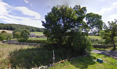
| Description | : | Cemeteries This Chapel had a graveyard Church History This Place of Worship was founded in 1850, but we understand it was closed in 2006. The chapel is now a private residence, but the churchyard is still accessible and in excellent condition. |
frequently asked questions (FAQ):
-
Where is Wesleyan Chapel?
Wesleyan Chapel is located at Chuch Lane Peak Forest, High Peak Borough ,Derbyshire ,England.
-
Wesleyan Chapel cemetery's updated grave count on graveviews.com?
0 memorials
-
Where are the coordinates of the Wesleyan Chapel?
Latitude: 53.3116840
Longitude: -1.8302360
Nearby Cemetories:
1. Charles King and Martyr Parish Churchyard
Peak Forest, High Peak Borough, England
Coordinate: 53.3095830, -1.8303960
2. St Paul Churchyard
Dove Holes, High Peak Borough, England
Coordinate: 53.3007950, -1.8859330
3. Dove Holes Methodist Churchyard
Dove Holes, High Peak Borough, England
Coordinate: 53.2975100, -1.8878900
4. St. Edmund's Churchyard
Castleton, High Peak Borough, England
Coordinate: 53.3428300, -1.7758600
5. St John the Baptist Tideswell
Tideswell, Derbyshire Dales District, England
Coordinate: 53.2785640, -1.7728500
6. St Margaret
Wormhill, High Peak Borough, England
Coordinate: 53.2646730, -1.8154230
7. Tideswell Parish Council Cemetery
Tideswell, Derbyshire Dales District, England
Coordinate: 53.2846630, -1.7639730
8. Edale Methodist Chapel
Edale, High Peak Borough, England
Coordinate: 53.3601000, -1.8315000
9. Immaculate Heart of Mary, Roman Catholic Chapel
Tideswell, Derbyshire Dales District, England
Coordinate: 53.2761640, -1.7741580
10. Town End Methodist Churchyard
Chapel-en-le-Frith, High Peak Borough, England
Coordinate: 53.3246590, -1.9090850
11. St Thomas A Beckett Churchyard
Chapel-en-le-Frith, High Peak Borough, England
Coordinate: 53.3243340, -1.9148240
12. Methodist Chapel Graveyard
Bradwell, Derbyshire Dales District, England
Coordinate: 53.3264690, -1.7417860
13. Bethlehem Churchyard
Bradwell, Derbyshire Dales District, England
Coordinate: 53.3277120, -1.7417070
14. St Barnabas Churchyard
Bradwell, Derbyshire Dales District, England
Coordinate: 53.3263560, -1.7387040
15. Trot Lane Private Cemetery
Foolow, Derbyshire Dales District, England
Coordinate: 53.2872651, -1.7434660
16. Chinley Independent Chapelyard
Chapel-en-le-Frith, High Peak Borough, England
Coordinate: 53.3349830, -1.9182290
17. Church of the Holy and Undivided Trinity
Edale, High Peak Borough, England
Coordinate: 53.3688190, -1.8154910
18. Methodist Churchyard
Great Hucklow, Derbyshire Dales District, England
Coordinate: 53.2970009, -1.7330000
19. Litton Cemetery
Litton, Derbyshire Dales District, England
Coordinate: 53.2654380, -1.7573610
20. St Peter's Churchyard
Hope, High Peak Borough, England
Coordinate: 53.3476570, -1.7424920
21. St Peter's Churchyard
Fairfield, High Peak Borough, England
Coordinate: 53.2642220, -1.9012830
22. White Knowle Methodist Chapel
Chinley, High Peak Borough, England
Coordinate: 53.3427389, -1.9242500
23. Hope Cemetery
Hope, High Peak Borough, England
Coordinate: 53.3523100, -1.7418640
24. Christ Churchyard
Kings Sterndale, High Peak Borough, England
Coordinate: 53.2421800, -1.8617860