
| Memorials | : | 0 |
| Location | : | Wagontown, Chester County, USA |
| Coordinate | : | 40.0109000, -75.8694000 |
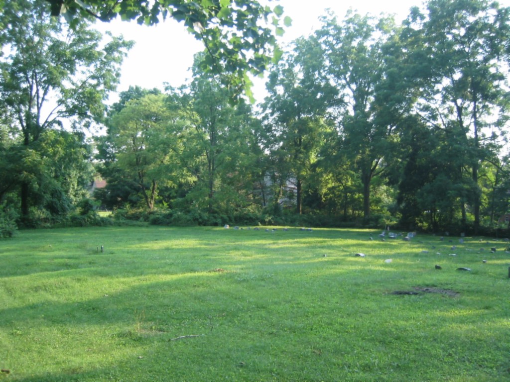
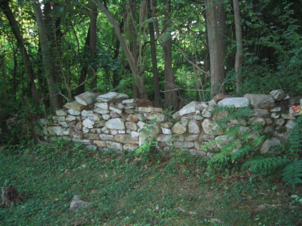
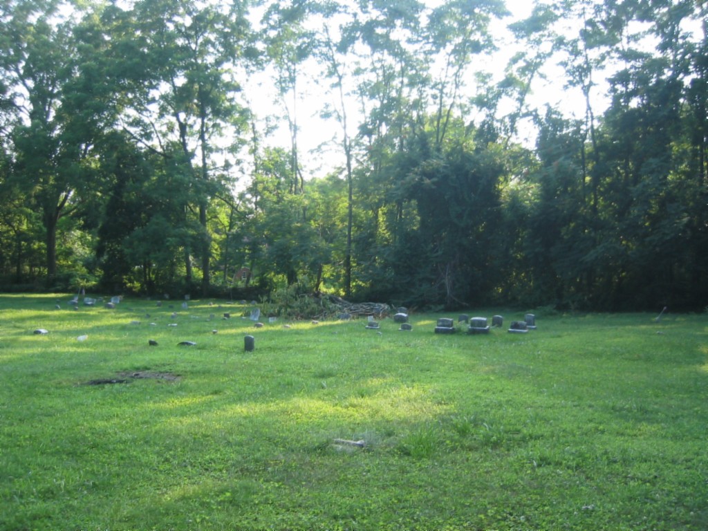
| Description | : | West Caln Meeting Cemetery is located just west of the West Caln Township building on route 340, aka Kings Highway. The Meeting house is long gone. This is NOT the same as Caln Meeting, aka Old Caln Meeting. Although Caln Meeting is on route 340, it is many miles East of this site. The cemetery is hidden on the same side of the road as the Township Building. Park in an abandoned home driveway directly across from a pool and spa company. |
frequently asked questions (FAQ):
-
Where is West Caln Friends Burial Ground?
West Caln Friends Burial Ground is located at Wagontown, Chester County ,Pennsylvania ,USA.
-
West Caln Friends Burial Ground cemetery's updated grave count on graveviews.com?
0 memorials
-
Where are the coordinates of the West Caln Friends Burial Ground?
Latitude: 40.0109000
Longitude: -75.8694000
Nearby Cemetories:
1. Dawson Family Cemetery
West Caln Township, Chester County, USA
Coordinate: 40.0009930, -75.8796790
2. West Caln Baptist Cemetery
Wagontown, Chester County, USA
Coordinate: 40.0172005, -75.8491974
3. Beth Israel Cemetery
Coatesville, Chester County, USA
Coordinate: 40.0053497, -75.8470131
4. Saint Stanislaus Kostka Polish Catholic Cemetery
Coatesville, Chester County, USA
Coordinate: 40.0046349, -75.8459930
5. Hibernia United Methodist Cemetery
Cedar Knoll, Chester County, USA
Coordinate: 40.0250015, -75.8339005
6. Holy Ghost Ukrainian Orthodox Cemetery
Valley Township, Chester County, USA
Coordinate: 39.9805984, -75.8516998
7. New Evergreen Cemetery
Coatesville, Chester County, USA
Coordinate: 39.9810220, -75.8495130
8. Saint Nicholas Russian Orthodox Cemetery
Coatesville, Chester County, USA
Coordinate: 39.9794000, -75.8516000
9. Sandy Hill African Methodist Episcopal Cemetery
West Caln Township, Chester County, USA
Coordinate: 40.0185200, -75.9133000
10. Sandy Hill Mennonite Cemetery
West Caln Township, Chester County, USA
Coordinate: 40.0094000, -75.9157000
11. Beacon Light Amish Cemetery
West Caln Township, Chester County, USA
Coordinate: 40.0071070, -75.9274910
12. East Sadsbury Friends Burial Ground
Parkesburg, Chester County, USA
Coordinate: 39.9796490, -75.9149740
13. Coatesville Presbyterian Cemetery
Coatesville, Chester County, USA
Coordinate: 39.9831543, -75.8184738
14. Saint Cecelia's Roman Catholic Cemetery
Coatesville, Chester County, USA
Coordinate: 39.9906006, -75.8114014
15. Upper Octorara New Side Presbyterian Cemetery
Sadsbury Township, Chester County, USA
Coordinate: 39.9667300, -75.9001400
16. Upper Octorara Presbyterian Church Cemetery
Sadsbury Township, Chester County, USA
Coordinate: 39.9742012, -75.9163971
17. Zion African Union Cemetery
West Caln Township, Chester County, USA
Coordinate: 40.0490479, -75.9218970
18. Fairview Cemetery
Coatesville, Chester County, USA
Coordinate: 39.9789009, -75.8071976
19. Saint John's Episcopal Church Cemetery
Compass, Chester County, USA
Coordinate: 40.0229111, -75.9439392
20. All Souls Cemetery
Coatesville, Chester County, USA
Coordinate: 40.0540340, -75.8121820
21. Forks of the Brandywine Seceder Cemetery
Glenmoore, Chester County, USA
Coordinate: 40.0592003, -75.8161011
22. Fallowfield Orthodox Friends Burial Ground
Ercildoun, Chester County, USA
Coordinate: 39.9485240, -75.8412000
23. Our Lady of the Seven Dolors Roman Catholic Cemetery
Parkesburg, Chester County, USA
Coordinate: 39.9632912, -75.9295197
24. Bawa Muhaiyaddeen Fellowship Farm Grounds Cemetery
Coatesville, Chester County, USA
Coordinate: 39.9447330, -75.8618150