
| Memorials | : | 0 |
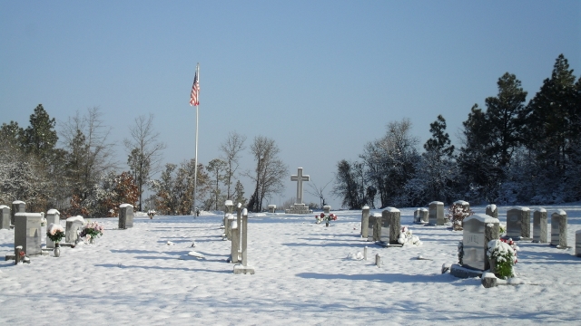
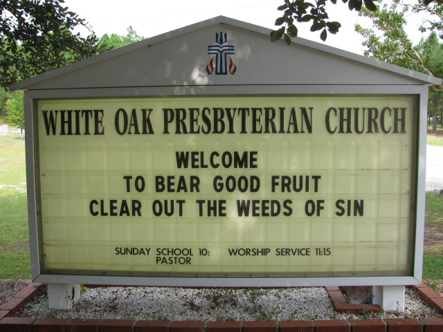
| Location | : | Ruby, Chesterfield County, USA |
| Coordinate | : | 34.6838420, -80.1955870 |
| Description | : | directions: Take Highway 109 south from Ruby, S.C. Go through the Highway 265 and Highway 109 intersection. Continue south on Highway 109. Turn left onto Angelus Road. Church and cemetery are on the left immediately after turning left. |
frequently asked questions (FAQ):
-
Where is White Oak Presbyterian Church Cemetery?
White Oak Presbyterian Church Cemetery is located at Ruby, Chesterfield County ,South Carolina ,USA.
-
White Oak Presbyterian Church Cemetery cemetery's updated grave count on graveviews.com?
0 memorials
-
Where are the coordinates of the White Oak Presbyterian Church Cemetery?
Latitude: 34.6838420
Longitude: -80.1955870


Nearby Cemetories:
1. Sweet Home Missionary Baptist Church Cemetery
Ruby, Chesterfield County, USA
Coordinate: 34.6867220, -80.1862370
2. Clanton Plains Baptist Church Cemetery
Ruby, Chesterfield County, USA
Coordinate: 34.6666410, -80.1897880
3. McNair Family Cemetery
Ruby, Chesterfield County, USA
Coordinate: 34.6734700, -80.2169380
4. Douglas Mill Baptist Church Cemetery
Ruby, Chesterfield County, USA
Coordinate: 34.6904940, -80.1658090
5. Watson Cemetery
Ruby, Chesterfield County, USA
Coordinate: 34.7093120, -80.2077910
6. Douglass Cemetery
Chesterfield, Chesterfield County, USA
Coordinate: 34.6970650, -80.1429240
7. Mount Olive Missionary Baptist Church Cemetery
Chesterfield, Chesterfield County, USA
Coordinate: 34.6977490, -80.1425870
8. Cross Roads Baptist Church Cemetery
Ruby, Chesterfield County, USA
Coordinate: 34.7182999, -80.2386017
9. Rock Springs Baptist Church Cemetery
Ruby, Chesterfield County, USA
Coordinate: 34.7338650, -80.1962580
10. Gulledge Cemetery
Ruby, Chesterfield County, USA
Coordinate: 34.7370540, -80.2192710
11. Campbell Family Cemetery
Chesterfield, Chesterfield County, USA
Coordinate: 34.6254210, -80.1894170
12. Ruby Church of God Cemetery
Ruby, Chesterfield County, USA
Coordinate: 34.7406250, -80.2151300
13. Mount Airy A.M.E. Zion Church Cemetery
Chesterfield, Chesterfield County, USA
Coordinate: 34.7315780, -80.1514510
14. Smith Cemetery
Ruby, Chesterfield County, USA
Coordinate: 34.7449670, -80.2004310
15. Smith Family Cemetery
Ruby, Chesterfield County, USA
Coordinate: 34.7451960, -80.1958290
16. Hopewell Baptist Church Cemetery
Chesterfield, Chesterfield County, USA
Coordinate: 34.7330600, -80.1486970
17. Ruby Cemetery
Ruby, Chesterfield County, USA
Coordinate: 34.7447014, -80.1769028
18. Smith Cemetery
Chesterfield, Chesterfield County, USA
Coordinate: 34.6902510, -80.1195570
19. Smith Cemetery
Ruby, Chesterfield County, USA
Coordinate: 34.7451040, -80.1773000
20. Brantley Family Cemetery
Ruby, Chesterfield County, USA
Coordinate: 34.7468360, -80.1879220
21. Roscoe-Cassidy Cemetery
Campbell Crossroads, Chesterfield County, USA
Coordinate: 34.6272011, -80.1577988
22. Melton Family Cemetery
Ruby, Chesterfield County, USA
Coordinate: 34.7428650, -80.1607650
23. Bethel United Methodist Church Cemetery
Ruby, Chesterfield County, USA
Coordinate: 34.6229840, -80.1655590
24. Campbell Cemetery
Ruby, Chesterfield County, USA
Coordinate: 34.7502340, -80.1913550