
| Memorials | : | 0 |
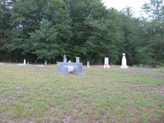
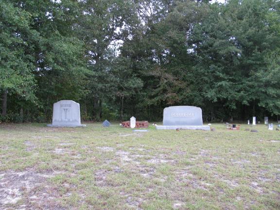
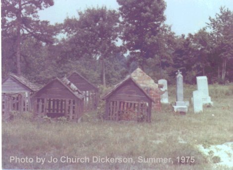
| Location | : | Ruby, Chesterfield County, USA |
| Coordinate | : | 34.7370540, -80.2192710 |
| Description | : | Directions: Take Highway 109 south from Ruby, S.C. Turn right onto Highway 265. Take Highway 265 to Walter Gulledge Road. Turn right onto Walter Gulledge Road. Then turn right onto Gulledge Cemetery Road which is dirt. Cemetery is on the right. |
frequently asked questions (FAQ):
-
Where is Gulledge Cemetery?
Gulledge Cemetery is located at Ruby, Chesterfield County ,South Carolina ,USA.
-
Gulledge Cemetery cemetery's updated grave count on graveviews.com?
0 memorials
-
Where are the coordinates of the Gulledge Cemetery?
Latitude: 34.7370540
Longitude: -80.2192710
Nearby Cemetories:
1. Ruby Church of God Cemetery
Ruby, Chesterfield County, USA
Coordinate: 34.7406250, -80.2151300
2. Gulledge Cemetery
Mount Croghan, Chesterfield County, USA
Coordinate: 34.7516890, -80.2247430
3. Smith Cemetery
Ruby, Chesterfield County, USA
Coordinate: 34.7449670, -80.2004310
4. Rock Springs Baptist Church Cemetery
Ruby, Chesterfield County, USA
Coordinate: 34.7338650, -80.1962580
5. Smith Family Cemetery
Ruby, Chesterfield County, USA
Coordinate: 34.7451960, -80.1958290
6. Cross Roads Baptist Church Cemetery
Ruby, Chesterfield County, USA
Coordinate: 34.7182999, -80.2386017
7. Sellers Cemetery
Ruby, Chesterfield County, USA
Coordinate: 34.7590400, -80.2025340
8. Campbell Cemetery
Ruby, Chesterfield County, USA
Coordinate: 34.7502340, -80.1913550
9. Brantley Family Cemetery
Ruby, Chesterfield County, USA
Coordinate: 34.7468360, -80.1879220
10. Watson Cemetery
Ruby, Chesterfield County, USA
Coordinate: 34.7093120, -80.2077910
11. Hancock Cemetery
Ruby, Chesterfield County, USA
Coordinate: 34.7579830, -80.1923260
12. Mount Croghan Memorial Park
Mount Croghan, Chesterfield County, USA
Coordinate: 34.7686005, -80.2244034
13. Mount Croghan United Methodist Church Cemetery
Mount Croghan, Chesterfield County, USA
Coordinate: 34.7686430, -80.2240780
14. Lamb of God Outreach Ministries Church Cemetery
Mount Croghan, Chesterfield County, USA
Coordinate: 34.7699190, -80.2325430
15. Smith Cemetery
Ruby, Chesterfield County, USA
Coordinate: 34.7451040, -80.1773000
16. Ruby Cemetery
Ruby, Chesterfield County, USA
Coordinate: 34.7447014, -80.1769028
17. Elizabeth Baptist Church Cemetery
Mount Croghan, Chesterfield County, USA
Coordinate: 34.7806015, -80.2130966
18. Piney Grove A.M.E. Zion Church Cemetery
Mount Croghan, Chesterfield County, USA
Coordinate: 34.7406480, -80.2731540
19. Gulledge Family Cemetery
Ruby, Chesterfield County, USA
Coordinate: 34.7685860, -80.1802830
20. Timmonsville Baptist Church Cemetery Old
Mount Croghan, Chesterfield County, USA
Coordinate: 34.7789940, -80.1903360
21. Melton Family Cemetery
Ruby, Chesterfield County, USA
Coordinate: 34.7428650, -80.1607650
22. Timmonsville Baptist Church Cemetery
Mount Croghan, Chesterfield County, USA
Coordinate: 34.7825050, -80.1944070
23. Center Grove Baptist Church
Mount Croghan, Chesterfield County, USA
Coordinate: 34.7682330, -80.2704480
24. Sellers Family Cemetery
Chesterfield, Chesterfield County, USA
Coordinate: 34.7437060, -80.1537960