
| Memorials | : | 0 |
| Location | : | Hernando, DeSoto County, USA |
| Coordinate | : | 34.7348500, -90.0499300 |
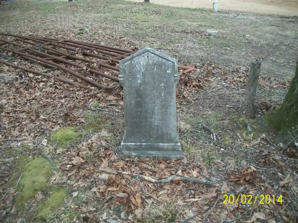
| Description | : | R8W, T4S, Sec 16 - property owned by Edward Sharp in 1983. It was located at the South end of Airport Road, off Wheeler Road. There is a single grave on private property. The current land owner discovered the grave marker while clearing brush and has kept the area around it clean. From the south end of Airport Rd. E., Hernando, MS 38632, angle right onto the property. Proceed past the first house and stop at the second house before the barn and corral. The grave is in front and to the right of the house just behind... Read More |
frequently asked questions (FAQ):
-
Where is William Grant Merritt Cemetery?
William Grant Merritt Cemetery is located at 8598 Airport Road E Hernando, DeSoto County ,Mississippi ,USA.
-
William Grant Merritt Cemetery cemetery's updated grave count on graveviews.com?
0 memorials
-
Where are the coordinates of the William Grant Merritt Cemetery?
Latitude: 34.7348500
Longitude: -90.0499300
Nearby Cemetories:
1. Solomon Cemetery
Hernando, DeSoto County, USA
Coordinate: 34.7281240, -90.0259670
2. Moore Family Cemetery
Hernando, DeSoto County, USA
Coordinate: 34.7441050, -90.0233790
3. Zion Hill Missionary Baptist Church Cemetery
Robinson Gin, DeSoto County, USA
Coordinate: 34.7655260, -90.0242000
4. Antioch M.B. Church Cemetery #2
Coldwater, Tate County, USA
Coordinate: 34.6852450, -90.0432750
5. McAninch Family Cemetery
Love, DeSoto County, USA
Coordinate: 34.7342500, -89.9880830
6. Perry Cemetery
DeSoto County, USA
Coordinate: 34.7334950, -89.9880360
7. Robertson Family Cemetery
Hernando, DeSoto County, USA
Coordinate: 34.7850740, -90.0318010
8. Mount Calm Missionary Baptist Church Cemetery
Coldwater, Tate County, USA
Coordinate: 34.6828210, -90.0697970
9. Hopewell Cemetery
Arkabutla, Tate County, USA
Coordinate: 34.7042870, -90.1106630
10. Pleasant Hill MB Church Cemetery
Pleasant Hill, DeSoto County, USA
Coordinate: 34.7863640, -90.0852230
11. Love Family Cemetery
Hernando, DeSoto County, USA
Coordinate: 34.7457610, -89.9764740
12. Brown Family Cemetery
Hernando, DeSoto County, USA
Coordinate: 34.7933040, -90.0769560
13. Brooks Chapel Cemetery
Arkabutla, Tate County, USA
Coordinate: 34.6706650, -90.0388020
14. Ella Green Baptist Church Cemetery
Coldwater, Tate County, USA
Coordinate: 34.7416920, -90.1293610
15. Love Cemetery
Hernando, DeSoto County, USA
Coordinate: 34.7600740, -89.9697020
16. McGaha Cemetery
Arkabutla, Tate County, USA
Coordinate: 34.6846310, -90.1199010
17. Oak Grove Church Cemetery
Hernando, DeSoto County, USA
Coordinate: 34.8092190, -90.0782130
18. Farley Cemetery
DeSoto County, USA
Coordinate: 34.7841988, -89.9721985
19. Cameron Road Jehovah Witness Cemetery
Coldwater, Tate County, USA
Coordinate: 34.6591845, -90.0048373
20. Magnolia Cemetery
Coldwater, Tate County, USA
Coordinate: 34.6989420, -89.9568420
21. New Pleasant Hill MB Church Cemetery
Arkabutla, Tate County, USA
Coordinate: 34.7136680, -90.1506790
22. Wheeler Cemetery
Hernando, DeSoto County, USA
Coordinate: 34.7984270, -89.9801780
23. Surretts Cemetery
Arkabutla, Tate County, USA
Coordinate: 34.6845870, -90.1369790
24. Edwards Chapel Cemetery
Coldwater, Tate County, USA
Coordinate: 34.6847100, -89.9618800