
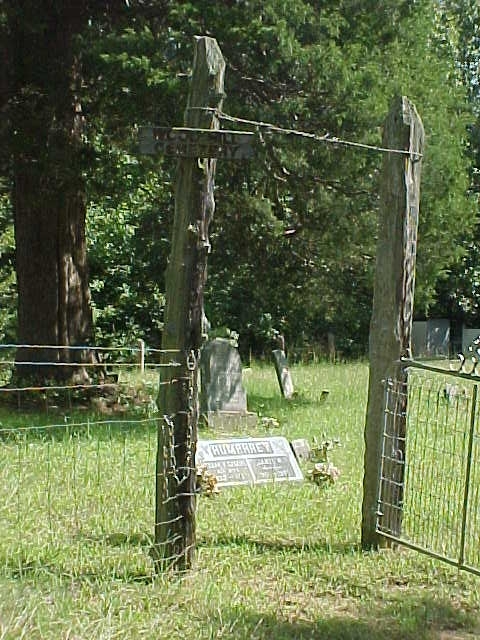
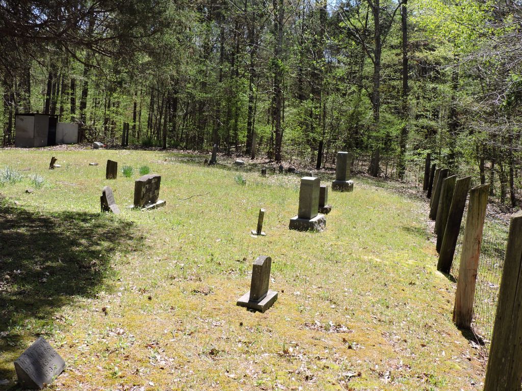
| Memorials | : | 1 |
| Location | : | Cedar Grove, Carroll County, USA |
| Coordinate | : | 35.8041440, -88.6211750 |
| Description | : | From the intersection of US-70 W & TN-104 in Cedar Grove, travel southwest on US-70 W for 1.8 mi., turning south (left) onto Wood Cemetery Ln, going about 150 yd., turning southeast (slightly left) going about another 150 yd. to the cemetery. |
frequently asked questions (FAQ):
-
Where is Wood Hill Cemetery?
Wood Hill Cemetery is located at Wood Cemetery Lane Cedar Grove, Carroll County ,Tennessee , 38305USA.
-
Wood Hill Cemetery cemetery's updated grave count on graveviews.com?
1 memorials
-
Where are the coordinates of the Wood Hill Cemetery?
Latitude: 35.8041440
Longitude: -88.6211750
Nearby Cemetories:
1. Lebanon Methodist Church Cemetery
Jackson, Madison County, USA
Coordinate: 35.7883540, -88.6222740
2. Manning Cemetery
Lavinia, Carroll County, USA
Coordinate: 35.8209170, -88.6414530
3. Kirk Family Cemetery
Cedar Grove, Henderson County, USA
Coordinate: 35.8158990, -88.5958870
4. Providence Cemetery
Carroll County, USA
Coordinate: 35.8306007, -88.6175003
5. Hickory Flat Church Cemetery
Cedar Grove, Carroll County, USA
Coordinate: 35.8223490, -88.5904320
6. Pearce Cemetery
Lavinia, Carroll County, USA
Coordinate: 35.8385000, -88.6180100
7. Threadgill Cemetery
Lavinia, Carroll County, USA
Coordinate: 35.8033300, -88.6683300
8. Adams Cemetery
Carroll County, USA
Coordinate: 35.7984900, -88.6688400
9. Barham Cemetery
Carroll County, USA
Coordinate: 35.8264600, -88.5800200
10. Donnell Cemetery
Spring Creek, Madison County, USA
Coordinate: 35.7750000, -88.6570000
11. Pleasant Hill Church Cemetery
Lavinia, Carroll County, USA
Coordinate: 35.8481670, -88.6147370
12. Spain Cemetery
Henderson County, USA
Coordinate: 35.8069000, -88.5663986
13. Oak Grove Cemetery
Madison County, USA
Coordinate: 35.7581000, -88.6139000
14. Burrow Family Cemetery
Lavinia, Carroll County, USA
Coordinate: 35.8089720, -88.6788210
15. Lavinia Cemetery
Lavinia, Carroll County, USA
Coordinate: 35.8447550, -88.6616150
16. Colonel Taylor's Cemetery
Jackson, Madison County, USA
Coordinate: 35.7732000, -88.6777800
17. Fly Cemetery
Spring Creek, Madison County, USA
Coordinate: 35.7523870, -88.6484160
18. New Carmel Cemetery
Madison County, USA
Coordinate: 35.7578290, -88.6644070
19. Oakley Cemetery
Jackson, Madison County, USA
Coordinate: 35.7467730, -88.6094490
20. Wards Grove Baptist Church Cemetery
Spring Creek, Madison County, USA
Coordinate: 35.7450900, -88.6235510
21. Cool Springs Cemetery
Independence, Henderson County, USA
Coordinate: 35.7494490, -88.5923100
22. Morning Sun Cemetery
Cedar Grove, Carroll County, USA
Coordinate: 35.8335550, -88.5556430
23. Burns Family Cemetery
Terry, Carroll County, USA
Coordinate: 35.8650700, -88.6197200
24. Askew Haughton Cemetery
Madison County, USA
Coordinate: 35.7541670, -88.6655290