
| Memorials | : | 0 |
| Location | : | Spring Creek, Madison County, USA |
| Coordinate | : | 35.7523870, -88.6484160 |
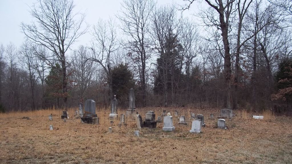
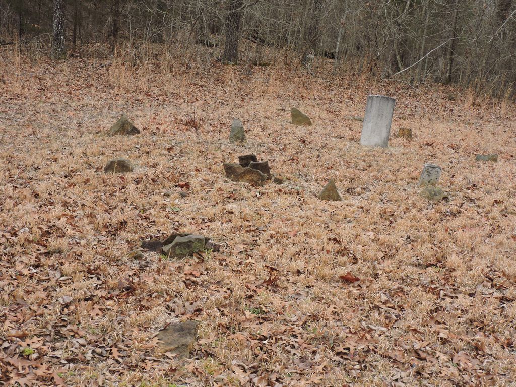
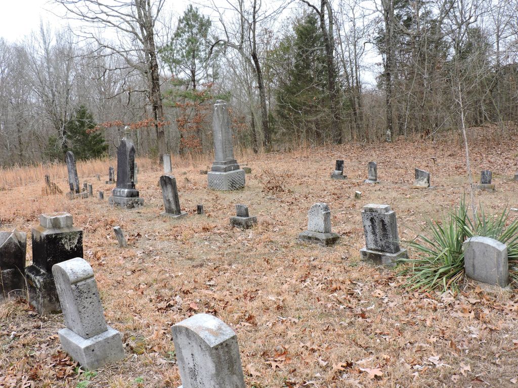
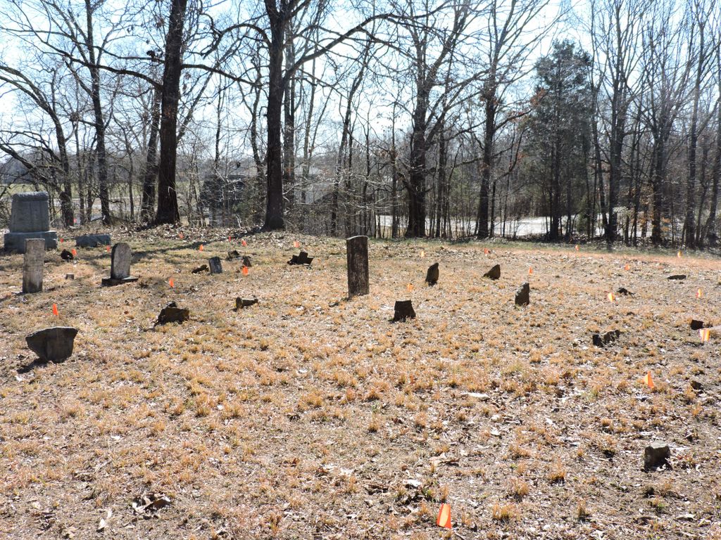
| Description | : | Fly Cemetery lies northwest of the intersection of State Highway 152 and Hughes Road. Turn north of Hughes road, drive a few hundred yards, then turn left/west of a grassy dirt field road that goes to the cemetery. The last burial in Fly Cemetery was in 1970. The cemetery is overgrown. Several graves are marked with field-stones |
frequently asked questions (FAQ):
-
Where is Fly Cemetery?
Fly Cemetery is located at Hughes Road E Spring Creek, Madison County ,Tennessee , 38305USA.
-
Fly Cemetery cemetery's updated grave count on graveviews.com?
0 memorials
-
Where are the coordinates of the Fly Cemetery?
Latitude: 35.7523870
Longitude: -88.6484160
Nearby Cemetories:
1. Grant-Gaston Cemeteryʌ
Spring Creek, Madison County, USA
Coordinate: 35.7412000, -88.6406000
2. Askew Haughton Cemetery
Madison County, USA
Coordinate: 35.7541670, -88.6655290
3. New Carmel Cemetery
Madison County, USA
Coordinate: 35.7578290, -88.6644070
4. Wards Grove Baptist Church Cemetery
Spring Creek, Madison County, USA
Coordinate: 35.7450900, -88.6235510
5. Donnell Cemetery
Spring Creek, Madison County, USA
Coordinate: 35.7750000, -88.6570000
6. Williams Family Cemetery
Jackson, Madison County, USA
Coordinate: 35.7306000, -88.6325000
7. Oak Grove Cemetery
Madison County, USA
Coordinate: 35.7581000, -88.6139000
8. Colonel Taylor's Cemetery
Jackson, Madison County, USA
Coordinate: 35.7732000, -88.6777800
9. Oakley Cemetery
Jackson, Madison County, USA
Coordinate: 35.7467730, -88.6094490
10. Spring Creek Church Cemetery
Spring Creek, Madison County, USA
Coordinate: 35.7696870, -88.6906290
11. Hilliard Cemetery
Spring Creek, Madison County, USA
Coordinate: 35.7708200, -88.6906400
12. Lebanon Methodist Church Cemetery
Jackson, Madison County, USA
Coordinate: 35.7883540, -88.6222740
13. Pearson Family Graveyard
Claybrook, Madison County, USA
Coordinate: 35.7083100, -88.6441600
14. Cool Springs Cemetery
Independence, Henderson County, USA
Coordinate: 35.7494490, -88.5923100
15. Gaston Cemetery
Spring Creek, Madison County, USA
Coordinate: 35.7738150, -88.6991500
16. Key Cemetery
Spring Creek, Madison County, USA
Coordinate: 35.7036680, -88.6538450
17. Claybrook-Berry Zion Cemetery
Beech Bluff, Madison County, USA
Coordinate: 35.7072720, -88.6249050
18. Adams Cemetery
Carroll County, USA
Coordinate: 35.7984900, -88.6688400
19. Gaskins Cemetery
Claybrook, Madison County, USA
Coordinate: 35.7176590, -88.6917720
20. Hilliard Cemetery
Madison County, USA
Coordinate: 35.7555000, -88.7111000
21. May Family Cemetery
Spring Creek, Madison County, USA
Coordinate: 35.7216000, -88.6985000
22. Threadgill Cemetery
Lavinia, Carroll County, USA
Coordinate: 35.8033300, -88.6683300
23. Fellowship Cemetery
Madison County, USA
Coordinate: 35.7477640, -88.7147910
24. Old Carmel Cemetery
Madison County, USA
Coordinate: 35.7476940, -88.7148150