
| Memorials | : | 9 |
| Location | : | Zaamslag, Terneuzen Municipality, Netherlands |
| Coordinate | : | 51.3125800, 3.9182100 |
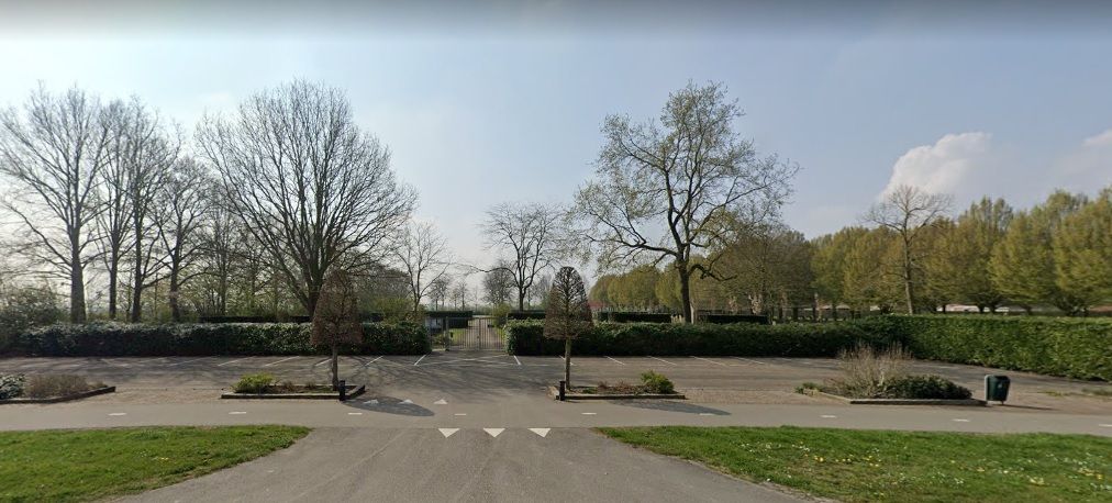
| Description | : | Zaamslag is a village in the middle of the Zeelandic Flanders. It is part of the Terneuzen Municipality, located in the province of Zeeland in the south-western Netherlands. It lies approx 9km east of Terneuzen. |
frequently asked questions (FAQ):
-
Where is Zaamslag General Cemetery?
Zaamslag General Cemetery is located at Veerstraat Zaamslag, Terneuzen Municipality ,Zeeland ,Netherlands.
-
Zaamslag General Cemetery cemetery's updated grave count on graveviews.com?
9 memorials
-
Where are the coordinates of the Zaamslag General Cemetery?
Latitude: 51.3125800
Longitude: 3.9182100
Nearby Cemetories:
1. Begraafplaats Vogelwaarde
Vogelwaarde, Hulst Municipality, Netherlands
Coordinate: 51.3268462, 3.9724116
2. Begraafplaats Vogelwaarde
Vogelwaarde, Hulst Municipality, Netherlands
Coordinate: 51.3241630, 3.9851875
3. Axel Westerzicht Cemetery
Axel, Terneuzen Municipality, Netherlands
Coordinate: 51.2691200, 3.8958100
4. Axel Heilige Gregoriuskerkhof
Axel, Terneuzen Municipality, Netherlands
Coordinate: 51.2661800, 3.9104100
5. Axel Algemene Begraafplaats
Axel, Terneuzen Municipality, Netherlands
Coordinate: 51.2636100, 3.9041900
6. H. Catharina Church Cemetery
Hengstdijk, Hulst Municipality, Netherlands
Coordinate: 51.3467612, 3.9979042
7. Rooms Katholieke Begraafplaats Terhole
Terhole, Hulst Municipality, Netherlands
Coordinate: 51.3168364, 4.0360870
8. Zuiddorpe Roman Catholic Churchyard
Zuiddorpe, Terneuzen Municipality, Netherlands
Coordinate: 51.2352900, 3.9045100
9. Kloosterzande General Cemetery
Kloosterzande, Hulst Municipality, Netherlands
Coordinate: 51.3644390, 4.0211730
10. Willibrorduskerk v.m.
Ossenisse, Hulst Municipality, Netherlands
Coordinate: 51.3888248, 3.9803445
11. Begraafplaats Begoniastraat
Hoek, Terneuzen Municipality, Netherlands
Coordinate: 51.3119844, 3.7793691
12. Kerkhof Rooms Katholieke kerk Heikant
Heikant, Hulst Municipality, Netherlands
Coordinate: 51.2517885, 4.0211986
13. Alg. Begraafplaats Molendreef
Hoek, Terneuzen Municipality, Netherlands
Coordinate: 51.3075086, 3.7741648
14. Rooms Katholieke Begraafplaats
Hulst, Hulst Municipality, Netherlands
Coordinate: 51.2851900, 4.0561700
15. Koewacht Roman Catholic Cemetery
Koewacht, Terneuzen Municipality, Netherlands
Coordinate: 51.2274700, 3.9762700
16. Begraafplaats Westdorpe
Westdorpe, Terneuzen Municipality, Netherlands
Coordinate: 51.2346912, 3.8290494
17. Baarland Steenweg Cemetery
Baarland, Borsele Municipality, Netherlands
Coordinate: 51.4072879, 3.8944024
18. Ellewoutsdijk Begraafplaats
Ellewoutsdijk, Borsele Municipality, Netherlands
Coordinate: 51.3922900, 3.8175300
19. Begraafplaats Philippine
Philippine, Terneuzen Municipality, Netherlands
Coordinate: 51.2800363, 3.7629284
20. Begraafplaats Sas van Gent
Sas van Gent, Terneuzen Municipality, Netherlands
Coordinate: 51.2464125, 3.7915800
21. Oudelande Algemene Begraafplaats
Oudelande, Borsele Municipality, Netherlands
Coordinate: 51.4095600, 3.8564700
22. Hoedekenskerke Waardweg Cemetery
Hoedekenskerke, Borsele Municipality, Netherlands
Coordinate: 51.4224100, 3.9129400
23. Hoedekenskerke Old Churchyard
Hoedekenskerke, Borsele Municipality, Netherlands
Coordinate: 51.4235320, 3.9121413
24. Moerbeke Kerkhof
Moerbeke, Arrondissement Gent, Belgium
Coordinate: 51.2014876, 3.9388085