
| Memorials | : | 0 |
| Location | : | Hengstdijk, Hulst Municipality, Netherlands |
| Coordinate | : | 51.3467612, 3.9979042 |
frequently asked questions (FAQ):
-
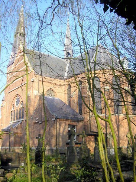
Where is H. Catharina Church Cemetery?
H. Catharina Church Cemetery is located at Hengstdijkse Kerkstraat 4 Hengstdijk, Hulst Municipality ,Zeeland ,Netherlands.
-
H. Catharina Church Cemetery cemetery's updated grave count on graveviews.com?
0 memorials
-
Where are the coordinates of the H. Catharina Church Cemetery?
Latitude: 51.3467612
Longitude: 3.9979042
Nearby Cemetories:
1. Kloosterzande General Cemetery
Kloosterzande, Hulst Municipality, Netherlands
Coordinate: 51.3644390, 4.0211730
2. Begraafplaats Vogelwaarde
Vogelwaarde, Hulst Municipality, Netherlands
Coordinate: 51.3241630, 3.9851875
3. Begraafplaats Vogelwaarde
Vogelwaarde, Hulst Municipality, Netherlands
Coordinate: 51.3268462, 3.9724116
4. Rooms Katholieke Begraafplaats Terhole
Terhole, Hulst Municipality, Netherlands
Coordinate: 51.3168364, 4.0360870
5. Willibrorduskerk v.m.
Ossenisse, Hulst Municipality, Netherlands
Coordinate: 51.3888248, 3.9803445
6. Zaamslag General Cemetery
Zaamslag, Terneuzen Municipality, Netherlands
Coordinate: 51.3125800, 3.9182100
7. Algemene begraafplaats Graauw
Graauw, Hulst Municipality, Netherlands
Coordinate: 51.3288902, 4.1029752
8. Rooms Katholieke Begraafplaats
Hulst, Hulst Municipality, Netherlands
Coordinate: 51.2851900, 4.0561700
9. Begraafplaats Memento Mori
Waarde, Reimerswaal Municipality, Netherlands
Coordinate: 51.4202400, 4.0657000
10. Baarland Steenweg Cemetery
Baarland, Borsele Municipality, Netherlands
Coordinate: 51.4072879, 3.8944024
11. Hoedekenskerke Waardweg Cemetery
Hoedekenskerke, Borsele Municipality, Netherlands
Coordinate: 51.4224100, 3.9129400
12. Hoedekenskerke Old Churchyard
Hoedekenskerke, Borsele Municipality, Netherlands
Coordinate: 51.4235320, 3.9121413
13. Kerkhof Rooms Katholieke kerk Heikant
Heikant, Hulst Municipality, Netherlands
Coordinate: 51.2517885, 4.0211986
14. Begraafplaats H. Henricus
Clinge, Hulst Municipality, Netherlands
Coordinate: 51.2693242, 4.0915061
15. Axel Heilige Gregoriuskerkhof
Axel, Terneuzen Municipality, Netherlands
Coordinate: 51.2661800, 3.9104100
16. Axel Westerzicht Cemetery
Axel, Terneuzen Municipality, Netherlands
Coordinate: 51.2691200, 3.8958100
17. Axel Algemene Begraafplaats
Axel, Terneuzen Municipality, Netherlands
Coordinate: 51.2636100, 3.9041900
18. Kruiningen General Cemetery
Kruiningen, Reimerswaal Municipality, Netherlands
Coordinate: 51.4488400, 4.0277900
19. Oudelande Algemene Begraafplaats
Oudelande, Borsele Municipality, Netherlands
Coordinate: 51.4095600, 3.8564700
20. Krabbendijke General Cemetery
Krabbendijke, Reimerswaal Municipality, Netherlands
Coordinate: 51.4315990, 4.1067807
21. Kerkhof Rooms Katholieke kerk Nieuw-Namen
Nieuw-Namen, Hulst Municipality, Netherlands
Coordinate: 51.2920988, 4.1606973
22. Schore Algemene Begraafplaats
Schore, Kapelle Municipality, Netherlands
Coordinate: 51.4658500, 3.9969800
23. Koewacht Roman Catholic Cemetery
Koewacht, Terneuzen Municipality, Netherlands
Coordinate: 51.2274700, 3.9762700
24. Ellewoutsdijk Begraafplaats
Ellewoutsdijk, Borsele Municipality, Netherlands
Coordinate: 51.3922900, 3.8175300