
| Memorials | : | 0 |
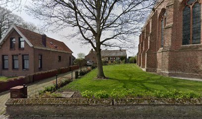
| Location | : | Hoedekenskerke, Borsele Municipality, Netherlands |
| Coordinate | : | 51.4235320, 3.9121413 |
frequently asked questions (FAQ):
-
Where is Hoedekenskerke Old Churchyard?
Hoedekenskerke Old Churchyard is located at Hoedekenskerke, Borsele Municipality ,Zeeland ,Netherlands.
-
Hoedekenskerke Old Churchyard cemetery's updated grave count on graveviews.com?
0 memorials
-
Where are the coordinates of the Hoedekenskerke Old Churchyard?
Latitude: 51.4235320
Longitude: 3.9121413
Nearby Cemetories:
1. Hoedekenskerke Waardweg Cemetery
Hoedekenskerke, Borsele Municipality, Netherlands
Coordinate: 51.4224100, 3.9129400
2. Baarland Steenweg Cemetery
Baarland, Borsele Municipality, Netherlands
Coordinate: 51.4072879, 3.8944024
3. Lenshoekdijk Old
's-Gravenpolder, Borsele Municipality, Netherlands
Coordinate: 51.4554900, 3.9012800
4. 's-Gravenpolder Algemene Begraafplaats
's-Gravenpolder, Borsele Municipality, Netherlands
Coordinate: 51.4556100, 3.9003500
5. Oudelande Algemene Begraafplaats
Oudelande, Borsele Municipality, Netherlands
Coordinate: 51.4095600, 3.8564700
6. Algemene Begraafplaats
Nisse, Borsele Municipality, Netherlands
Coordinate: 51.4584900, 3.8467600
7. Willibrorduskerk v.m.
Ossenisse, Hulst Municipality, Netherlands
Coordinate: 51.3888248, 3.9803445
8. Ovezande Bloemenstraat Cemetery
Ovezande, Borsele Municipality, Netherlands
Coordinate: 51.4274400, 3.8208500
9. Crematorium en uitvaartcentrum Het Zeeuwse Land
Goes Municipality, Netherlands
Coordinate: 51.4810570, 3.8994665
10. Biezelinge Algemene Begraafplaats
Biezelinge, Kapelle Municipality, Netherlands
Coordinate: 51.4777300, 3.9575600
11. Ellewoutsdijk Begraafplaats
Ellewoutsdijk, Borsele Municipality, Netherlands
Coordinate: 51.3922900, 3.8175300
12. Driewegen Protestant Cemetery
Driewegen, Borsele Municipality, Netherlands
Coordinate: 51.4176900, 3.8052200
13. Schore Algemene Begraafplaats
Schore, Kapelle Municipality, Netherlands
Coordinate: 51.4658500, 3.9969800
14. Kapelle French Military Cemetery
Kapelle, Kapelle Municipality, Netherlands
Coordinate: 51.4877370, 3.9482423
15. Kloetinge General Cemetery
Kloetinge, Goes Municipality, Netherlands
Coordinate: 51.4971500, 3.9232100
16. Kruiningen General Cemetery
Kruiningen, Reimerswaal Municipality, Netherlands
Coordinate: 51.4488400, 4.0277900
17. Heinkenszand Kerklaan Cemetery
Heinkenszand, Borsele Municipality, Netherlands
Coordinate: 51.4717900, 3.8139200
18. 's-Heer-Hendrikskinderen Algemene Begraafplaats
's-Heer Hendrikskinderen, Goes Municipality, Netherlands
Coordinate: 51.5012100, 3.8463800
19. Goes Algemene Begraafplaats
Goes, Goes Municipality, Netherlands
Coordinate: 51.5120600, 3.8866100
20. Kloosterzande General Cemetery
Kloosterzande, Hulst Municipality, Netherlands
Coordinate: 51.3644390, 4.0211730
21. R.K. Begraafplaats
's-Heerenhoek, Borsele Municipality, Netherlands
Coordinate: 51.4542131, 3.7715854
22. H. Catharina Church Cemetery
Hengstdijk, Hulst Municipality, Netherlands
Coordinate: 51.3467612, 3.9979042
23. Begraafplaats Memento Mori
Waarde, Reimerswaal Municipality, Netherlands
Coordinate: 51.4202400, 4.0657000
24. 's-Heerenhoek Old Cemetery
's-Heerenhoek, Borsele Municipality, Netherlands
Coordinate: 51.4634500, 3.7642900