
| Memorials | : | 0 |
| Location | : | Baarland, Borsele Municipality, Netherlands |
| Coordinate | : | 51.4072879, 3.8944024 |
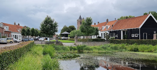
| Description | : | This cemetery no longer exist. Even the precise location is unknown. We know the cemetery was situated east of the village, between Baarland and Bakendorp. The road from Baarland to Bakendorp was then called "Steenweg", later called "Straatweg" and now it's called "Bakendorpseweg". Old documents tell us about "the old cemetery near the Steenweg". From about 1836 till 1873, the dead of Baarland were burried there. In 1873 a new cemetery, west of the village, replaced the old cemetery. |
frequently asked questions (FAQ):
-
Where is Baarland Steenweg Cemetery?
Baarland Steenweg Cemetery is located at Bakendorpseweg, Baarland, Borsele Municipality, Zeeland, Netherlands Baarland, Borsele Municipality ,Zeeland , 4435 NHNetherlands.
-
Baarland Steenweg Cemetery cemetery's updated grave count on graveviews.com?
0 memorials
-
Where are the coordinates of the Baarland Steenweg Cemetery?
Latitude: 51.4072879
Longitude: 3.8944024
Nearby Cemetories:
1. Hoedekenskerke Waardweg Cemetery
Hoedekenskerke, Borsele Municipality, Netherlands
Coordinate: 51.4224100, 3.9129400
2. Hoedekenskerke Old Churchyard
Hoedekenskerke, Borsele Municipality, Netherlands
Coordinate: 51.4235320, 3.9121413
3. Oudelande Algemene Begraafplaats
Oudelande, Borsele Municipality, Netherlands
Coordinate: 51.4095600, 3.8564700
4. Lenshoekdijk Old
's-Gravenpolder, Borsele Municipality, Netherlands
Coordinate: 51.4554900, 3.9012800
5. 's-Gravenpolder Algemene Begraafplaats
's-Gravenpolder, Borsele Municipality, Netherlands
Coordinate: 51.4556100, 3.9003500
6. Ovezande Bloemenstraat Cemetery
Ovezande, Borsele Municipality, Netherlands
Coordinate: 51.4274400, 3.8208500
7. Ellewoutsdijk Begraafplaats
Ellewoutsdijk, Borsele Municipality, Netherlands
Coordinate: 51.3922900, 3.8175300
8. Driewegen Protestant Cemetery
Driewegen, Borsele Municipality, Netherlands
Coordinate: 51.4176900, 3.8052200
9. Willibrorduskerk v.m.
Ossenisse, Hulst Municipality, Netherlands
Coordinate: 51.3888248, 3.9803445
10. Algemene Begraafplaats
Nisse, Borsele Municipality, Netherlands
Coordinate: 51.4584900, 3.8467600
11. Crematorium en uitvaartcentrum Het Zeeuwse Land
Goes Municipality, Netherlands
Coordinate: 51.4810570, 3.8994665
12. Biezelinge Algemene Begraafplaats
Biezelinge, Kapelle Municipality, Netherlands
Coordinate: 51.4777300, 3.9575600
13. Heinkenszand Kerklaan Cemetery
Heinkenszand, Borsele Municipality, Netherlands
Coordinate: 51.4717900, 3.8139200
14. Schore Algemene Begraafplaats
Schore, Kapelle Municipality, Netherlands
Coordinate: 51.4658500, 3.9969800
15. Kapelle French Military Cemetery
Kapelle, Kapelle Municipality, Netherlands
Coordinate: 51.4877370, 3.9482423
16. H. Catharina Church Cemetery
Hengstdijk, Hulst Municipality, Netherlands
Coordinate: 51.3467612, 3.9979042
17. R.K. Begraafplaats
's-Heerenhoek, Borsele Municipality, Netherlands
Coordinate: 51.4542131, 3.7715854
18. Kloosterzande General Cemetery
Kloosterzande, Hulst Municipality, Netherlands
Coordinate: 51.3644390, 4.0211730
19. Kloetinge General Cemetery
Kloetinge, Goes Municipality, Netherlands
Coordinate: 51.4971500, 3.9232100
20. Kruiningen General Cemetery
Kruiningen, Reimerswaal Municipality, Netherlands
Coordinate: 51.4488400, 4.0277900
21. Begraafplaats Vogelwaarde
Vogelwaarde, Hulst Municipality, Netherlands
Coordinate: 51.3268462, 3.9724116
22. Zaamslag General Cemetery
Zaamslag, Terneuzen Municipality, Netherlands
Coordinate: 51.3125800, 3.9182100
23. 's-Heer-Hendrikskinderen Algemene Begraafplaats
's-Heer Hendrikskinderen, Goes Municipality, Netherlands
Coordinate: 51.5012100, 3.8463800
24. 's-Heerenhoek Old Cemetery
's-Heerenhoek, Borsele Municipality, Netherlands
Coordinate: 51.4634500, 3.7642900