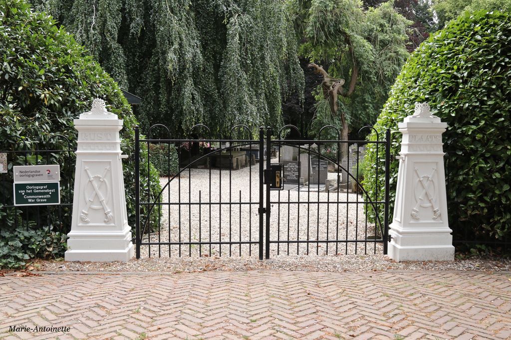
| Memorials | : | 0 |
| Location | : | Zaltbommel, Zaltbommel Municipality, Netherlands |
| Coordinate | : | 51.8105900, 5.2509500 |
| Description | : | Zaltbommel, a town on the south bank of the river Waal, is about 1 kilometre due east of the main road between 's-Hertogenbosch and Utrecht, and is 13 kilometres north of the former. The cemetery is on the south side of the road leading from the main road to Zaltbommel, and is 682 metres from the main road. |
frequently asked questions (FAQ):
-
Where is Zaltbommel General Cemetery?
Zaltbommel General Cemetery is located at Zaltbommel, Zaltbommel Municipality ,Gelderland ,Netherlands.
-
Zaltbommel General Cemetery cemetery's updated grave count on graveviews.com?
0 memorials
-
Where are the coordinates of the Zaltbommel General Cemetery?
Latitude: 51.8105900
Longitude: 5.2509500
Nearby Cemetories:
1. Joodse Begraafplaats Bossche Poort
Zaltbommel Municipality, Netherlands
Coordinate: 51.8104310, 5.2514020
2. Joodse Begraafplaats Maarten van Rossumsingel
Zaltbommel Municipality, Netherlands
Coordinate: 51.8084430, 5.2469290
3. Algemene Begraafplaats Haaften
Haaften, Neerijnen Municipality, Netherlands
Coordinate: 51.8186100, 5.2134100
4. Algemene Begraafplaats Waardenburg
Waardenburg, Neerijnen Municipality, Netherlands
Coordinate: 51.8359820, 5.2699709
5. Begraafplaats Bruchem
Bruchem, Zaltbommel Municipality, Netherlands
Coordinate: 51.7833840, 5.2255020
6. Opijnen Protestant Churchyard
Opijnen, Neerijnen Municipality, Netherlands
Coordinate: 51.8280200, 5.3003800
7. Algemene Begraafplaats
Rossum, Maasdriel Municipality, Netherlands
Coordinate: 51.8053361, 5.3233691
8. Veld-Driel Roman Catholic Churchyard
Velddriel, Maasdriel Municipality, Netherlands
Coordinate: 51.7698800, 5.3047100
9. Algemene begraafplaats
Est, Neerijnen Municipality, Netherlands
Coordinate: 51.8496882, 5.3131190
10. Begraafplaats Meteren
Meteren, Geldermalsen Municipality, Netherlands
Coordinate: 51.8686615, 5.2737818
11. Joodse Begraafplaats
Geldermalsen Municipality, Netherlands
Coordinate: 51.8713890, 5.3025000
12. Zuilichem General Cemetery
Zuilichem, Zaltbommel Municipality, Netherlands
Coordinate: 51.8060400, 5.1354500
13. Geldermalsen General Cemetery
Geldermalsen, Geldermalsen Municipality, Netherlands
Coordinate: 51.8804000, 5.2984400
14. Buurmalsen General Cemetery
Buurmalsen, Geldermalsen Municipality, Netherlands
Coordinate: 51.8873500, 5.2817100
15. Oud-Empel Roman Catholic Churchyard
Oud-Empel, 's-Hertogenbosch Municipality, Netherlands
Coordinate: 51.7362500, 5.3046800
16. Veen Nederlands Hervormd Cemetery
Veen, Aalburg Municipality, Netherlands
Coordinate: 51.7797400, 5.1072100
17. Joodse Begraafplaats Beesd
Beesd, Geldermalsen Municipality, Netherlands
Coordinate: 51.8986210, 5.1895010
18. Engelen General Cemetery
Engelen, 's-Hertogenbosch Municipality, Netherlands
Coordinate: 51.7157900, 5.2753500
19. Wijk-en-Aalburg General Cemetery
Wijk en Aalburg, Aalburg Municipality, Netherlands
Coordinate: 51.7587900, 5.1168100
20. Ophemert General Cemetery
Ophemert, Neerijnen Municipality, Netherlands
Coordinate: 51.8530200, 5.3965700
21. Heusden Buytenhove Algemene Begraafplaats
Heusden, Heusden Municipality, Netherlands
Coordinate: 51.7323600, 5.1485200
22. Wadenoijen Protestant Churchyard
Wadenoijen, Tiel Municipality, Netherlands
Coordinate: 51.8737900, 5.3789300
23. Haarsteeg Roman Catholic Cemetery
Haarsteeg, Heusden Municipality, Netherlands
Coordinate: 51.7107300, 5.1983600
24. Joodse Begraafplaats
Heesbeen, Heusden Municipality, Netherlands
Coordinate: 51.7358060, 5.1302780

