
| Memorials | : | 0 |
| Location | : | Colfax, Guilford County, USA |
| Coordinate | : | 36.0865610, -79.9945560 |
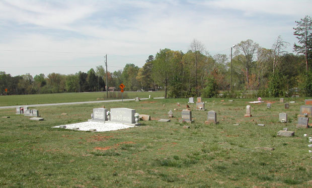
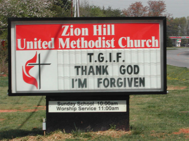
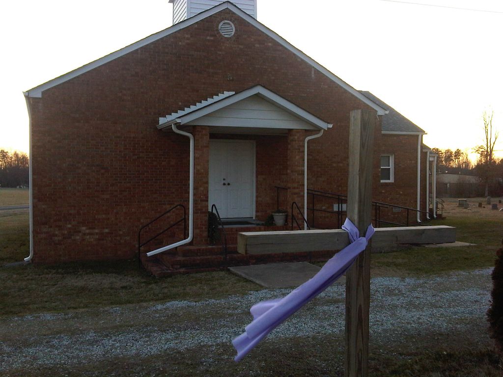
| Description | : | This is a well kept cemetery beside Zion Hill United Methodist Church on Sandy Ridge Rd at Tyner Loop just south of I-40 near the Piedmont Triad Farmers Market |
frequently asked questions (FAQ):
-
Where is Zion Hill United Methodist Church Cemetery?
Zion Hill United Methodist Church Cemetery is located at 2901 Sandy Ridge Rd Colfax, Guilford County ,North Carolina ,USA.
-
Zion Hill United Methodist Church Cemetery cemetery's updated grave count on graveviews.com?
0 memorials
-
Where are the coordinates of the Zion Hill United Methodist Church Cemetery?
Latitude: 36.0865610
Longitude: -79.9945560
Nearby Cemetories:
1. Smith Grove Baptist Church Cemetery
Colfax, Guilford County, USA
Coordinate: 36.0856700, -79.9937170
2. Saint Johns Church Cemetery
Greensboro, Guilford County, USA
Coordinate: 36.0835810, -79.9814340
3. Sandy Ridge United Methodist Church Cemetery
High Point, Guilford County, USA
Coordinate: 36.0722300, -80.0003740
4. The Church of Jesus Christ of LDS Cemetery
Colfax, Guilford County, USA
Coordinate: 36.1042100, -79.9958200
5. Shady Grove Wesleyan Church Cemetery
Colfax, Guilford County, USA
Coordinate: 36.1138115, -80.0147629
6. Friendship United Methodist Church Cemetery
Friendship, Guilford County, USA
Coordinate: 36.0958140, -79.9534400
7. Dover Friends Meeting Cemetery
Colfax, Guilford County, USA
Coordinate: 36.1274810, -79.9971490
8. Baker Family Cemetery
Kernersville, Forsyth County, USA
Coordinate: 36.1207930, -80.0419290
9. Bunker Hill Community Cemetery
Kernersville, Forsyth County, USA
Coordinate: 36.0745970, -80.0587980
10. Sunlight Baptist Church Cemetery
Kernersville, Forsyth County, USA
Coordinate: 36.1073280, -80.0607210
11. Mount Carmel Baptist Church Cemetery
High Point, Guilford County, USA
Coordinate: 36.0278854, -80.0074005
12. Deep River Friends Meeting Cemetery
High Point, Guilford County, USA
Coordinate: 36.0307770, -79.9640808
13. Seventh Day Adventist Cemetery
Kernersville, Forsyth County, USA
Coordinate: 36.1165500, -80.0608340
14. Persimmon Grove A.M.E. Cemetery
Guilford County, USA
Coordinate: 36.0747190, -79.9153200
15. Hickory Grove United Methodist Church Cemetery
Guilford County, USA
Coordinate: 36.0474970, -79.9265630
16. Northwest Baptist Church Cemetery
Greensboro, Guilford County, USA
Coordinate: 36.1461800, -79.9543460
17. Turners Chapel AME Church Cemetery
Friendship, Guilford County, USA
Coordinate: 36.0239300, -79.9566830
18. Union Grove Baptist Church Cemetery
Oak Ridge, Guilford County, USA
Coordinate: 36.1531590, -80.0232820
19. Kernersville Church of Christ Cemetery
Kernersville, Forsyth County, USA
Coordinate: 36.1061950, -80.0789980
20. Ai Methodist Memorial Cemetery
Oak Ridge, Guilford County, USA
Coordinate: 36.1558990, -79.9756012
21. Muddy Creek Friends Cemetery
Kernersville, Forsyth County, USA
Coordinate: 36.1008148, -80.0831680
22. Raleighs Crossroads UMC Cemetery
Greensboro, Guilford County, USA
Coordinate: 36.0608420, -79.9095370
23. Reynolds Chapel Baptist Church Cemetery
Greensboro, Guilford County, USA
Coordinate: 36.0642690, -79.9078590
24. Main Street United Methodist Church Cemetery
Kernersville, Forsyth County, USA
Coordinate: 36.1170380, -80.0783120