
| Birth | : | 30 Aug 1917 Pitt County, North Carolina, USA |
| Death | : | 27 Sep 1944 Quay County, New Mexico, USA |
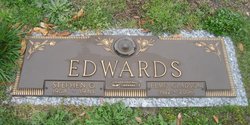
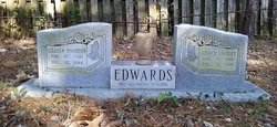
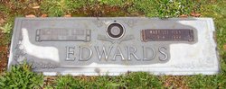
| Burial | : | Mount Tamalpais Cemetery, San Rafael, Marin County, USA |
| Coordinate | : | 37.9861984, -122.5544891 |
| Plot | : | Sec A5, Row 2 Upper, Lot 11, Grave 5 |
| Description | : | FIRST LIEUTENANT, 3007 BASE UNIT, KIRTLAND ARMY AIRFIELD, NEW MEXICO First Lieutenant Edwards was a student pilot aboard RB-24E Liberator #42-7125. During a flight from Chicago to Albuquerque, the bomber crashed 23 miles east of Tucumcari, New Mexico. Severe icing conditions were attributed. The crew reported their position to the Amarillo, Texas, radio tower and an icing report was issued for eastern New Mexico but there was no confirmation the airplane received the message. The crash occurred at night around 22:00 hours. All eleven men aboard were killed. The aircrew members killed were: Capt. Willis A... Read More |
frequently asked questions (FAQ):
-
Where is 1LT Donald Astor Edwards's memorial?
1LT Donald Astor Edwards's memorial is located at: Mount Tamalpais Cemetery, San Rafael, Marin County, USA.
-
When did 1LT Donald Astor Edwards death?
1LT Donald Astor Edwards death on 27 Sep 1944 in Quay County, New Mexico, USA
-
Where are the coordinates of the 1LT Donald Astor Edwards's memorial?
Latitude: 37.9861984
Longitude: -122.5544891
Family Members:
Parent
Siblings

Flowers:


Nearby Cemetories:
1. Mount Tamalpais Cemetery
San Rafael, Marin County, USA
Coordinate: 37.9861984, -122.5544891
2. First Presbyterian Church Memorial Garden
San Anselmo, Marin County, USA
Coordinate: 37.9703310, -122.5667860
3. Montgomery Memorial Chapel Crypt
San Anselmo, Marin County, USA
Coordinate: 37.9687940, -122.5638630
4. Mount Olivet Catholic Cemetery
San Rafael, Marin County, USA
Coordinate: 38.0024986, -122.5397034
5. Mission San Rafael Arcangel Cemetery
San Rafael, Marin County, USA
Coordinate: 37.9744330, -122.5280570
6. Marin County Farm Cemetery
Marin County, USA
Coordinate: 38.0285500, -122.5652530
7. Saint Vincents Orphanage Cemetery
San Rafael, Marin County, USA
Coordinate: 38.0355800, -122.5334550
8. San Quentin Prison Cemetery
San Rafael, Marin County, USA
Coordinate: 37.9436480, -122.4883760
9. Druid Heights Burial Site
Mill Valley, Marin County, USA
Coordinate: 37.8892100, -122.5647100
10. Fernwood Cemetery
Mill Valley, Marin County, USA
Coordinate: 37.8767014, -122.5231018
11. St. Stephen's Episcopal Church Memorial Garden
Belvedere, Marin County, USA
Coordinate: 37.8767515, -122.4712901
12. Saint Mary Magdalene Catholic Church Cemetery
Bolinas, Marin County, USA
Coordinate: 37.9212570, -122.6938858
13. Bolinas Cemetery
Bolinas, Marin County, USA
Coordinate: 37.9212600, -122.6938900
14. Pioneer Memorial Cemetery
Novato, Marin County, USA
Coordinate: 38.1132532, -122.5902599
15. Valley Memorial Park
Novato, Marin County, USA
Coordinate: 38.1204300, -122.5436300
16. Taylor Cemetery
Lagunitas, Marin County, USA
Coordinate: 38.0272580, -122.7346590
17. Sailors Cemetery
Sausalito, Marin County, USA
Coordinate: 37.8442390, -122.4774770
18. Angel Island Cemetery (defunct)
Tiburon, Marin County, USA
Coordinate: 37.8621830, -122.4325920
19. Saint Pauls Cemetery (Defunct)
San Pablo, Contra Costa County, USA
Coordinate: 37.9563332, -122.3430099
20. Salesian Cemetery
Richmond, Contra Costa County, USA
Coordinate: 37.9532650, -122.3401230
21. Saint Joseph Catholic Cemetery
San Pablo, Contra Costa County, USA
Coordinate: 37.9612700, -122.3336600
22. Olema Cemetery
Olema, Marin County, USA
Coordinate: 38.0313988, -122.7789001
23. Rolling Hills Memorial Park
Richmond, Contra Costa County, USA
Coordinate: 37.9756012, -122.3146973
24. Presidio of San Francisco Pet Cemetery
San Francisco, San Francisco County, USA
Coordinate: 37.8025490, -122.4671960