
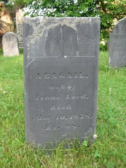

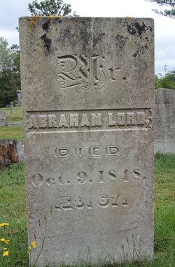
Abagail Milliken Lord
| Birth | : | 29 Sep 1750 Scarborough, Cumberland County, Maine, USA |
| Death | : | 10 May 1838 Surry, Hancock County, Maine, USA |
| Burial | : | West Saint Olaf Cemetery, Vernon, Dodge County, USA |
| Coordinate | : | 43.9266701, -92.7177811 |
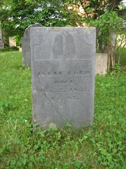
| Description | : | Other Children of Abagail & Isaac: HEARD, 1769 - 1846 ELIAS, 1785 - Jul 24, 1859 in Boston ISAAC, Jan 31, 1783 - May 18, 1823 DONALD, Apr 3, 1793 - Aug 15, 1866 |
frequently asked questions (FAQ):
-
Where is Abagail Milliken Lord's memorial?
Abagail Milliken Lord's memorial is located at: West Saint Olaf Cemetery, Vernon, Dodge County, USA.
-
When did Abagail Milliken Lord death?
Abagail Milliken Lord death on 10 May 1838 in Surry, Hancock County, Maine, USA
-
Where are the coordinates of the Abagail Milliken Lord's memorial?
Latitude: 43.9266701
Longitude: -92.7177811
Family Members:
Parent
Spouse
Siblings

Children
Flowers:


Nearby Cemetories:
1. South Zumbro Lutheran Church Cemetery
Salem Corners, Olmsted County, USA
Coordinate: 43.9517670, -92.6777878
2. East Saint Olaf Lutheran Church Cemetery
Rock Dell, Olmsted County, USA
Coordinate: 43.9327812, -92.6383286
3. Zion Cemetery
Rock Dell, Olmsted County, USA
Coordinate: 43.9297218, -92.6377792
4. Evanger Lutheran Church Cemetery
Sargeant, Mower County, USA
Coordinate: 43.8416710, -92.7300034
5. Riverside Cemetery
Salem Corners, Olmsted County, USA
Coordinate: 43.9785995, -92.6074982
6. Maple Grove Cemetery
Kasson, Dodge County, USA
Coordinate: 44.0214005, -92.7553024
7. Fairview Cemetery
Hayfield, Dodge County, USA
Coordinate: 43.8849983, -92.8585968
8. Byron Cemetery
Byron, Olmsted County, USA
Coordinate: 44.0359459, -92.6424713
9. Oakridge Farm Cemetery
Rochester, Olmsted County, USA
Coordinate: 43.9479480, -92.5435090
10. Saint Margaret Cemetery
Mantorville, Dodge County, USA
Coordinate: 44.0616989, -92.7435989
11. Evergreen Cemetery
Mantorville, Dodge County, USA
Coordinate: 44.0619011, -92.7418976
12. Zion Lutheran Church Cemetery
Sargeant, Mower County, USA
Coordinate: 43.7891693, -92.7161102
13. Pleasant Valley Cemetery
Racine, Mower County, USA
Coordinate: 43.8116989, -92.6074982
14. Immanuel Cemetery
Racine, Mower County, USA
Coordinate: 43.8107986, -92.6089020
15. High Forest Cemetery
High Forest, Olmsted County, USA
Coordinate: 43.8472214, -92.5413895
16. Riverside Cemetery
Dodge Center, Dodge County, USA
Coordinate: 44.0393982, -92.8597031
17. Mayowood Cemetery
Rochester, Olmsted County, USA
Coordinate: 43.9909500, -92.5218800
18. Saint Johns Lutheran Cemetery
Sargeant, Mower County, USA
Coordinate: 43.7751083, -92.7908936
19. Wildwood Cemetery
Wasioja, Dodge County, USA
Coordinate: 44.0713997, -92.8142014
20. Saint Johns Evangelical Cemetery
Racine, Mower County, USA
Coordinate: 43.8053017, -92.5586014
21. Saint Bernard Catholic Cemetery
Stewartville, Olmsted County, USA
Coordinate: 43.8624992, -92.4942017
22. Waltham Cemetery
Waltham, Mower County, USA
Coordinate: 43.7905998, -92.8685989
23. Woodlawn Cemetery
Stewartville, Olmsted County, USA
Coordinate: 43.8561707, -92.4966507
24. Mount Hope Cemetery
Rochester, Olmsted County, USA
Coordinate: 44.0703011, -92.5783005