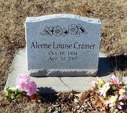
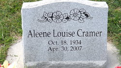
Aleene Louise Cramer
| Birth | : | 18 Oct 1934 Holton, Jackson County, Kansas, USA |
| Death | : | 30 Apr 2007 Topeka, Shawnee County, Kansas, USA |
| Burial | : | Randolph Cemetery, Columbia, Richland County, USA |
| Coordinate | : | 34.0093500, -81.0540800 |
| Plot | : | Section K |
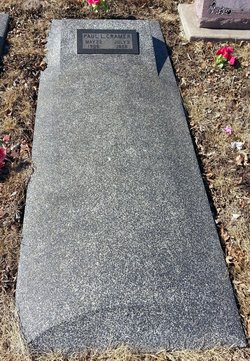
| Description | : | Aleene Louise Cramer, 72, was born October 18, 1934 in Holton, KS, the daughter of Paul and Bertha Wolfe Cramer. She passed away Monday, April 30, 2007 at a care center in Topeka, KS. Aleene attended Netawaka, KS schools and following graduation, moved to Topeka. She had worked for Supply Depot, Blue Cross and Blue Shield and for the State of Kansas. She married Frank Smith. They were divorced. She was then married to Bob Thompson and they later divorced. Her parents preceded her in death. Aleene is survived by her brother, Leon Cramer and his wife, Betty of Holton;... Read More |
frequently asked questions (FAQ):
-
Where is Aleene Louise Cramer's memorial?
Aleene Louise Cramer's memorial is located at: Randolph Cemetery, Columbia, Richland County, USA.
-
When did Aleene Louise Cramer death?
Aleene Louise Cramer death on 30 Apr 2007 in Topeka, Shawnee County, Kansas, USA
-
Where are the coordinates of the Aleene Louise Cramer's memorial?
Latitude: 34.0093500
Longitude: -81.0540800
Family Members:
Parent
Flowers:
Nearby Cemetories:
1. Randolph Cemetery
Columbia, Richland County, USA
Coordinate: 34.0093500, -81.0540800
2. Lower Cemetery
Columbia, Richland County, USA
Coordinate: 34.0093900, -81.0571990
3. Elmwood Memorial Gardens
Columbia, Richland County, USA
Coordinate: 34.0121000, -81.0523200
4. Saint Peter's Cemetery
Columbia, Richland County, USA
Coordinate: 34.0119200, -81.0488700
5. Douglass Cemetery
Columbia, Richland County, USA
Coordinate: 34.0180340, -81.0492810
6. Hebrew Benevolent Society Cemetery
Columbia, Richland County, USA
Coordinate: 34.0049780, -81.0435680
7. Saint Peter's Catholic Church Cemetery
Columbia, Richland County, USA
Coordinate: 34.0052900, -81.0384100
8. Ebenezer Lutheran Church Cemetery
Columbia, Richland County, USA
Coordinate: 34.0113680, -81.0361220
9. Mount Pleasant United Methodist Church Cemetery
Columbia, Richland County, USA
Coordinate: 34.0101996, -81.0350037
10. Geiger Avenue Cemetery
Columbia, Richland County, USA
Coordinate: 34.0228050, -81.0394590
11. First Baptist Church Cemetery
Columbia, Richland County, USA
Coordinate: 34.0062460, -81.0321850
12. Church of the Good Shepherd Memorial Gardens
Columbia, Richland County, USA
Coordinate: 34.0096610, -81.0316160
13. First Presbyterian Churchyard
Columbia, Richland County, USA
Coordinate: 34.0041110, -81.0293900
14. Miller Cemetery
Columbia, Richland County, USA
Coordinate: 34.0321999, -81.0391998
15. Fridig Cemetery
Lexington County, USA
Coordinate: 33.9961600, -81.0836350
16. Saint Lukes Episcopal Church Memorial Garden
Columbia, Richland County, USA
Coordinate: 34.0082060, -81.0180940
17. Colored Asylum Cemetery
Columbia, Richland County, USA
Coordinate: 34.0244050, -81.0220490
18. All Saints Episcopal Church Garden
Cayce, Lexington County, USA
Coordinate: 33.9810790, -81.0695250
19. Barhamville Cemetery
Columbia, Richland County, USA
Coordinate: 34.0236870, -81.0107570
20. Granby Gardens Park Pavilion Cemetery
Cayce, Lexington County, USA
Coordinate: 33.9712890, -81.0677060
21. Lincoln Cemetery
Columbia, Richland County, USA
Coordinate: 34.0400009, -81.0214005
22. Olympia Cemetery
Columbia, Richland County, USA
Coordinate: 33.9719009, -81.0325012
23. Cayce Burial Gnd
Cayce, Lexington County, USA
Coordinate: 33.9693510, -81.0675840
24. Earl Cemetery
Cayce, Lexington County, USA
Coordinate: 33.9677560, -81.0646100

