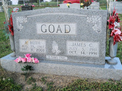
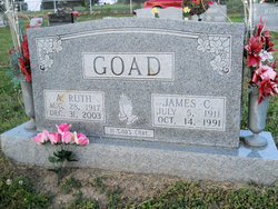
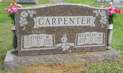
Alta Ruth Killian Goad
| Birth | : | 28 Aug 1917 Newberry, Greene County, Indiana, USA |
| Death | : | 31 Dec 2003 Corydon, Harrison County, Indiana, USA |
| Burial | : | Eastleigh Cemetery, Eastleigh, Eastleigh Borough, England |
| Coordinate | : | 50.9724710, -1.3612860 |
| Inscription | : | In God's care |
| Description | : | Alta Ruth Goad, 86, of Bloomfield, passed away at 4:30 a.m. on Dec. 31, 2003, at the Harrison County Hospital in Corydon. Born Aug. 28, 1917, in Newberry, she was the daughter of Edgar P. and Ada Johnson Killian. She was a homemaker and a member of the Bloomfield Wesleyan Church. She is survived by two sons and their spouses, Donald and Helen Goad and James E. and Pam Goad, all of Bloomfield; one daughter and her husband, Lois L. and Ronnie Toler of Corydon; seven grandchildren, Jeff Goad, Sandy Goad Usrey, Ron Toler, Jr., Rhonda Ernstberger, Rob... Read More |
frequently asked questions (FAQ):
-
Where is Alta Ruth Killian Goad's memorial?
Alta Ruth Killian Goad's memorial is located at: Eastleigh Cemetery, Eastleigh, Eastleigh Borough, England.
-
When did Alta Ruth Killian Goad death?
Alta Ruth Killian Goad death on 31 Dec 2003 in Corydon, Harrison County, Indiana, USA
-
Where are the coordinates of the Alta Ruth Killian Goad's memorial?
Latitude: 50.9724710
Longitude: -1.3612860
Family Members:
Parent
Spouse
Siblings
Children
Flowers:
Nearby Cemetories:
1. Eastleigh Cemetery
Eastleigh, Eastleigh Borough, England
Coordinate: 50.9724710, -1.3612860
2. Hampshire Fire and Rescue Garden of Remembrance
Eastleigh, Eastleigh Borough, England
Coordinate: 50.9728200, -1.3710200
3. St Mary Churchyard
Bishopstoke, Eastleigh Borough, England
Coordinate: 50.9760650, -1.3358720
4. St Nicolas Churchyard
North Stoneham, Eastleigh Borough, England
Coordinate: 50.9535160, -1.3741760
5. Bishopstoke Cemetery
Bishopstoke, Eastleigh Borough, England
Coordinate: 50.9777740, -1.3272020
6. Ramalley Cemetery
Chandlers Ford, Eastleigh Borough, England
Coordinate: 50.9912950, -1.3914870
7. Pine Road Cemetery
Chandlers Ford, Eastleigh Borough, England
Coordinate: 50.9969590, -1.3904110
8. Southampton Crematorium and Garden of Remembrance
Southampton, Southampton Unitary Authority, England
Coordinate: 50.9471770, -1.3899120
9. St. Matthew's Churchyard
Otterbourne, City of Winchester, England
Coordinate: 51.0030630, -1.3503880
10. St. Matthew's Old Graveyard
Winchester, City of Winchester, England
Coordinate: 51.0015670, -1.3383760
11. South Stoneham Cemetery
Swaythling, Southampton Unitary Authority, England
Coordinate: 50.9401030, -1.3660260
12. St. Mary's Churchyard
Swaythling, Southampton Unitary Authority, England
Coordinate: 50.9367800, -1.3752300
13. Holy Trinity Churchyard
Colden Common, City of Winchester, England
Coordinate: 50.9912400, -1.3087900
14. St. Deny's Churchyard
Chilworth, Test Valley Borough, England
Coordinate: 50.9669770, -1.4226050
15. Fair Oak Cemetery
Fair Oak, Eastleigh Borough, England
Coordinate: 50.9615900, -1.2979800
16. St Thomas Churchyard
Fair Oak, Eastleigh Borough, England
Coordinate: 50.9651300, -1.2966400
17. West End Cemetery and Memorial Gardens
West End, Eastleigh Borough, England
Coordinate: 50.9342600, -1.3316300
18. St John the Baptist Churchyard
North Baddesley, Test Valley Borough, England
Coordinate: 50.9858300, -1.4283100
19. Highfield Churchyard
Portswood, Southampton Unitary Authority, England
Coordinate: 50.9295400, -1.3949800
20. St. James' Church Cemetery
West End, Eastleigh Borough, England
Coordinate: 50.9267690, -1.3326580
21. Wessex Vale Crematorium
West End, Eastleigh Borough, England
Coordinate: 50.9376550, -1.3054100
22. St James Churchyard
West End, Eastleigh Borough, England
Coordinate: 50.9243200, -1.3382300
23. St. Mark's Churchyard
Ampfield, Test Valley Borough, England
Coordinate: 51.0093350, -1.4211790
24. Holy Cross Churchyard
Durley, City of Winchester, England
Coordinate: 50.9500800, -1.2822000

