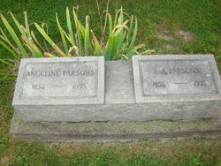
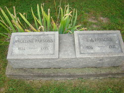
Angeline “Angie” Park Parsons
| Birth | : | 25 Oct 1854 Iowa, USA |
| Death | : | 19 May 1935 Jefferson County, Iowa, USA |
| Burial | : | Esterly Cemetery, Leetonia, Columbiana County, USA |
| Coordinate | : | 40.8886700, -80.7270200 |
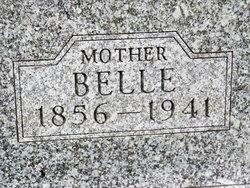
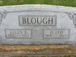
| Description | : | Wife of Eugene A Parsons. Married on Dec. 27, 1887. Children: Helen Parsons (Blough) and Rex Parsons. -------------------------- Note: this memorial updated Nov. 4, 2018 with this information - Angeline "Angie" Park was a bridesmaid on January 27, 1876 at Salina, Iowa, for the marriage of Arthur Middleton Bartlett Jr and Fannie Jane Jones Bartlett. |
frequently asked questions (FAQ):
-
Where is Angeline “Angie” Park Parsons's memorial?
Angeline “Angie” Park Parsons's memorial is located at: Esterly Cemetery, Leetonia, Columbiana County, USA.
-
When did Angeline “Angie” Park Parsons death?
Angeline “Angie” Park Parsons death on 19 May 1935 in Jefferson County, Iowa, USA
-
Where are the coordinates of the Angeline “Angie” Park Parsons's memorial?
Latitude: 40.8886700
Longitude: -80.7270200
Family Members:
Parent
Spouse
Siblings
Children
Flowers:
Nearby Cemetories:
1. Esterly Cemetery
Leetonia, Columbiana County, USA
Coordinate: 40.8886700, -80.7270200
2. Nold Mennonite Cemetery
Leetonia, Columbiana County, USA
Coordinate: 40.8771820, -80.7394080
3. Zion Hill Church of the Brethren Cemetery
North Lima, Mahoning County, USA
Coordinate: 40.9067700, -80.7052420
4. Mount Joy Mennonite Church Cemetery
Leetonia, Columbiana County, USA
Coordinate: 40.8922670, -80.7600100
5. Oakdale Cemetery
Leetonia, Columbiana County, USA
Coordinate: 40.8666992, -80.7538986
6. Trinity Lutheran Cemetery
Washingtonville, Mahoning County, USA
Coordinate: 40.9013880, -80.7646550
7. Robbins Methodist Cemetery
Washingtonville, Mahoning County, USA
Coordinate: 40.9016000, -80.7650800
8. Columbiana Cemetery
Columbiana, Columbiana County, USA
Coordinate: 40.8869019, -80.6844025
9. Pleasant View Mennonite Church Cemetery
Mahoning County, USA
Coordinate: 40.9223400, -80.7266500
10. Midway Mennonite Church Cemetery
Mahoning County, USA
Coordinate: 40.9243400, -80.7183500
11. Mount Calvary Cemetery
Leetonia, Columbiana County, USA
Coordinate: 40.8630981, -80.7667007
12. Cool Springs Cemetery
Fairfield Township, Columbiana County, USA
Coordinate: 40.8486820, -80.7263520
13. Schneider Farm Cemetery
North Lima, Mahoning County, USA
Coordinate: 40.9079340, -80.6799890
14. Sharon Mennonite Fellowship Cemetery
Green Township, Mahoning County, USA
Coordinate: 40.9286850, -80.7463390
15. Washingtonville Cemetery
Washingtonville, Mahoning County, USA
Coordinate: 40.9033012, -80.7846985
16. Gleckler Farm Cemetery
Beaver Township, Mahoning County, USA
Coordinate: 40.9068950, -80.6673950
17. Laipply Farm Cemetery
North Lima, Mahoning County, USA
Coordinate: 40.9074200, -80.6656600
18. Evangelical Church Cemetery
North Lima, Mahoning County, USA
Coordinate: 40.9269560, -80.6832690
19. Bethel Cemetery
Knox Township, Columbiana County, USA
Coordinate: 40.8363991, -80.7174988
20. Hum Cemetery
Columbiana, Columbiana County, USA
Coordinate: 40.8708000, -80.6603012
21. Switzer Cemetery
Leetonia, Columbiana County, USA
Coordinate: 40.8358300, -80.7547200
22. Franklin Square United Methodist Church Cemetery
Franklin Square, Columbiana County, USA
Coordinate: 40.8562902, -80.7902739
23. Schnurrenberger Cemetery
North Lima, Mahoning County, USA
Coordinate: 40.9144210, -80.6573300
24. Dressel Farm Cemetery
Greenford, Mahoning County, USA
Coordinate: 40.9363770, -80.7745730


