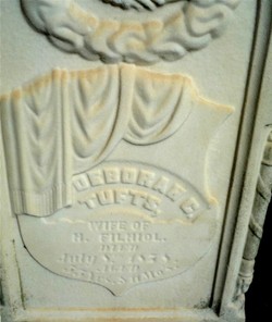
Ann Tufts Bradley
| Birth | : | 31 Mar 1819 Cambridge, Middlesex County, Massachusetts, USA |
| Death | : | 5 Dec 1857 |
| Burial | : | Brigstock Parish Cemetery, Brigstock, East Northamptonshire Borough, England |
| Coordinate | : | 52.4552481, -0.6061781 |
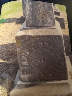
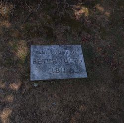
| Description | : | Ann Tufts Bradley was related to Charles Tufts, the Medford businessman who donated the land Tufts University was built upon. First husband Henry Dowell, then Patrick John Hughes, then William H. Bradley. [Many thanks to findagrave contributor Tom Bond for maiden name, birth and marriage information.] Ann Tufts was the daughter of Peter Tufts, Esq. and Anna Cutter Benjamin and was born in Medford, Middlesex, Massachusetts. She married Patrick John Hughes on November 10, 1839 in Ouachita Parish. Ann's sister Adeline married a John Dowell in 1840 in Ouachita Parish. Ann has a cenotaph in the Old Burying Ground in Arlington,... Read More |
frequently asked questions (FAQ):
-
Where is Ann Tufts Bradley's memorial?
Ann Tufts Bradley's memorial is located at: Brigstock Parish Cemetery, Brigstock, East Northamptonshire Borough, England.
-
When did Ann Tufts Bradley death?
Ann Tufts Bradley death on 5 Dec 1857 in
-
Where are the coordinates of the Ann Tufts Bradley's memorial?
Latitude: 52.4552481
Longitude: -0.6061781
Family Members:
Parent
Siblings
Children
Flowers:
Nearby Cemetories:
1. Brigstock Parish Cemetery
Brigstock, East Northamptonshire Borough, England
Coordinate: 52.4552481, -0.6061781
2. All Saints Church
Sudborough, East Northamptonshire Borough, England
Coordinate: 52.4283980, -0.5782500
3. St. Mary Churchyard
Benefield, East Northamptonshire Borough, England
Coordinate: 52.4854100, -0.5460660
4. St. James the Apostle Churchyard
Grafton Underwood, Kettering Borough, England
Coordinate: 52.4108323, -0.6449725
5. Geddington Churchyard
Geddington, Kettering Borough, England
Coordinate: 52.4379600, -0.6845200
6. St. Peter's Churchyard
Lowick, East Northamptonshire Borough, England
Coordinate: 52.4116300, -0.5570600
7. St. Michael and All Angels Churchyard
Wadenhoe, East Northamptonshire Borough, England
Coordinate: 52.4382400, -0.5176200
8. Aldwincle St Peters Churchyard
Aldwincle, East Northamptonshire Borough, England
Coordinate: 52.4255060, -0.5217460
9. St. Nicholas' Churchyard
Twywell, East Northamptonshire Borough, England
Coordinate: 52.3936001, -0.6024166
10. St Mary the Virgin Churchyard
Weekley, Kettering Borough, England
Coordinate: 52.4196890, -0.6952190
11. All Saints Churchyard
Aldwincle, East Northamptonshire Borough, England
Coordinate: 52.4222080, -0.5142150
12. St. Nicholas Churchyard
Islip, East Northamptonshire Borough, England
Coordinate: 52.3991300, -0.5513600
13. St Edmund Churchyard
Warkton, Kettering Borough, England
Coordinate: 52.4091701, -0.6884724
14. Deene Park
Deene, East Northamptonshire Borough, England
Coordinate: 52.5242960, -0.6010350
15. Saint Peter's Churchyard
Deene, East Northamptonshire Borough, England
Coordinate: 52.5242490, -0.5984740
16. Thrapston Cemetery
Thrapston, East Northamptonshire Borough, England
Coordinate: 52.4000170, -0.5292640
17. St. Rumbold Churchyard
Stoke Doyle, East Northamptonshire Borough, England
Coordinate: 52.4678253, -0.4880529
18. St. Andrew's Churchyard
Cranford, Kettering Borough, England
Coordinate: 52.3856700, -0.6438700
19. St. John's Churchyard
Cranford St John, Kettering Borough, England
Coordinate: 52.3840560, -0.6391670
20. St. Mary's Churchyard
Titchmarsh, East Northamptonshire Borough, England
Coordinate: 52.4076080, -0.4998860
21. Oundle Cemetery
Oundle, East Northamptonshire Borough, England
Coordinate: 52.4799120, -0.4803840
22. Shire Lodge Cemetery
Corby, Corby Borough, England
Coordinate: 52.5073610, -0.7084990
23. St Leonard's Churchyard
Glapthorn, East Northamptonshire Borough, England
Coordinate: 52.5001397, -0.4924849
24. St. Nicholas' Churchyard
Bulwick, East Northamptonshire Borough, England
Coordinate: 52.5376000, -0.5818000

