
| Memorials | : | 60 |
| Location | : | Oundle, East Northamptonshire Borough, England |
| Coordinate | : | 52.4799120, -0.4803840 |
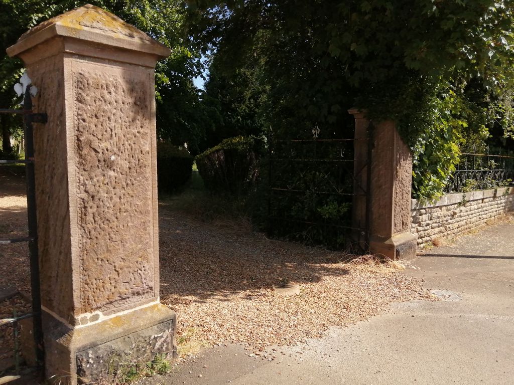
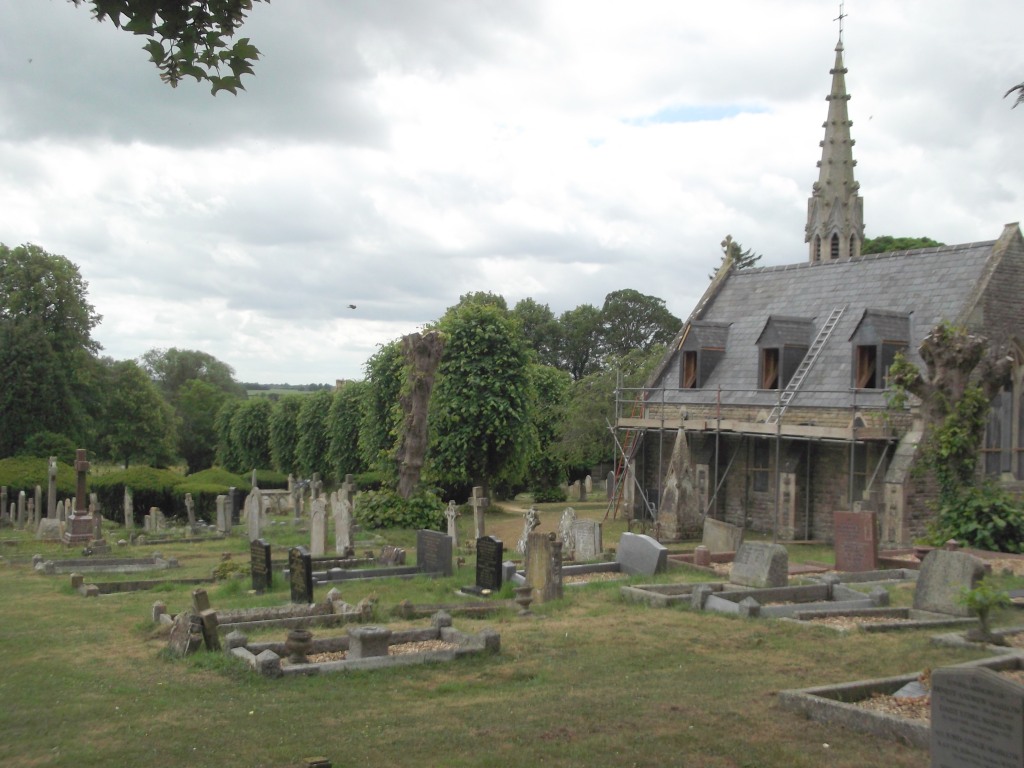
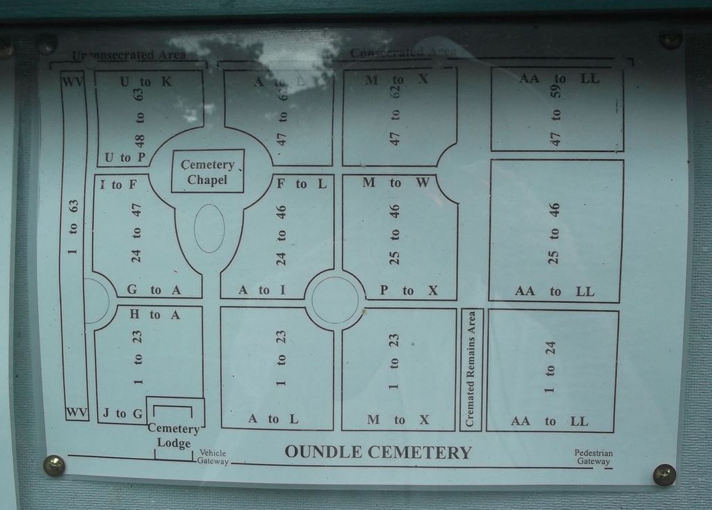
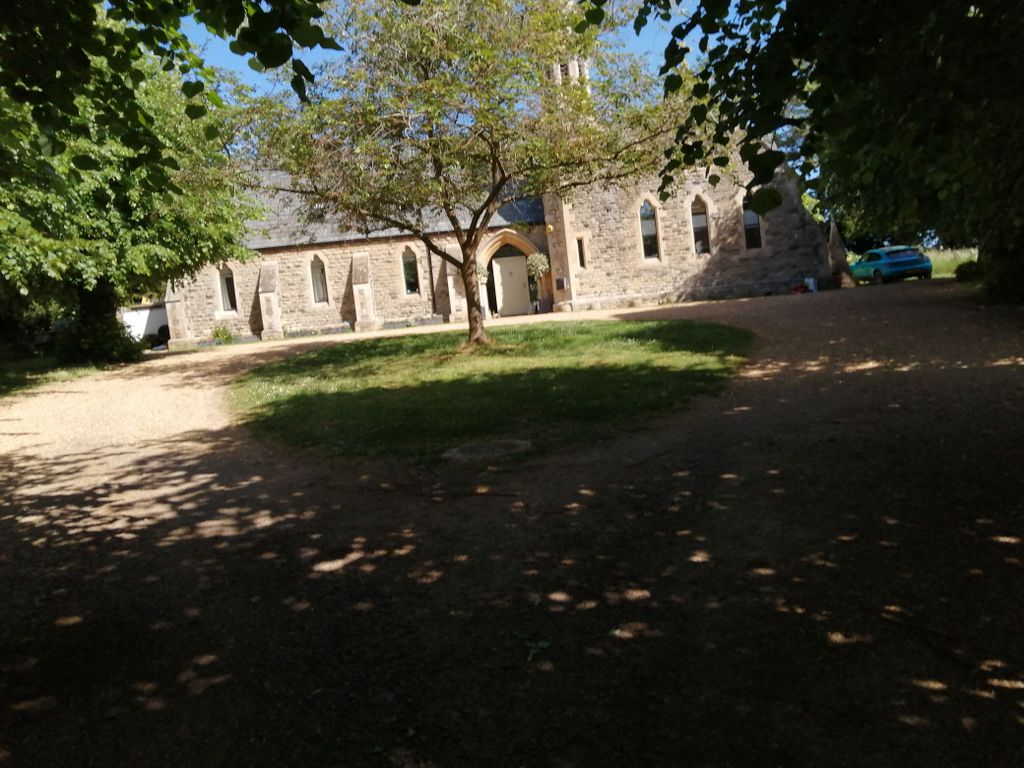
| Description | : | The Oundle Cemetery in Stoke Doyle Road is administered by Oundle Town Council and was established on this site in the mid-1850's. All of the Cemetery Records have been computerised which facilitates searches for historical purposes, for which a small charge applies. There are two buildings at the Cemetery - Cemetery Lodge which is in private ownership and the Chapel which, since deconsecration, is now privately owned. |
frequently asked questions (FAQ):
-
Where is Oundle Cemetery?
Oundle Cemetery is located at Stoke Doyle Road Oundle, East Northamptonshire Borough ,Northamptonshire ,England.
-
Oundle Cemetery cemetery's updated grave count on graveviews.com?
60 memorials
-
Where are the coordinates of the Oundle Cemetery?
Latitude: 52.4799120
Longitude: -0.4803840
Nearby Cemetories:
1. St. Peter's Churchyard
Oundle, East Northamptonshire Borough, England
Coordinate: 52.4817430, -0.4671130
2. St. Rumbold Churchyard
Stoke Doyle, East Northamptonshire Borough, England
Coordinate: 52.4678253, -0.4880529
3. St Leonard's Churchyard
Glapthorn, East Northamptonshire Borough, England
Coordinate: 52.5001397, -0.4924849
4. St. Mary's Churchyard
Tansor, East Northamptonshire Borough, England
Coordinate: 52.5057500, -0.4493700
5. All Saints Chancel
Barnwell, East Northamptonshire Borough, England
Coordinate: 52.4482400, -0.4594600
6. St. Mary Churchyard
Benefield, East Northamptonshire Borough, England
Coordinate: 52.4854100, -0.5460660
7. St. Michael and All Angels Churchyard
Wadenhoe, East Northamptonshire Borough, England
Coordinate: 52.4382400, -0.5176200
8. Saint Mary the Virgin Churchyard
Warmington, East Northamptonshire Borough, England
Coordinate: 52.5064111, -0.4144919
9. Fotheringhay Castle
Fotheringhay, East Northamptonshire Borough, England
Coordinate: 52.5243170, -0.4363420
10. St Mary the Virgin and All Saints Churchyard
Fotheringhay, East Northamptonshire Borough, England
Coordinate: 52.5258330, -0.4390740
11. St Mary Churchyard
Woodnewton, East Northamptonshire Borough, England
Coordinate: 52.5392210, -0.4795790
12. Aldwincle St Peters Churchyard
Aldwincle, East Northamptonshire Borough, England
Coordinate: 52.4255060, -0.5217460
13. All Saints Churchyard
Aldwincle, East Northamptonshire Borough, England
Coordinate: 52.4222080, -0.5142150
14. St James the Great
Thurning, East Northamptonshire Borough, England
Coordinate: 52.4327883, -0.4042219
15. All Saints Churchyard
Elton, Huntingdonshire District, England
Coordinate: 52.5320200, -0.4063200
16. St Leonard Churchyard
Apethorpe, East Northamptonshire Borough, England
Coordinate: 52.5495140, -0.4899340
17. St. Mary's Churchyard
Titchmarsh, East Northamptonshire Borough, England
Coordinate: 52.4076080, -0.4998860
18. St. Peter's Churchyard
Clopton, East Northamptonshire Borough, England
Coordinate: 52.4077000, -0.4342000
19. Saint Mary the Virgin & All Saints Churchyard
Nassington, East Northamptonshire Borough, England
Coordinate: 52.5530000, -0.4332000
20. All Saints Church
Sudborough, East Northamptonshire Borough, England
Coordinate: 52.4283980, -0.5782500
21. Brigstock Parish Cemetery
Brigstock, East Northamptonshire Borough, England
Coordinate: 52.4552481, -0.6061781
22. Kings Cliffe Cemetery
Kings Cliffe, East Northamptonshire Borough, England
Coordinate: 52.5605586, -0.5102005
23. St. Peter's Churchyard
Lowick, East Northamptonshire Borough, England
Coordinate: 52.4116300, -0.5570600
24. Saint Peter's Churchyard
Deene, East Northamptonshire Borough, England
Coordinate: 52.5242490, -0.5984740