
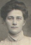
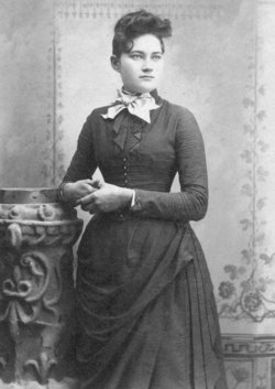
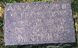
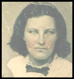
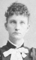
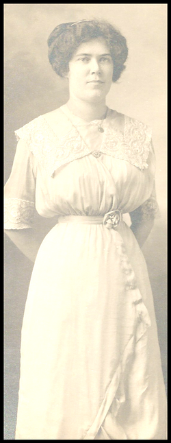
Anna Adell “Della” Goodwin Daddow
| Birth | : | 13 Jun 1870 Horton, Bremer County, Iowa, USA |
| Death | : | 23 Oct 1918 Omaha, Douglas County, Nebraska, USA |
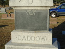
| Burial | : | Bunhill Fields Burial Ground, London Borough of Islington, England |
| Coordinate | : | 51.5236015, -0.0888900 |
| Plot | : | In protestant section |
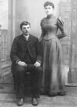
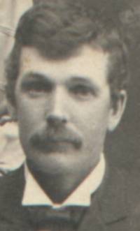
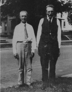
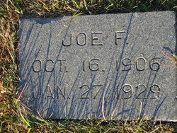
| Description | : | Della and Tom were married March 26, 1890 at Loup City, Sherman County, Nebraska. The official marriage records for Della show her name as Annie D. Goodwin, but other records show her as Anna Adell, called Della. She came to Sherman County, Nebraska with her parents in 1883. Della died in Nebraska Methodist Hospital in Omaha, Nebraska. She was quite ill for many months prior to death. |
frequently asked questions (FAQ):
-
Where is Anna Adell “Della” Goodwin Daddow's memorial?
Anna Adell “Della” Goodwin Daddow's memorial is located at: Bunhill Fields Burial Ground, London Borough of Islington, England.
-
When did Anna Adell “Della” Goodwin Daddow death?
Anna Adell “Della” Goodwin Daddow death on 23 Oct 1918 in Omaha, Douglas County, Nebraska, USA
-
Where are the coordinates of the Anna Adell “Della” Goodwin Daddow's memorial?
Latitude: 51.5236015
Longitude: -0.0888900
Family Members:
Parent

Spouse
Siblings
Children
Flowers:


Nearby Cemetories:
1. Bunhill Fields Burial Ground
London Borough of Islington, England
Coordinate: 51.5236015, -0.0888900
2. Wesleys Chapel
London Borough of Islington, England
Coordinate: 51.5237140, -0.0865760
3. Quaker Gardens
London, City of London, England
Coordinate: 51.5239250, -0.0911890
4. Bunhill Fields Quaker Burying Ground
Islington, London Borough of Islington, England
Coordinate: 51.5239250, -0.0911890
5. St Luke Churchyard
St Luke's, London Borough of Islington, England
Coordinate: 51.5251312, -0.0941940
6. Old Church of St. Mary Moorfields (Defunct)
London, City of London, England
Coordinate: 51.5187890, -0.0857140
7. St. Giles Cripplegate Churchyard
London, City of London, England
Coordinate: 51.5187100, -0.0939510
8. St Mary's Moorfields Churchyard
London, City of London, England
Coordinate: 51.5177280, -0.0858980
9. Holywell Priory
Shoreditch, London Borough of Hackney, England
Coordinate: 51.5238050, -0.0785300
10. Plague Grave At Seward Street And Mount Mills
Clerkenwell, London Borough of Islington, England
Coordinate: 51.5259780, -0.0985880
11. Liverpool Street Station
London, City of London, England
Coordinate: 51.5187870, -0.0814920
12. Charthouse Chapel and Churchyard
City of London, England
Coordinate: 51.5209310, -0.0987080
13. Priory of St. Mary of Bethlehem Cemetery
Bishopsgate, City of London, England
Coordinate: 51.5183640, -0.0818180
14. St Clement with St Barnabas and St Matthew
Finsbury, London Borough of Islington, England
Coordinate: 51.5277700, -0.0977600
15. Charterhouse
London Borough of Islington, England
Coordinate: 51.5213890, -0.0997220
16. All Hallows on the Wall Churchyard
London, City of London, England
Coordinate: 51.5165990, -0.0843330
17. St Mary Aldermanbury Churchyard
London, City of London, England
Coordinate: 51.5164830, -0.0930720
18. St Albans Churchyard (Defunct)
London, City of London, England
Coordinate: 51.5166460, -0.0940880
19. St. Leonard Churchyard
Shoreditch, London Borough of Hackney, England
Coordinate: 51.5268230, -0.0773640
20. Guildhall
London, City of London, England
Coordinate: 51.5158200, -0.0911380
21. St Bartholomew the Great Churchyard
London, City of London, England
Coordinate: 51.5189300, -0.0995360
22. St Botolph Church
Bishopsgate, City of London, England
Coordinate: 51.5167080, -0.0816560
23. St. Botholph without Bishopsgate
Finsbury, London Borough of Islington, England
Coordinate: 51.5166840, -0.0815590
24. Austin Friars Churchyard
Broad Street, City of London, England
Coordinate: 51.5155030, -0.0854620