
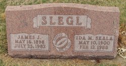
| Birth | : | 16 Nov 1876 Czech Republic |
| Death | : | 19 Apr 1944 Dodge, Dodge County, Nebraska, USA |
| Burial | : | Riverview Cemetery, Saint Joseph, Berrien County, USA |
| Coordinate | : | 42.0657997, -86.4657974 |
| Description | : | According to 1920 US Census, immigration from Bohemia 1880 MRS. EMIL SKALA DIES SUDDENLY Mrs. Emil Skala, 70 was found dead in her bed early Wednesday morning by members of her family, who along with others in the community were extremely shocked and grieved at the sudden loss of a beloved wife, mother and friend. Mrs. Skala had complained of no illness and appeared to be in good health when she retired the night before after having made arrangements for her next days work. Death was attributed to a cerebral hemorrhage. Anna Skala, nee Karnik was born... Read More |
frequently asked questions (FAQ):
-
Where is Anna Belle Karnik Skala's memorial?
Anna Belle Karnik Skala's memorial is located at: Riverview Cemetery, Saint Joseph, Berrien County, USA.
-
When did Anna Belle Karnik Skala death?
Anna Belle Karnik Skala death on 19 Apr 1944 in Dodge, Dodge County, Nebraska, USA
-
Where are the coordinates of the Anna Belle Karnik Skala's memorial?
Latitude: 42.0657997
Longitude: -86.4657974
Family Members:
Parent

Spouse
Siblings
Children
Flowers:


Nearby Cemetories:
1. Riverview Cemetery
Saint Joseph, Berrien County, USA
Coordinate: 42.0657997, -86.4657974
2. Saint Joseph First UMC Memorial Garden
Saint Joseph, Berrien County, USA
Coordinate: 42.0810930, -86.4909620
3. Highland Cemetery
Saint Joseph, Berrien County, USA
Coordinate: 42.0650980, -86.4987150
4. First Congregational Church UCC Memorial Garden
Saint Joseph, Berrien County, USA
Coordinate: 42.0949790, -86.4842940
5. Hickory Bluff Cemetery
Stevensville, Berrien County, USA
Coordinate: 42.0398670, -86.4952000
6. Spring Run Cemetery
Scottdale, Berrien County, USA
Coordinate: 42.0407600, -86.4348526
7. Saint Joseph City Cemetery
Saint Joseph, Berrien County, USA
Coordinate: 42.0960090, -86.4905980
8. Jerome Cemetery
Saint Joseph, Berrien County, USA
Coordinate: 42.0302699, -86.4758279
9. Resurrection Cemetery
Saint Joseph, Berrien County, USA
Coordinate: 42.0975800, -86.4920883
10. Calvary Cemetery
Benton Harbor, Berrien County, USA
Coordinate: 42.0901820, -86.4196160
11. Temple Beth El Memorial Park
Berrien County, USA
Coordinate: 42.0908660, -86.4154530
12. Crystal Springs Cemetery
Benton Harbor, Berrien County, USA
Coordinate: 42.0918999, -86.4150009
13. B'nai Sholom Cemetery
Fair Plain, Berrien County, USA
Coordinate: 42.0938988, -86.4163971
14. Bethel Cemetery
Sodus, Berrien County, USA
Coordinate: 42.0652770, -86.4013880
15. Lincoln Charter Township Cemetery
Stevensville, Berrien County, USA
Coordinate: 42.0271490, -86.5139110
16. Morton Hill Cemetery
Benton Harbor, Berrien County, USA
Coordinate: 42.1194000, -86.4417038
17. Royalton Cemetery
Saint Joseph, Berrien County, USA
Coordinate: 42.0094365, -86.4249946
18. Pearl Cemetery
Benton Township, Berrien County, USA
Coordinate: 42.0905991, -86.3641968
19. Mount Pleasant Cemetery
Sodus Township, Berrien County, USA
Coordinate: 42.0194016, -86.3581009
20. Feather Cemetery
Hinchman, Berrien County, USA
Coordinate: 41.9720955, -86.4356689
21. Ruggles Cemetery
Baroda, Berrien County, USA
Coordinate: 41.9644012, -86.4906006
22. Shanghai Cemetery
Eau Claire, Berrien County, USA
Coordinate: 42.0378100, -86.3299300
23. Salem Cemetery
Oronoko Township, Berrien County, USA
Coordinate: 41.9644012, -86.4278030
24. Shanghai Memorial Cemetery
Eau Claire, Berrien County, USA
Coordinate: 42.0377560, -86.3288930