
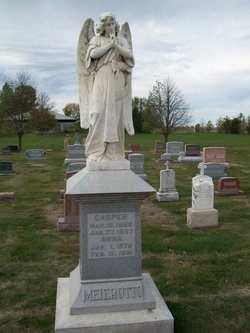

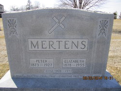
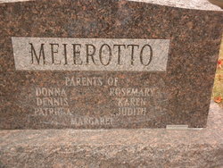
Anna Mertens Meierotto
| Birth | : | 1 Jan 1875 Houghton, Lee County, Iowa, USA |
| Death | : | 12 Feb 1951 Fort Madison, Lee County, Iowa, USA |
| Burial | : | Southfield Cemetery, Southfield, Oakland County, USA |
| Coordinate | : | 42.4749985, -83.2608032 |
| Plot | : | Row 1, Sec 3 |
| Description | : | Mrs. Casper (Anna) Meierotto, a lifelong resident of the Houghton community, died at Sacred Heart hospital, Monday, February 12, at 10:35 a.m., aged 76 years, 1 month and 11 days. Death followed a lingering illness. Mrs. Meierotto was born at Houghton (Ia) on January 1, 1875, and married to Casper Meierotto in St. James church, St. Paul, on April 25, 1899. She was a member of St. John's church, Houghton, and its Altar and Rosary society. Surviving besides the husband are two sons, Alvis Meierotto, Mt. Hamill, and Chris Meierotto, Keokuk; two daughters, Mrs. Raymond J. Rueter and Mrs. Arnold... Read More |
frequently asked questions (FAQ):
-
Where is Anna Mertens Meierotto's memorial?
Anna Mertens Meierotto's memorial is located at: Southfield Cemetery, Southfield, Oakland County, USA.
-
When did Anna Mertens Meierotto death?
Anna Mertens Meierotto death on 12 Feb 1951 in Fort Madison, Lee County, Iowa, USA
-
Where are the coordinates of the Anna Mertens Meierotto's memorial?
Latitude: 42.4749985
Longitude: -83.2608032
Family Members:
Parent
Spouse

Siblings

Children
Flowers:


Nearby Cemetories:
1. Pioneer Cemetery
Southfield, Oakland County, USA
Coordinate: 42.4749140, -83.2603170
2. Southfield Reformed Cemetery
Southfield, Oakland County, USA
Coordinate: 42.4848420, -83.2405580
3. Dun Scotus - Franciscan Catholic Cemetery
Southfield, Oakland County, USA
Coordinate: 42.4609690, -83.2437940
4. Holy Sepulchre Cemetery
Southfield, Oakland County, USA
Coordinate: 42.4813995, -83.3028030
5. Greater Grace Temple of the Apostolic Faith Garden
Detroit, Wayne County, USA
Coordinate: 42.4297295, -83.2711334
6. Saint David Episcopal Church Columbarium
Southfield, Oakland County, USA
Coordinate: 42.5030990, -83.2096400
7. Beekman Cemetery
Southfield, Oakland County, USA
Coordinate: 42.5098076, -83.2176285
8. Mount Hazel Cemetery
Detroit, Wayne County, USA
Coordinate: 42.4253006, -83.2566986
9. Northbrook Presbyterian Church Columbarium
Beverly Hills, Oakland County, USA
Coordinate: 42.5297550, -83.2657280
10. Acacia Park Cemetery
Beverly Hills, Oakland County, USA
Coordinate: 42.5217018, -83.2197037
11. Congregation for Humanistic Judaism Peace Garden
Farmington Hills, Oakland County, USA
Coordinate: 42.4989110, -83.3299670
12. East Farmington Cemetery
Farmington Hills, Oakland County, USA
Coordinate: 42.5003014, -83.3296967
13. Grand Lawn Cemetery
Detroit, Wayne County, USA
Coordinate: 42.4188995, -83.2724991
14. Franklin Cemetery
Franklin, Oakland County, USA
Coordinate: 42.5224991, -83.3059921
15. Nardin Park United Methodist Church Memorial Garde
Farmington Hills, Oakland County, USA
Coordinate: 42.4848680, -83.3414050
16. Saint Mary of Redford Cemetery (Defunct)
Redford, Wayne County, USA
Coordinate: 42.4147600, -83.2531930
17. Franklin Community Church Columbarium
Franklin, Oakland County, USA
Coordinate: 42.5258470, -83.3100450
18. Clarenceville Cemetery
Livonia, Wayne County, USA
Coordinate: 42.4411011, -83.3324966
19. Roseland Park Cemetery
Berkley, Oakland County, USA
Coordinate: 42.5060997, -83.1797028
20. Redford Cemetery
Redford, Wayne County, USA
Coordinate: 42.4063988, -83.2752991
21. Mount Calvary Cemetery
Detroit, Wayne County, USA
Coordinate: 42.4073490, -83.2358180
22. First United Methodist Church Memorial Garden
Birmingham, Oakland County, USA
Coordinate: 42.5454370, -83.2330870
23. Lutheran Church of the Redeemer Columbarium
Birmingham, Oakland County, USA
Coordinate: 42.5463540, -83.2373950
24. First Presbyterian Church Columbarium
Birmingham, Oakland County, USA
Coordinate: 42.5463380, -83.2351040