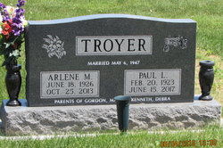
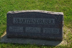
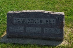
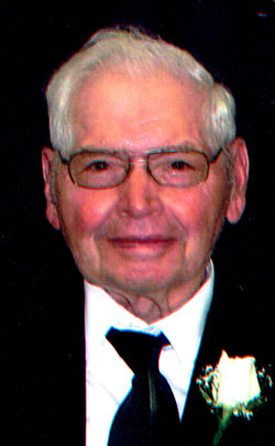
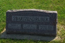
Arlene Mae Swartzendruber Troyer
| Birth | : | 18 Jun 1926 Mount Pleasant, Henry County, Iowa, USA |
| Death | : | 25 Oct 2013 Iowa City, Johnson County, Iowa, USA |
| Burial | : | Lower Deer Creek Cemetery, Johnson County, USA |
| Coordinate | : | 41.5381012, -91.7985992 |
| Description | : | Arlene M. Troyer, 87, of Kalona, died Friday, Oct. 25, 2013, at Mercy Iowa City in Iowa City following a battle with pulmonary fibrosis. A Celebration of Life will be 10 a.m. Tuesday, Oct. 29, at Lower Deer Creek Mennonite Church, rural Kalona, with Pastors Don Patterson and Steve Nelson officiating. Burial will follow in Lower Deer Creek Mennonite Cemetery. Visitation will be Monday, Oct. 28, from 2 to 4 and 5 to 7 p.m. at Peterseim Funeral Home in Kalona. A memorial fund has been established for the Coralville Fire Department, Kalona First Responders and Iowa City Hospice. |
frequently asked questions (FAQ):
-
Where is Arlene Mae Swartzendruber Troyer's memorial?
Arlene Mae Swartzendruber Troyer's memorial is located at: Lower Deer Creek Cemetery, Johnson County, USA.
-
When did Arlene Mae Swartzendruber Troyer death?
Arlene Mae Swartzendruber Troyer death on 25 Oct 2013 in Iowa City, Johnson County, Iowa, USA
-
Where are the coordinates of the Arlene Mae Swartzendruber Troyer's memorial?
Latitude: 41.5381012
Longitude: -91.7985992
Family Members:
Parent
Spouse
Siblings
Flowers:
Nearby Cemetories:
1. Pleasant Hill Cemetery
Johnson County, USA
Coordinate: 41.5346170, -91.7884060
2. Schottler Cemetery
Amish, Johnson County, USA
Coordinate: 41.5348950, -91.8118270
3. Wertz Cemetery
Amish, Johnson County, USA
Coordinate: 41.5486500, -91.7939000
4. Upper Deer Creek Mennonite Church Cemetery
Iowa County, USA
Coordinate: 41.5408300, -91.8398500
5. Brenneman Cemetery
Amish, Johnson County, USA
Coordinate: 41.5166702, -91.7611084
6. West Union Mennonite Cemetery
Parnell, Iowa County, USA
Coordinate: 41.5631866, -91.8408966
7. Bethel Cemetery
Johnson County, USA
Coordinate: 41.5835991, -91.8082962
8. Haven Cemetery
Johnson County, USA
Coordinate: 41.5558080, -91.7320500
9. Angels Rest Cemetery
Washington Township, Johnson County, USA
Coordinate: 41.5896000, -91.7648000
10. Coffman Cemetery
English River Township, Washington County, USA
Coordinate: 41.4889045, -91.7585030
11. Frytown Cemetery
Johnson County, USA
Coordinate: 41.5718000, -91.7355000
12. Wassonville Cemetery
Daytonville, Washington County, USA
Coordinate: 41.4846992, -91.8317032
13. South Gingerich Mennonite Cemetery
Kalona, Washington County, USA
Coordinate: 41.5076294, -91.7227936
14. McArtor Cemetery
Holbrook, Iowa County, USA
Coordinate: 41.5520134, -91.8852692
15. Sharon Bethel Cemetery
Williamstown, Johnson County, USA
Coordinate: 41.5558000, -91.7086000
16. Snider Cemetery
Kalona, Washington County, USA
Coordinate: 41.4997386, -91.7196131
17. East Union Mennonite Cemetery
Sharon Center, Johnson County, USA
Coordinate: 41.5258179, -91.7049484
18. Graper Farm Cemetery
Iowa City, Johnson County, USA
Coordinate: 41.5904360, -91.7317740
19. North Gingerich Sharon Cemetery
Johnson County, USA
Coordinate: 41.5553017, -91.7024994
20. Windham Cemetery
Johnson County, USA
Coordinate: 41.6116982, -91.7667007
21. Wellman Mennonite Cemetery
Wellman, Washington County, USA
Coordinate: 41.4658012, -91.8478012
22. Sharon Hill Cemetery
Kalona, Washington County, USA
Coordinate: 41.4928017, -91.7071991
23. Wellman Cemetery
Wellman, Washington County, USA
Coordinate: 41.4636002, -91.8475037
24. Saint Peters Cemetery
Windham, Johnson County, USA
Coordinate: 41.6091995, -91.7407990

