
| Birth | : | 14 Nov 1854 |
| Death | : | 13 Feb 1941 Poolesville, Montgomery County, Maryland, USA |
| Burial | : | Carlton Cemetery, Nottingham, Nottingham Unitary Authority, England |
| Coordinate | : | 52.9682820, -1.0900230 |
| Plot | : | Row G, Lot 12 Upper, Site 1 |
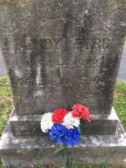
| Description | : | Son of Joseph White and Ann Veirs White Obituary Frederick Post - February 15, 1941 Arthur White, a retired farmer, died at his home in Poolesville, Thursday night at 10 o'clock, aged 86 years, 3 month, 29 days. He was a native of Poolesville but had resided for many years near Adamstown. He was a son of the late Joseph and Ann White and is survived by two brothers, John White, Terre Haute, Ind., and Furr White, Poolesville. The body is at the funeral home in Barnesville where it will remain until time of the funeral Monday morning at 11 o'clock in Monocacy Cemetery chapel,... Read More |
frequently asked questions (FAQ):
-
Where is Arthur White's memorial?
Arthur White's memorial is located at: Carlton Cemetery, Nottingham, Nottingham Unitary Authority, England.
-
When did Arthur White death?
Arthur White death on 13 Feb 1941 in Poolesville, Montgomery County, Maryland, USA
-
Where are the coordinates of the Arthur White's memorial?
Latitude: 52.9682820
Longitude: -1.0900230
Family Members:
Parent

Siblings
Flowers:


Nearby Cemetories:
1. Carlton Cemetery
Nottingham, Nottingham Unitary Authority, England
Coordinate: 52.9682820, -1.0900230
2. All Hallows Churchyard
Gedling, Gedling Borough, England
Coordinate: 52.9769400, -1.0805130
3. Gedling Cemetery
Gedling, Gedling Borough, England
Coordinate: 52.9806930, -1.0870670
4. St. Paul's Churchyard
Nottingham Unitary Authority, England
Coordinate: 52.9667590, -1.1172140
5. St. Luke's Churchyard
Stoke Bardolph, Gedling Borough, England
Coordinate: 52.9659896, -1.0404380
6. St Luke's Churchyard
Stoke Bardolph, Gedling Borough, England
Coordinate: 52.9680500, -1.0389300
7. St. Mary Rest Ground
Nottingham, Nottingham Unitary Authority, England
Coordinate: 52.9568310, -1.1406580
8. National Ice Centre
Nottingham, Nottingham Unitary Authority, England
Coordinate: 52.9527790, -1.1394460
9. St Mary's Burial Grounds
Nottingham, Nottingham Unitary Authority, England
Coordinate: 52.9527860, -1.1419160
10. St Mary Churchyard
Radcliffe-on-Trent, Rushcliffe Borough, England
Coordinate: 52.9464660, -1.0419420
11. Burton Joyce Cemetery
Burton Joyce, Gedling Borough, England
Coordinate: 52.9863100, -1.0370710
12. National Justice Museum High Pavement Nottingham
Nottingham Unitary Authority, England
Coordinate: 52.9510680, -1.1443050
13. Radcliffe-on-Trent Cemetery
Radcliffe-on-Trent, Rushcliffe Borough, England
Coordinate: 52.9459200, -1.0409700
14. St. Helen's Churchyard
Burton Joyce, Gedling Borough, England
Coordinate: 52.9866700, -1.0365400
15. St. John's Carrington Churchyard
Nottingham, Nottingham Unitary Authority, England
Coordinate: 52.9755350, -1.1506790
16. St Peters Church Yard
Nottingham, Nottingham Unitary Authority, England
Coordinate: 52.9522800, -1.1486940
17. Nottingham Church Cemetery
Nottingham, Nottingham Unitary Authority, England
Coordinate: 52.9649830, -1.1558070
18. St Nicholas Churchyard
Nottingham, Nottingham Unitary Authority, England
Coordinate: 52.9504780, -1.1509220
19. Cathedral Church of St. Barnabas
Nottingham, Nottingham Unitary Authority, England
Coordinate: 52.9546750, -1.1570460
20. Nottingham General Cemetery
Nottingham, Nottingham Unitary Authority, England
Coordinate: 52.9575370, -1.1594236
21. St. Giles's Church & Churchyard
West Bridgford, Rushcliffe Borough, England
Coordinate: 52.9316460, -1.1288450
22. General Cemetery
Nottingham, Nottingham Unitary Authority, England
Coordinate: 52.9561430, -1.1615420
23. SS Peter & Paul Churchyard
Shelford, Rushcliffe Borough, England
Coordinate: 52.9745600, -1.0161200
24. Hardy Street Jewish Cemetery
Nottingham, Nottingham Unitary Authority, England
Coordinate: 52.9619500, -1.1665900