
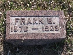
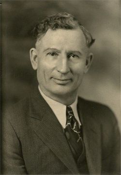
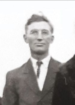
Benjamin Frank “Frank” Smith
| Birth | : | Aug 1876 Logansport, Cass County, Indiana, USA |
| Death | : | 20 Jun 1903 Spink County, South Dakota, USA |
| Burial | : | Howsham Churchyard, Howsham, Ryedale District, England |
| Coordinate | : | 54.0565520, -0.8755670 |
| Description | : | Frank Smith died at the age of 27yrs from a limb amputated. |
frequently asked questions (FAQ):
-
Where is Benjamin Frank “Frank” Smith's memorial?
Benjamin Frank “Frank” Smith's memorial is located at: Howsham Churchyard, Howsham, Ryedale District, England.
-
When did Benjamin Frank “Frank” Smith death?
Benjamin Frank “Frank” Smith death on 20 Jun 1903 in Spink County, South Dakota, USA
-
Where are the coordinates of the Benjamin Frank “Frank” Smith's memorial?
Latitude: 54.0565520
Longitude: -0.8755670
Family Members:
Parent

Siblings
Flowers:


Nearby Cemetories:
1. Howsham Churchyard
Howsham, Ryedale District, England
Coordinate: 54.0565520, -0.8755670
2. St Michael Churchyard
Crambe, Ryedale District, England
Coordinate: 54.0744550, -0.8809390
3. St Peter and St Paul Churchyard
Scrayingham, Ryedale District, England
Coordinate: 54.0342510, -0.8826130
4. St Botolph Churchyard
Bossall, Ryedale District, England
Coordinate: 54.0375570, -0.9047540
5. Kirkham Priory
Kirkham, Ryedale District, England
Coordinate: 54.0826180, -0.8768470
6. St. Mary's Churchyard
Westow, Ryedale District, England
Coordinate: 54.0846190, -0.8406850
7. All Saints Churchyard
Foston, Ryedale District, England
Coordinate: 54.0775719, -0.9331510
8. St John the Evangelist Churchyard
Buttercrambe, Ryedale District, England
Coordinate: 54.0137300, -0.8812900
9. St John the Baptist
Acklam, Ryedale District, England
Coordinate: 54.0451010, -0.8006330
10. St John the Evangelist Churchyard
Welburn (Malton), Ryedale District, England
Coordinate: 54.1008850, -0.8985440
11. Burythorpe Churchyard
Burythorpe, Ryedale District, England
Coordinate: 54.0752951, -0.7955984
12. St Lawrence Churchyard
Flaxton, Ryedale District, England
Coordinate: 54.0508680, -0.9624500
13. St. Margaret's Churchyard
Huttons Ambo, Ryedale District, England
Coordinate: 54.1066490, -0.8490640
14. St. Mary's Churchyard
Sand Hutton, Ryedale District, England
Coordinate: 54.0183800, -0.9410700
15. St Martin Churchyard
Bulmer, Ryedale District, England
Coordinate: 54.0997510, -0.9317700
16. St Andrew Churchyard
Bugthorpe, East Riding of Yorkshire Unitary Authority, England
Coordinate: 54.0108100, -0.8226900
17. Castle Howard Mausoleum
Castle Howard, Ryedale District, England
Coordinate: 54.1173870, -0.8886900
18. St Peter Churchyard
Upper Helmsley, Ryedale District, England
Coordinate: 54.0044650, -0.9409770
19. St Andrew Churchyard
Langton, Ryedale District, England
Coordinate: 54.0934510, -0.7834680
20. St Mary Churchyard
Full Sutton, East Riding of Yorkshire Unitary Authority, England
Coordinate: 53.9897620, -0.8613700
21. All Saints Churchyard
Kirby Underdale, East Riding of Yorkshire Unitary Authority, England
Coordinate: 54.0166200, -0.7677100
22. Coneysthorpe Cemetery
Coneysthorpe, Ryedale District, England
Coordinate: 54.1308750, -0.9042820
23. St Mary Churchyard
Birdsall, Ryedale District, England
Coordinate: 54.0780000, -0.7508000
24. St Helen and the Holy Cross Churchyard
Sheriff Hutton, Ryedale District, England
Coordinate: 54.0882280, -0.9965280