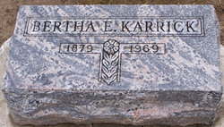
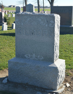
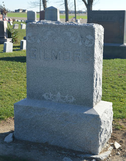
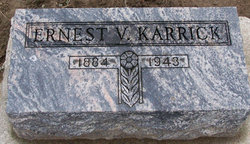
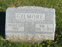
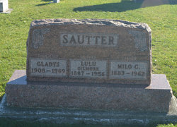
Bertha Gilmore Karrick
| Birth | : | 21 Jul 1879 Ohiopyle, Beaver County, Pennsylvania, USA |
| Death | : | 16 May 1969 Cambridge, Guernsey County, Ohio, USA |
| Burial | : | Faringdon Nonconformist Cemetery, Faringdon, Vale of White Horse District, England |
| Coordinate | : | 51.6576700, -1.5907200 |
| Description | : | Bertha Karrick ADA - Mrs. Bertha Karrick, 89, former Ada resident, died 1:10 p.m. Friday in Cambridge State Hospital, Cambridge, after a long illness. Born July 21, 1879, in Ohio Pyle, Pa., she was the daughter of John and Mary Wable Gilmore. She was married Oct. 17, 1911 to Ernest Karrick. He died May 13, 1943. Mrs. Karrick was a member of United Methodist Church and DAR. Surviving are a daughter, Mrs. Chester Cullen of St. Clairsville; a brother, Ray Gilmore of here and two grandchildren. Services will be 2 p.m. Monday in Preston Funeral Home, Rev. Elford Hoff officiating. Burial will... Read More |
frequently asked questions (FAQ):
-
Where is Bertha Gilmore Karrick's memorial?
Bertha Gilmore Karrick's memorial is located at: Faringdon Nonconformist Cemetery, Faringdon, Vale of White Horse District, England.
-
When did Bertha Gilmore Karrick death?
Bertha Gilmore Karrick death on 16 May 1969 in Cambridge, Guernsey County, Ohio, USA
-
Where are the coordinates of the Bertha Gilmore Karrick's memorial?
Latitude: 51.6576700
Longitude: -1.5907200
Family Members:
Parent
Spouse
Siblings
Children
Flowers:
Nearby Cemetories:
1. Faringdon Nonconformist Cemetery
Faringdon, Vale of White Horse District, England
Coordinate: 51.6576700, -1.5907200
2. All Saints Churchyard
Faringdon, Vale of White Horse District, England
Coordinate: 51.6595730, -1.5839770
3. St. Mary's Churchyard
Little Coxwell, Vale of White Horse District, England
Coordinate: 51.6398280, -1.5941840
4. St. Giles Churchyard
Great Coxwell, Vale of White Horse District, England
Coordinate: 51.6389520, -1.6114148
5. Littleworth Cemetery
Littleworth, Vale of White Horse District, England
Coordinate: 51.6722500, -1.5492500
6. Church of Saint Michael and All Angels
Eaton Hastings, Vale of White Horse District, England
Coordinate: 51.6852000, -1.6212000
7. St John the Evangelist Churchyard
Fernham, Vale of White Horse District, England
Coordinate: 51.6251600, -1.5777100
8. St. Faith Churchyard
Shellingford, Vale of White Horse District, England
Coordinate: 51.6394270, -1.5407780
9. Buscot Park
Faringdon, Vale of White Horse District, England
Coordinate: 51.6684973, -1.6518000
10. St Mary the Virgin Parish Churchyard
Longcot, Vale of White Horse District, England
Coordinate: 51.6146420, -1.6056320
11. All Saints Churchyard
Coleshill, Vale of White Horse District, England
Coordinate: 51.6422960, -1.6611320
12. St. George's Churchyard
Kelmscott, West Oxfordshire District, England
Coordinate: 51.6925550, -1.6408780
13. St George's Parish Church
Hatford, Vale of White Horse District, England
Coordinate: 51.6510000, -1.5120000
14. St Nicholas Churchyard
Baulking, Vale of White Horse District, England
Coordinate: 51.6142910, -1.5431850
15. St Deny's Churchyard
Stanford-in-the-Vale, Vale of White Horse District, England
Coordinate: 51.6399960, -1.5062800
16. St. Mary's Churchyard
Buscot, Vale of White Horse District, England
Coordinate: 51.6815710, -1.6736770
17. St George Roman Catholic Churchyard
Buckland, Vale of White Horse District, England
Coordinate: 51.6804300, -1.5068720
18. St Mary Churchyard
Buckland, Vale of White Horse District, England
Coordinate: 51.6819730, -1.5060150
19. St Mary Churchyard
Uffington, Vale of White Horse District, England
Coordinate: 51.6018480, -1.5649000
20. Watchfield Military Cemetery
Watchfield, Vale of White Horse District, England
Coordinate: 51.6110800, -1.6469400
21. Watchfield Cemetery
Watchfield, Vale of White Horse District, England
Coordinate: 51.6109220, -1.6467980
22. St. Thomas Churchyard
Watchfield, Vale of White Horse District, England
Coordinate: 51.6107409, -1.6468265
23. St. Stephen's Churchyard
Clanfield, West Oxfordshire District, England
Coordinate: 51.7174060, -1.5911740
24. All Saints Church
Pusey, Vale of White Horse District, England
Coordinate: 51.6663890, -1.4801330

