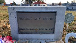
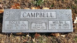
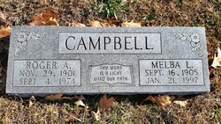
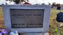
Beverly Ann Campbell Scheid
| Birth | : | 22 Jun 1929 Topeka, Shawnee County, Kansas, USA |
| Death | : | 29 Nov 1976 Kansas, USA |
| Burial | : | Elmwood Cemetery, Cedar Springs, Kent County, USA |
| Coordinate | : | 43.2118988, -85.5532990 |
| Plot | : | Section H |
frequently asked questions (FAQ):
-
Where is Beverly Ann Campbell Scheid's memorial?
Beverly Ann Campbell Scheid's memorial is located at: Elmwood Cemetery, Cedar Springs, Kent County, USA.
-
When did Beverly Ann Campbell Scheid death?
Beverly Ann Campbell Scheid death on 29 Nov 1976 in Kansas, USA
-
Where are the coordinates of the Beverly Ann Campbell Scheid's memorial?
Latitude: 43.2118988
Longitude: -85.5532990
Family Members:
Parent
Spouse
Siblings
Children
Flowers:
Nearby Cemetories:
1. Elmwood Cemetery
Cedar Springs, Kent County, USA
Coordinate: 43.2118988, -85.5532990
2. Punches Cemetery
Cedar Springs, Kent County, USA
Coordinate: 43.2467003, -85.5317001
3. Solon Township Cemetery
Cedar Springs, Kent County, USA
Coordinate: 43.2344589, -85.6100235
4. Saint Mary's Cemetery
Sand Lake, Kent County, USA
Coordinate: 43.2717018, -85.4969025
5. Briggs Family Cemetery
Rockford, Kent County, USA
Coordinate: 43.1391670, -85.5508330
6. East Nelson Cemetery
Cedar Springs, Kent County, USA
Coordinate: 43.2355995, -85.4561005
7. Courtland Township Cemetery
Rockford, Kent County, USA
Coordinate: 43.1521988, -85.4897003
8. Sand Lake Cemetery
Sand Lake, Kent County, USA
Coordinate: 43.2861480, -85.5313380
9. Algoma Township Cemetery
Rockford, Kent County, USA
Coordinate: 43.1563988, -85.6252975
10. Crandall Cemetery
Ensley Center, Newaygo County, USA
Coordinate: 43.2938995, -85.5939026
11. DeGraw Family Cemetery
Cedar Springs, Kent County, USA
Coordinate: 43.2066585, -85.4283281
12. Rockford Pioneer Cemetery
Rockford, Kent County, USA
Coordinate: 43.1177780, -85.5525000
13. Rockford Cemetery
Rockford, Kent County, USA
Coordinate: 43.1152992, -85.5522003
14. Saint Margarets Catholic Cemetery
Spencer Township, Kent County, USA
Coordinate: 43.2063890, -85.4169440
15. Myers Cemetery
Sparta, Kent County, USA
Coordinate: 43.1610985, -85.6857986
16. Horton Cemetery
Oakfield Township, Kent County, USA
Coordinate: 43.1767006, -85.4111023
17. Tower Family Cemetery
Rockford, Kent County, USA
Coordinate: 43.1470280, -85.4219210
18. Fairplains Cemetery
Sparta, Kent County, USA
Coordinate: 43.1528015, -85.6988983
19. White Swan Cemetery
Rockford, Kent County, USA
Coordinate: 43.1474991, -85.4119034
20. Idlewild Cemetery
Kent City, Kent County, USA
Coordinate: 43.2338982, -85.7260971
21. Greenwood Cemetery
Sparta, Kent County, USA
Coordinate: 43.1609764, -85.7163696
22. Pierson Township Cemetery
Pierson, Montcalm County, USA
Coordinate: 43.3381004, -85.5006027
23. Oakfield Cemetery
Rockford, Kent County, USA
Coordinate: 43.1693993, -85.3814011
24. Blythefield Memory Gardens
Belmont, Kent County, USA
Coordinate: 43.0758018, -85.5681000

