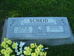
Floyd Milford Scheid
| Birth | : | 13 Jun 1953 Holton, Jackson County, Kansas, USA |
| Death | : | 21 Jan 2008 Holton, Jackson County, Kansas, USA |
| Burial | : | Saint John Lutheran Church Cemetery, Ridgeville Township, Henry County, USA |
| Coordinate | : | 41.4425410, -84.3084650 |
| Plot | : | Section A (west) |
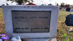
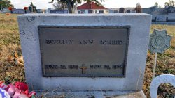
| Description | : | Holton-Floyd Milford Scheid, 54, of Holton, died Monday, January 21, 2008 at his home after an extended illness. He was born June 13, 1953 in Holton, the son of Milford Louis and Beverly Ann Campbell Scheid. He was baptized on July 5, 1953 in the Evangelical Lutheran Church in Holton. Floyd attended Philo (District #7, east of Holton); Larkinburg and Denison Grade Schools; also Denison and Holton High Schools. He had lived in Holton all of his life working in concrete construction. He worked for Sullivan Construction Co. in Holton for 18 years and later worked for Emerson Construction Co.... Read More |
frequently asked questions (FAQ):
-
Where is Floyd Milford Scheid's memorial?
Floyd Milford Scheid's memorial is located at: Saint John Lutheran Church Cemetery, Ridgeville Township, Henry County, USA.
-
When did Floyd Milford Scheid death?
Floyd Milford Scheid death on 21 Jan 2008 in Holton, Jackson County, Kansas, USA
-
Where are the coordinates of the Floyd Milford Scheid's memorial?
Latitude: 41.4425410
Longitude: -84.3084650
Family Members:
Parent
Siblings
Flowers:
Nearby Cemetories:
1. Saint John Lutheran Church Cemetery
Ridgeville Township, Henry County, USA
Coordinate: 41.4425410, -84.3084650
2. Saint Marks Lutheran Cemetery
Defiance, Defiance County, USA
Coordinate: 41.4129240, -84.3257920
3. Locust Grove Cemetery
Ridgeville Corners, Henry County, USA
Coordinate: 41.4389650, -84.2558060
4. Saint Peter Lutheran Cemetery
Ridgeville Township, Henry County, USA
Coordinate: 41.4389000, -84.2549973
5. Zion Cemetery
Williams County, USA
Coordinate: 41.4417000, -84.3628006
6. Zion Lutheran Church Cemetery
Napoleon, Henry County, USA
Coordinate: 41.4414170, -84.2495930
7. Bethlehem Lutheran Cemetery
Defiance County, USA
Coordinate: 41.4050120, -84.2608930
8. Archbold Cemetery
Archbold, Fulton County, USA
Coordinate: 41.5028000, -84.3058014
9. Reform Cemetery
Archbold, Fulton County, USA
Coordinate: 41.5039790, -84.3061070
10. Domersville Cemetery
Defiance, Defiance County, USA
Coordinate: 41.3821983, -84.3244019
11. Battenburg Cemetery
Defiance County, USA
Coordinate: 41.3840010, -84.2748520
12. Evansport Cemetery
Evansport, Defiance County, USA
Coordinate: 41.4075012, -84.3964005
13. Rupp Cemetery
Archbold, Fulton County, USA
Coordinate: 41.5140110, -84.2771370
14. Metz-Tittle Cemetery
Defiance County, USA
Coordinate: 41.3669014, -84.2857971
15. Saint Pauls Cemetery
Napoleon, Henry County, USA
Coordinate: 41.4063290, -84.2163380
16. Saint Michaels Catholic Cemetery
Adams Ridge, Defiance County, USA
Coordinate: 41.3631060, -84.3060610
17. Freedom Township Cemetery
Freedom Township, Henry County, USA
Coordinate: 41.4752970, -84.2069960
18. Poplar Ridge Cemetery
Defiance, Defiance County, USA
Coordinate: 41.3596992, -84.2947006
19. Saint Johns Methodist Cemetery
Defiance County, USA
Coordinate: 41.3878700, -84.3943100
20. Buck Cemetery
Williams County, USA
Coordinate: 41.4272003, -84.4250031
21. Bremer Cemetery
Okolona, Henry County, USA
Coordinate: 41.3863980, -84.2093960
22. Bethlehem Lutheran Cemetery
Defiance County, USA
Coordinate: 41.3702100, -84.2291200
23. Union Chapel Cemetery
Napoleon, Henry County, USA
Coordinate: 41.4166985, -84.1877975
24. Saint Pauls Lutheran Cemetery
Napoleon, Henry County, USA
Coordinate: 41.4061060, -84.1900350


