
Boyd B Schmitter
| Birth | : | 12 Mar 1917 Queen City, Schuyler County, Missouri, USA |
| Death | : | 19 Sep 1987 Ottumwa, Wapello County, Iowa, USA |
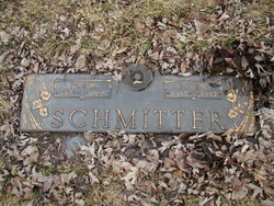
| Burial | : | Memorial Lawn Cemetery, Fairfield, Jefferson County, USA |
| Coordinate | : | 41.0068000, -91.9805000 |
| Plot | : | Devotion B #112 |
| Description | : | Son of Fred Otto Schmitter Sr. and Edith Snowbarger Schmitter. He lived most of his life in the Libertyville community. Schmitter had retired form John Deere where he worked at the Libertyville and Fairfield parts stores. He married Ivas Woodburn, Dec. 31, 1946. She died in November 1985. Surviving are two daughters, Shirley Jo Topping, Birmingham, and Barbara Zimmerman, Des Moines; one son Richard Mitchell, St. Louis, Mo. .... (adapted from Fairfield Ledger obituary, September 21, 1987) Note: this contributor is distantly connected to Edith Pringle Schmitter, who married Boyd's father in 1933. However, if anyone more closely related to... Read More |
frequently asked questions (FAQ):
-
Where is Boyd B Schmitter's memorial?
Boyd B Schmitter's memorial is located at: Memorial Lawn Cemetery, Fairfield, Jefferson County, USA.
-
When did Boyd B Schmitter death?
Boyd B Schmitter death on 19 Sep 1987 in Ottumwa, Wapello County, Iowa, USA
-
Where are the coordinates of the Boyd B Schmitter's memorial?
Latitude: 41.0068000
Longitude: -91.9805000
Family Members:
Parent

Spouse

Siblings
Flowers:


Nearby Cemetories:
1. Memorial Lawn Cemetery
Fairfield, Jefferson County, USA
Coordinate: 41.0068000, -91.9805000
2. Old Fairfield Cemetery
Fairfield, Jefferson County, USA
Coordinate: 41.0148000, -91.9598000
3. Evergreen Cemetery
Fairfield, Jefferson County, USA
Coordinate: 41.0138600, -91.9562100
4. Smith Family Cemetery
Libertyville, Jefferson County, USA
Coordinate: 40.9972416, -92.0362857
5. Roth Cemetery
Fairfield, Jefferson County, USA
Coordinate: 40.9589005, -91.9574966
6. Switzer Cemetery
Fairfield, Jefferson County, USA
Coordinate: 41.0368996, -91.9096985
7. Bradshaw Cemetery
Jefferson County, USA
Coordinate: 40.9766998, -91.9032974
8. Jefferson County Poor Farm Cemetery
Libertyville, Jefferson County, USA
Coordinate: 40.9416900, -91.9996200
9. Moorman Cemetery
Fairfield, Jefferson County, USA
Coordinate: 41.0452995, -92.0622025
10. Gregg Cemetery
Jefferson County, USA
Coordinate: 41.0078011, -92.0811005
11. Bethesda Cemetery
Fairfield, Jefferson County, USA
Coordinate: 41.0019000, -91.8796000
12. McCleary Cemetery
Jefferson County, USA
Coordinate: 40.9892006, -92.0805969
13. Cumberland Cemetery
Jefferson County, USA
Coordinate: 40.9248000, -91.9903000
14. Galliher Cemetery
Glasgow, Jefferson County, USA
Coordinate: 40.9666892, -91.8835038
15. Pattison Cemetery
Fairfield, Jefferson County, USA
Coordinate: 40.9444008, -91.9049988
16. Wheeler Cemetery
Jefferson County, USA
Coordinate: 41.0797000, -91.9185500
17. Brooks Cemetery
Jefferson County, USA
Coordinate: 41.0635986, -92.0693970
18. Koons Cemetery
Locust Grove Township, Jefferson County, USA
Coordinate: 41.0286410, -92.0948960
19. Morgan Burial Plot
Des Moines Township, Jefferson County, USA
Coordinate: 40.9837160, -92.0964340
20. Thompson Cemetery
Jefferson County, USA
Coordinate: 40.9155998, -91.9772034
21. Upper Richwoods Cemetery
Salina, Jefferson County, USA
Coordinate: 41.0602989, -91.8807983
22. Perlee Cemetery
Perlee, Jefferson County, USA
Coordinate: 41.0805750, -91.8993380
23. Wright Cemetery
Fairfield, Jefferson County, USA
Coordinate: 40.9524000, -91.8728000
24. Gantz Cemetery
Abingdon, Jefferson County, USA
Coordinate: 41.0464000, -92.1017000