


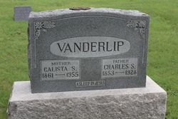

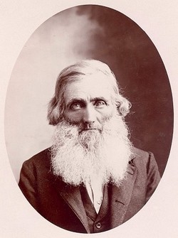
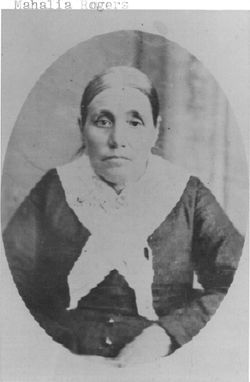
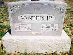
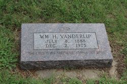
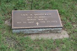
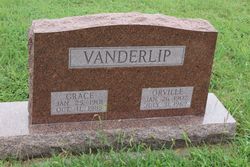
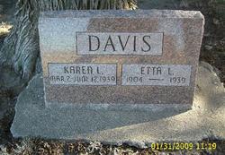
Calista Sarah Rogers Vanderlip
| Birth | : | 8 Oct 1861 Rock Island, Rock Island County, Illinois, USA |
| Death | : | 5 Aug 1955 Rooks County, Kansas, USA |
| Burial | : | San Joaquin Valley National Cemetery, Santa Nella, Merced County, USA |
| Coordinate | : | 37.1198170, -121.0738000 |
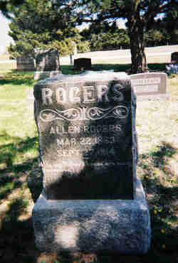
| Description | : | Calista Sarah Rogers was the 6th child and eldest daughter of George Washington Rogers and Mahala Hammond Rogers.in Rock Island,Illinois. They first settled in Washington county and moved to Smith County in 1875 and finally to Ash Rock Community in 1878. In 1870, at age 9,she traveled with her parents and 7 siblings to settle in Kansas in two covered wagons pulled by teams of oxen. She married Charles S. Vanderlip on December 10,1882. She helped to raise two step daughters, Ida and Nellie, as well as 10 of her own children. In 1900,Charles and Calista operated their farm,... Read More |
frequently asked questions (FAQ):
-
Where is Calista Sarah Rogers Vanderlip's memorial?
Calista Sarah Rogers Vanderlip's memorial is located at: San Joaquin Valley National Cemetery, Santa Nella, Merced County, USA.
-
When did Calista Sarah Rogers Vanderlip death?
Calista Sarah Rogers Vanderlip death on 5 Aug 1955 in Rooks County, Kansas, USA
-
Where are the coordinates of the Calista Sarah Rogers Vanderlip's memorial?
Latitude: 37.1198170
Longitude: -121.0738000
Family Members:
Parent
Spouse
Siblings
Children
Flowers:


Nearby Cemetories:
1. San Joaquin Valley National Cemetery
Santa Nella, Merced County, USA
Coordinate: 37.1198170, -121.0738000
2. Cottonwood Cemetery
Gustine, Merced County, USA
Coordinate: 37.1878128, -121.0403900
3. Harper Family Cemetery
Los Banos, Merced County, USA
Coordinate: 37.0215379, -121.1236853
4. Calvary Cemetery
Los Banos, Merced County, USA
Coordinate: 37.0486800, -120.8547000
5. Los Banos Cemetery
Los Banos, Merced County, USA
Coordinate: 37.0470200, -120.8547000
6. Hills Ferry Cemetery
Newman, Stanislaus County, USA
Coordinate: 37.3321991, -121.0496979
7. Stevinson Sunnyside Cemetery
Stevinson, Merced County, USA
Coordinate: 37.3292007, -120.9231033
8. Colonel James J Stevinson Cemetery
Stevinson, Merced County, USA
Coordinate: 37.3572044, -120.9112320
9. South Hilmar Cemetery
Hilmar, Merced County, USA
Coordinate: 37.3802681, -120.8868408
10. North Hilmar Cemetery
Hilmar, Merced County, USA
Coordinate: 37.4146614, -120.8864288
11. Calvary-Sacred Heart Cemetery
Hollister, San Benito County, USA
Coordinate: 36.8483009, -121.3767014
12. Saint Benedicts Columbarium
Hollister, San Benito County, USA
Coordinate: 36.8337440, -121.3667120
13. Dos Palos Cemetery
Dos Palos, Merced County, USA
Coordinate: 36.9831009, -120.6357651
14. Odd Fellows Cemetery
Hollister, San Benito County, USA
Coordinate: 36.8571210, -121.4104100
15. Paul Gerber Memorial Cemetery
Santa Clara County, USA
Coordinate: 37.3637830, -121.4857920
16. Turlock Memorial Park
Turlock, Stanislaus County, USA
Coordinate: 37.4937592, -120.8659821
17. Saint Mary Church Cemetery
Gilroy, Santa Clara County, USA
Coordinate: 37.0155970, -121.5765950
18. Patterson District Cemetery
Patterson, Stanislaus County, USA
Coordinate: 37.5268135, -121.1728287
19. Saint Mary Cemetery
Gilroy, Santa Clara County, USA
Coordinate: 37.0134300, -121.5882000
20. Saint Francis Episcopal Church Columbarium
Turlock, Stanislaus County, USA
Coordinate: 37.5014300, -120.8368400
21. Gavilan Hills Memorial Park
Gilroy, Santa Clara County, USA
Coordinate: 37.0124000, -121.5909200
22. Paicines Cemetery
Paicines, San Benito County, USA
Coordinate: 36.7088580, -121.2456330
23. Winton Cemetery
Winton, Merced County, USA
Coordinate: 37.3820267, -120.6260223
24. Grayson Cemetery
Grayson, Stanislaus County, USA
Coordinate: 37.5594559, -121.1802826