
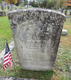
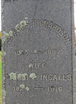
Capt Artemas Richardson
| Birth | : | 17 Feb 1780 Templeton, Worcester County, Massachusetts, USA |
| Death | : | 13 Jun 1844 Oxford County, Maine, USA |
| Burial | : | Union Cemetery, Arnold, Westmoreland County, USA |
| Coordinate | : | 40.5819016, -79.7549973 |
| Inscription | : | ae 64yrs |
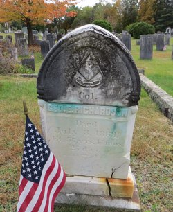
| Description | : | s/o Israel & Elizabeth (Hutchinson) Richardson ----- COD: suicide by hanging ----- [Note: Early in the 19th century Capt. Artemas Richardson, from Massachusetts, settled on Hiram Hill where John Clemons, Jr., settled in 1790. He was for many years one of Hiram's most extensive farmers. His son, Col. George E. Richardson, was one of the leading citizens at Hiram Village. A more complete account of the Richardson Farm may be found in Gideon T. Ridlon's "Deserted Homes in Hiram.] ----- 9/10/2012 - Special thanks to Peter for supplying full birth and death information! |
frequently asked questions (FAQ):
-
Where is Capt Artemas Richardson's memorial?
Capt Artemas Richardson's memorial is located at: Union Cemetery, Arnold, Westmoreland County, USA.
-
When did Capt Artemas Richardson death?
Capt Artemas Richardson death on 13 Jun 1844 in Oxford County, Maine, USA
-
Where are the coordinates of the Capt Artemas Richardson's memorial?
Latitude: 40.5819016
Longitude: -79.7549973
Family Members:
Spouse
Children
Flowers:


Nearby Cemetories:
1. Union Cemetery
Arnold, Westmoreland County, USA
Coordinate: 40.5819016, -79.7549973
2. Ross Cemetery
Lower Burrell, Westmoreland County, USA
Coordinate: 40.5881190, -79.7422660
3. Beth Jacob Congregational Cemetery
New Kensington, Westmoreland County, USA
Coordinate: 40.5928001, -79.7481995
4. Bethel Cemetery
Lower Burrell, Westmoreland County, USA
Coordinate: 40.5891991, -79.7292023
5. Logans Ferry UP Church Cemetery
Parnassus, Westmoreland County, USA
Coordinate: 40.5539080, -79.7591810
6. Prospect Cemetery
Brackenridge, Allegheny County, USA
Coordinate: 40.6102982, -79.7472000
7. Round Hill Cemetery
New Kensington, Westmoreland County, USA
Coordinate: 40.5529060, -79.7620316
8. Dugan Cemetery
Allegheny County, USA
Coordinate: 40.5447006, -79.7339020
9. Puckety UP Church Cemetery
Lower Burrell, Westmoreland County, USA
Coordinate: 40.5787010, -79.6961975
10. Saint Mary Cemetery
Lower Burrell, Westmoreland County, USA
Coordinate: 40.5868988, -79.6964035
11. Morrison Cemetery
Lower Burrell, Westmoreland County, USA
Coordinate: 40.6082500, -79.7003600
12. Burtner Cemetery
Natrona Heights, Allegheny County, USA
Coordinate: 40.6299000, -79.7293000
13. Walter Chapel Cemetery
Cheswick, Allegheny County, USA
Coordinate: 40.5895996, -79.8247986
14. Lefever Family Cemetery
Indiana Township, Allegheny County, USA
Coordinate: 40.5709000, -79.8244000
15. Greenwood Memorial Park
Lower Burrell, Westmoreland County, USA
Coordinate: 40.5957985, -79.6849976
16. Deer Creek Cemetery
Cheswick, Allegheny County, USA
Coordinate: 40.5536003, -79.8182983
17. Saint Joseph Parish Cemetery
Natrona Heights, Allegheny County, USA
Coordinate: 40.6316150, -79.7158960
18. Bethesda Cemetery
Westmoreland County, USA
Coordinate: 40.5833015, -79.6744003
19. Mount Hope Cemetery
Westmoreland County, USA
Coordinate: 40.6166382, -79.6881180
20. Henderson Cemetery
Harmarville, Allegheny County, USA
Coordinate: 40.5447998, -79.8231964
21. Mount Airy Cemetery
Natrona Heights, Allegheny County, USA
Coordinate: 40.6371994, -79.7089005
22. Pet Haven at Mount Airy
Natrona Heights, Allegheny County, USA
Coordinate: 40.6388615, -79.7090183
23. Millerstown Cemetery
Millerstown, Allegheny County, USA
Coordinate: 40.6491013, -79.7982025
24. East Union Church Cemetery
Cheswick, Allegheny County, USA
Coordinate: 40.6096687, -79.8520432