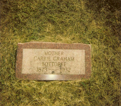
Carrie Graham Bottorff
| Birth | : | 1873 USA |
| Death | : | 1932 Sarpy County, Nebraska, USA |
| Burial | : | Peyton Cemetery, Peyton, El Paso County, USA |
| Coordinate | : | 39.0333710, -104.4878464 |
| Plot | : | Section 76, Row N01 |
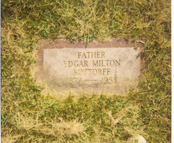
| Description | : | Carrie married Edgar Milton Bottorff, a son of Madison Bottorff and Olive P. Sisson. They were married 1901 in Sarpy County, Nebraska. Carrie and Edgar had children. |
frequently asked questions (FAQ):
-
Where is Carrie Graham Bottorff's memorial?
Carrie Graham Bottorff's memorial is located at: Peyton Cemetery, Peyton, El Paso County, USA.
-
When did Carrie Graham Bottorff death?
Carrie Graham Bottorff death on 1932 in Sarpy County, Nebraska, USA
-
Where are the coordinates of the Carrie Graham Bottorff's memorial?
Latitude: 39.0333710
Longitude: -104.4878464
Family Members:
Spouse
Flowers:
Nearby Cemetories:
1. Peyton Cemetery
Peyton, El Paso County, USA
Coordinate: 39.0333710, -104.4878464
2. Scott Cemetery
Calhan, El Paso County, USA
Coordinate: 38.9980420, -104.4061970
3. Eastonville Cemetery
Eastonville, El Paso County, USA
Coordinate: 39.0161018, -104.6061020
4. Bluff Cemetery
Eastonville, El Paso County, USA
Coordinate: 39.0999985, -104.5849991
5. Bijou Basin Cemetery
Elbert County, USA
Coordinate: 39.1352997, -104.4561005
6. Calhan Cemetery
Calhan, El Paso County, USA
Coordinate: 39.0335236, -104.3128815
7. National Slovak Society Cemetery
Calhan, El Paso County, USA
Coordinate: 39.0703011, -104.3161011
8. Flynn Cemetery
El Paso County, USA
Coordinate: 38.8962000, -104.5241000
9. Lenardt Cemetery
El Paso County, USA
Coordinate: 39.0900000, -104.3004000
10. Black Forest Lutheran Church Columbarium
Black Forest, El Paso County, USA
Coordinate: 39.0118000, -104.6988000
11. James Cemetery
Elbert, Elbert County, USA
Coordinate: 39.1724892, -104.6196976
12. Saint Michaels Cemetery
Calhan, El Paso County, USA
Coordinate: 39.1180500, -104.2928000
13. Saint Mary Cemetery
Calhan, El Paso County, USA
Coordinate: 39.1180500, -104.2924000
14. Table Rock Cemetery
El Paso County, USA
Coordinate: 39.1182000, -104.6855000
15. LaForet Chapel Cemetery
Colorado Springs, El Paso County, USA
Coordinate: 39.0067470, -104.7186140
16. Myers Cemetery
Calhan, El Paso County, USA
Coordinate: 38.9893990, -104.2613983
17. Elbert Cemetery
Elbert, Elbert County, USA
Coordinate: 39.2291603, -104.5360870
18. Saint Benedict Cemetery
El Paso County, USA
Coordinate: 39.0619316, -104.7633133
19. Bethel Lutheran Church Columbarium
Colorado Springs, El Paso County, USA
Coordinate: 38.9070000, -104.7352000
20. Sakala Cemetery
Elbert County, USA
Coordinate: 39.1716995, -104.2482986
21. Spring Valley Cemetery
Douglas County, USA
Coordinate: 39.1592674, -104.7680130
22. Boot Ranch Cemetery
Elbert, Elbert County, USA
Coordinate: 39.2742000, -104.5900000
23. Kiowa Old Cemetery
Kiowa, Elbert County, USA
Coordinate: 39.2962000, -104.5019000
24. Beth-El Mennonite Church Columbarium
Colorado Springs, El Paso County, USA
Coordinate: 38.8989320, -104.7795400


