
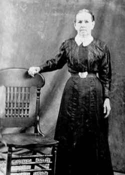


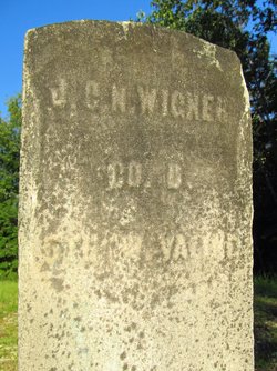
Catharine Gainer Wigner
| Birth | : | 12 Jan 1838 |
| Death | : | 6 Apr 1935 Gilmer County, West Virginia, USA |
| Burial | : | Chestnut Grove Baptist Church Cemetery, Gilmer County, USA |
| Coordinate | : | 38.9340420, -80.9885860 |
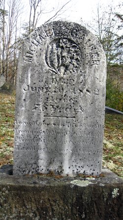
| Description | : | She was a daughter of Mary and Michael Gainer. She married John C. N. Wigner. Records: www.wvculture.org/vrr/va_view.aspx?Id=526656&Type=Death |
frequently asked questions (FAQ):
-
Where is Catharine Gainer Wigner's memorial?
Catharine Gainer Wigner's memorial is located at: Chestnut Grove Baptist Church Cemetery, Gilmer County, USA.
-
When did Catharine Gainer Wigner death?
Catharine Gainer Wigner death on 6 Apr 1935 in Gilmer County, West Virginia, USA
-
Where are the coordinates of the Catharine Gainer Wigner's memorial?
Latitude: 38.9340420
Longitude: -80.9885860
Family Members:
Parent
Spouse
Siblings
Children

Flowers:


Nearby Cemetories:
1. Chestnut Grove Baptist Church Cemetery
Gilmer County, USA
Coordinate: 38.9340420, -80.9885860
2. Ayers Cemetery
Latonia, Gilmer County, USA
Coordinate: 38.9422222, -81.0058333
3. Job's Temple Cemetery
Glenville, Gilmer County, USA
Coordinate: 38.9322220, -80.9618810
4. Bethel-Bennett-Burns Cemetery
Grantsville, Calhoun County, USA
Coordinate: 38.9022000, -81.0153000
5. Trace Fork United Methodist Church Cemetery
Gilmer County, USA
Coordinate: 38.9743580, -81.0005560
6. Three Poplar Cemetery
Glenville, Gilmer County, USA
Coordinate: 38.9628600, -80.9445500
7. Pisgah United Methodist Church Cemetery
De Kalb, Gilmer County, USA
Coordinate: 38.9425160, -80.9219560
8. Riddle Cemetery
Lockney, Gilmer County, USA
Coordinate: 38.8854710, -80.9561810
9. Tanner Baptist Church Cemetery
Gilmer County, USA
Coordinate: 38.9814310, -80.9480630
10. Riddle Cemetery
Hardman, Gilmer County, USA
Coordinate: 38.8961111, -80.9333333
11. Good Shepherd Catholic Cemetery
Tanner, Gilmer County, USA
Coordinate: 38.9811830, -80.9447050
12. Pleasant Hill Cemetery
Grantsville, Calhoun County, USA
Coordinate: 38.9508018, -81.0627975
13. Nobe Cemetery
Nobe, Calhoun County, USA
Coordinate: 38.9813000, -81.0380300
14. Maxwell-Collins Cemetery
Hardman, Gilmer County, USA
Coordinate: 38.9043220, -80.9195185
15. Turner Cemetery
Lockney, Gilmer County, USA
Coordinate: 38.8764000, -80.9555969
16. Johnny Godfrey Cemetery
Lockney, Gilmer County, USA
Coordinate: 38.8755150, -80.9503720
17. Brown Cemetery
Gilmer County, USA
Coordinate: 38.8869070, -80.9272360
18. Cox Cemetery
Normantown, Gilmer County, USA
Coordinate: 38.8953300, -80.9170500
19. Riddle Cemetery
Gilmer County, USA
Coordinate: 38.9547005, -80.9049988
20. Bell Cemetery
Gilmer County, USA
Coordinate: 38.9281006, -80.8933029
21. Snakeroot Cemetery
Gilmer County, USA
Coordinate: 38.8586006, -80.9910965
22. Bethlehem Cemetery
Grantsville, Calhoun County, USA
Coordinate: 38.9124985, -81.0841980
23. Mount Liberty Cemetery
Tanner, Gilmer County, USA
Coordinate: 39.0086390, -80.9616440
24. Bennett Cemetery
Calhoun County, USA
Coordinate: 38.8636017, -81.0314026