
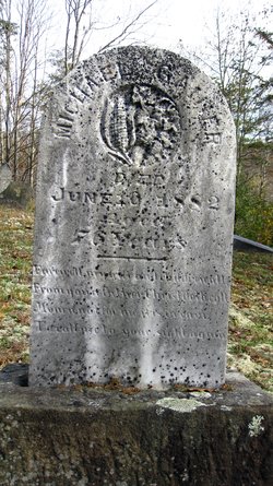
Michael Gainer
| Birth | : | 1806 Barbour County, West Virginia, USA |
| Death | : | 10 Jun 1882 De Kalb, Gilmer County, West Virginia, USA |
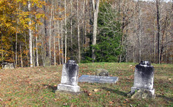
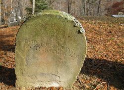
| Burial | : | Chestnut Grove Baptist Church Cemetery, Gilmer County, USA |
| Coordinate | : | 38.9340420, -80.9885860 |
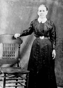
| Description | : | Michael Gainer and Mary Smith (some sources give her surname as Stallman) were married in 1837 by Simeon Harris in Randolph Co, VA (now Barbour Co., WV) according to Randolph County, West Virginia Marriage Records. They relocated from the George's Creek area of Barbour to Tanner Creek in Gilmer County, as did their siblings, parents, and extended families. |
frequently asked questions (FAQ):
-
Where is Michael Gainer's memorial?
Michael Gainer's memorial is located at: Chestnut Grove Baptist Church Cemetery, Gilmer County, USA.
-
When did Michael Gainer death?
Michael Gainer death on 10 Jun 1882 in De Kalb, Gilmer County, West Virginia, USA
-
Where are the coordinates of the Michael Gainer's memorial?
Latitude: 38.9340420
Longitude: -80.9885860
Family Members:
Parent
Spouse
Siblings

Children
Flowers:


Nearby Cemetories:
1. Chestnut Grove Baptist Church Cemetery
Gilmer County, USA
Coordinate: 38.9340420, -80.9885860
2. Ayers Cemetery
Latonia, Gilmer County, USA
Coordinate: 38.9422222, -81.0058333
3. Job's Temple Cemetery
Glenville, Gilmer County, USA
Coordinate: 38.9322220, -80.9618810
4. Bethel-Bennett-Burns Cemetery
Grantsville, Calhoun County, USA
Coordinate: 38.9022000, -81.0153000
5. Trace Fork United Methodist Church Cemetery
Gilmer County, USA
Coordinate: 38.9743580, -81.0005560
6. Three Poplar Cemetery
Glenville, Gilmer County, USA
Coordinate: 38.9628600, -80.9445500
7. Pisgah United Methodist Church Cemetery
De Kalb, Gilmer County, USA
Coordinate: 38.9425160, -80.9219560
8. Riddle Cemetery
Lockney, Gilmer County, USA
Coordinate: 38.8854710, -80.9561810
9. Tanner Baptist Church Cemetery
Gilmer County, USA
Coordinate: 38.9814310, -80.9480630
10. Riddle Cemetery
Hardman, Gilmer County, USA
Coordinate: 38.8961111, -80.9333333
11. Good Shepherd Catholic Cemetery
Tanner, Gilmer County, USA
Coordinate: 38.9811830, -80.9447050
12. Pleasant Hill Cemetery
Grantsville, Calhoun County, USA
Coordinate: 38.9508018, -81.0627975
13. Nobe Cemetery
Nobe, Calhoun County, USA
Coordinate: 38.9813000, -81.0380300
14. Maxwell-Collins Cemetery
Hardman, Gilmer County, USA
Coordinate: 38.9043220, -80.9195185
15. Turner Cemetery
Lockney, Gilmer County, USA
Coordinate: 38.8764000, -80.9555969
16. Johnny Godfrey Cemetery
Lockney, Gilmer County, USA
Coordinate: 38.8755150, -80.9503720
17. Brown Cemetery
Gilmer County, USA
Coordinate: 38.8869070, -80.9272360
18. Cox Cemetery
Normantown, Gilmer County, USA
Coordinate: 38.8953300, -80.9170500
19. Riddle Cemetery
Gilmer County, USA
Coordinate: 38.9547005, -80.9049988
20. Bell Cemetery
Gilmer County, USA
Coordinate: 38.9281006, -80.8933029
21. Snakeroot Cemetery
Gilmer County, USA
Coordinate: 38.8586006, -80.9910965
22. Bethlehem Cemetery
Grantsville, Calhoun County, USA
Coordinate: 38.9124985, -81.0841980
23. Mount Liberty Cemetery
Tanner, Gilmer County, USA
Coordinate: 39.0086390, -80.9616440
24. Bennett Cemetery
Calhoun County, USA
Coordinate: 38.8636017, -81.0314026