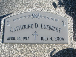
Catherine Dorothy Scharfen Luebbert
| Birth | : | 14 Apr 1917 Boone County, Nebraska, USA |
| Death | : | 4 Jul 2006 West Point, Cuming County, Nebraska, USA |
| Burial | : | Parsons City Cemetery, Parsons, Tucker County, USA |
| Coordinate | : | 39.0894410, -79.6690080 |
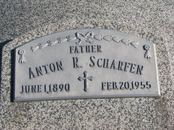
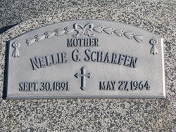
| Description | : | Daughter of Anton and Nellie Rozendal Scharfen. She attended country school District #13 and was a 1935 graduate of Albion High School. Teaching was her chosen profession. She taught at District #23 in Boone County before moving to Cuming County with her parents in 1938, teaching for 3 years at District #68. On June 3, 1941 she married Victor Luebbert at St. Mary's Catholic Church in West Point. Catherine taught school off and on and attended Wayne College to update her teaching certificate. She also farmed with her husband until they retired in 1983 and moved into West Point. In... Read More |
frequently asked questions (FAQ):
-
Where is Catherine Dorothy Scharfen Luebbert's memorial?
Catherine Dorothy Scharfen Luebbert's memorial is located at: Parsons City Cemetery, Parsons, Tucker County, USA.
-
When did Catherine Dorothy Scharfen Luebbert death?
Catherine Dorothy Scharfen Luebbert death on 4 Jul 2006 in West Point, Cuming County, Nebraska, USA
-
Where are the coordinates of the Catherine Dorothy Scharfen Luebbert's memorial?
Latitude: 39.0894410
Longitude: -79.6690080
Family Members:
Parent
Spouse
Children
Flowers:
Nearby Cemetories:
1. Parsons City Cemetery
Parsons, Tucker County, USA
Coordinate: 39.0894410, -79.6690080
2. Goff Memorial Church of the Brethren Cemetery
Hambleton, Tucker County, USA
Coordinate: 39.0826420, -79.6447480
3. Goff Cemetery
Hambleton, Tucker County, USA
Coordinate: 39.0847015, -79.6421967
4. Collett Cemetery
Hambleton, Tucker County, USA
Coordinate: 39.0844002, -79.6410980
5. McNeeley Cemetery
Hendricks, Tucker County, USA
Coordinate: 39.0786018, -79.6378021
6. Fansler Cemetery
Hendricks, Tucker County, USA
Coordinate: 39.0800018, -79.6316986
7. Porterwood Cemetery
Porterwood, Tucker County, USA
Coordinate: 39.0690930, -79.7014900
8. Moore Cemetery
Porterwood, Tucker County, USA
Coordinate: 39.0772750, -79.7108930
9. Bethel Cemetery
Holly Meadows, Tucker County, USA
Coordinate: 39.1363983, -79.6841965
10. Tucker County Poor Farm Cemetery
Holly Meadows, Tucker County, USA
Coordinate: 39.1485980, -79.6655360
11. Mount Zion Cemetery
Saint George, Tucker County, USA
Coordinate: 39.1300583, -79.7348175
12. Sugarlands Brethren Church Cemetery
Thomas, Tucker County, USA
Coordinate: 39.1369170, -79.6102830
13. Irons Chapel Cemetery
Porterwood, Tucker County, USA
Coordinate: 39.0322830, -79.7138850
14. Parsons Family Cemetery
Pleasant Run, Tucker County, USA
Coordinate: 39.0320000, -79.7145000
15. Bonnifield Cemetery
Saint George, Tucker County, USA
Coordinate: 39.1617012, -79.6386032
16. Union Chapel Cemetery
Tucker County, USA
Coordinate: 39.1226040, -79.7756230
17. Harsh Cemetery
Saint George, Tucker County, USA
Coordinate: 39.1197290, -79.7946770
18. Mount Pleasant Cemetery
Saint George, Tucker County, USA
Coordinate: 39.1197590, -79.7947820
19. Jones-Auvil Cemetery
Saint George, Tucker County, USA
Coordinate: 39.1970520, -79.6679160
20. Close Mountain Cemetery
Tucker County, USA
Coordinate: 39.1758200, -79.5716670
21. Hile Cemetery
Tucker County, USA
Coordinate: 39.1946983, -79.6093979
22. Mount Olivet Cemetery
Tucker County, USA
Coordinate: 39.2047005, -79.6442032
23. Clark-Carr Cemetery
Red Creek, Tucker County, USA
Coordinate: 39.0240580, -79.5434710
24. Primitive Baptist Church Cemetery
Montrose, Randolph County, USA
Coordinate: 39.0646330, -79.8187350


