
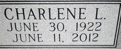
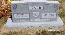
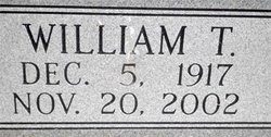
Charlene Lois Strom Garr
| Birth | : | 30 Jun 1922 Morris County, Kansas, USA |
| Death | : | 11 Jun 2012 Cottonwood Falls, Chase County, Kansas, USA |
| Burial | : | Strong Township Cemetery, Strong City, Chase County, USA |
| Coordinate | : | 38.3983002, -96.5222015 |
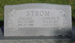
| Description | : | *************************************** Parent info per Contributor #47033251 (Mae) October 20, 2016 *************************************** Charlene L. Garr, age 89, died Monday, June 11, 2012, at the Golden Living Center of Chase County in Cottonwood Falls, KS. A celebration of life service will be held Saturday, June 16, 2012, at 10:00 A.M., at the First Baptist Church in Cottonwood Falls. Pastor Steve Strom will conduct the service. Pastor David Hatch will conduct the committal service at the Strong City Cemetery. Charlene Lois Strom was born June 30, 1922, in Morris County, Kansas to Charley Hugo and Pauline Esther Strom. She attended one room school houses during grade school and went... Read More |
frequently asked questions (FAQ):
-
Where is Charlene Lois Strom Garr's memorial?
Charlene Lois Strom Garr's memorial is located at: Strong Township Cemetery, Strong City, Chase County, USA.
-
When did Charlene Lois Strom Garr death?
Charlene Lois Strom Garr death on 11 Jun 2012 in Cottonwood Falls, Chase County, Kansas, USA
-
Where are the coordinates of the Charlene Lois Strom Garr's memorial?
Latitude: 38.3983002
Longitude: -96.5222015
Family Members:
Parent

Spouse
Siblings
Children
Flowers:


Nearby Cemetories:
1. Strong Township Cemetery
Strong City, Chase County, USA
Coordinate: 38.3983002, -96.5222015
2. Saint Anthony Cemetery
Strong City, Chase County, USA
Coordinate: 38.4056015, -96.5547028
3. Prairie Grove Cemetery
Cottonwood Falls, Chase County, USA
Coordinate: 38.3741989, -96.5639038
4. Simmons Cemetery
Strong City, Chase County, USA
Coordinate: 38.3988991, -96.5849991
5. Miller Cemetery
Cottonwood Falls, Chase County, USA
Coordinate: 38.3471985, -96.4916992
6. McDowall Cemetery
Strong City, Chase County, USA
Coordinate: 38.4059860, -96.6022720
7. Peyton Family Cemetery
Toledo Township, Chase County, USA
Coordinate: 38.3819210, -96.4209340
8. Elmdale Cemetery
Elmdale, Chase County, USA
Coordinate: 38.3778000, -96.6628036
9. Hillside Cemetery
Toledo, Chase County, USA
Coordinate: 38.4305992, -96.3741989
10. Lawless Cemetery
Strong City, Chase County, USA
Coordinate: 38.4496700, -96.6630200
11. Old Quaker Cemetery
Toledo, Chase County, USA
Coordinate: 38.4208100, -96.3693200
12. Bazaar Cemetery
Bazaar, Chase County, USA
Coordinate: 38.2717018, -96.5449982
13. Grandview Cemetery
Plymouth, Lyon County, USA
Coordinate: 38.3838997, -96.3542023
14. Sharps Creek Cemetery
Bazaar, Chase County, USA
Coordinate: 38.2481400, -96.5123400
15. Haworth Cemetery
Plymouth, Lyon County, USA
Coordinate: 38.3804207, -96.3178024
16. Boenitz Cemetery
Elmdale, Chase County, USA
Coordinate: 38.5052986, -96.7016983
17. Diamond Creek Cemetery
Chase County, USA
Coordinate: 38.5071983, -96.7136002
18. Fruitland Cemetery
Americus, Lyon County, USA
Coordinate: 38.5078011, -96.3308029
19. Cottonwood Cemetery
Emporia, Lyon County, USA
Coordinate: 38.4130096, -96.2725525
20. Clements Cemetery
Clements, Chase County, USA
Coordinate: 38.3040900, -96.7438800
21. Pleasant View Cemetery
Council Grove, Morris County, USA
Coordinate: 38.5948000, -96.5880700
22. Elk Cemetery
Elmdale, Chase County, USA
Coordinate: 38.4138985, -96.7844009
23. Four Mile Cemetery
Council Grove, Morris County, USA
Coordinate: 38.6086200, -96.5097000
24. Ice Cemetery
Chase County, USA
Coordinate: 38.2924800, -96.7594600