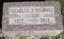
Charles Jesse Nichols
| Birth | : | 9 Jan 1872 Giard, Clayton County, Iowa, USA |
| Death | : | 16 Dec 1954 Waterloo, Black Hawk County, Iowa, USA |
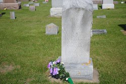
| Burial | : | Giard Cemetery, Farmersburg, Clayton County, USA |
| Coordinate | : | 42.9933014, -91.3080978 |
| Inscription | : | Father |
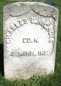
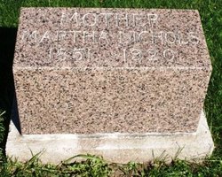
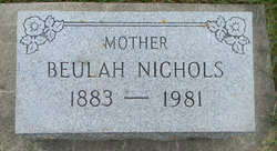
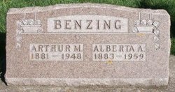
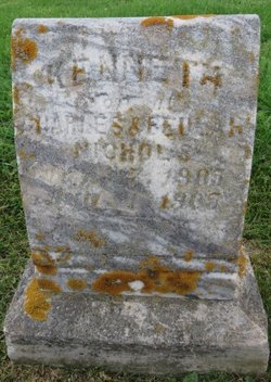
| Description | : | Charles Jesse Nichols, 82, of 1410 W. 2nd St. died Thursday at 5:15 p. m. at Schoitz Memorial Hospital. He was born at Giard Jan. 9, 1872, the son of Dr. Charles E. and Martha J. Snyder Nichols. On Oct. 29, 1892, he married Beulah Lee. They were later divorced. Survivors include two daughters, Mrs. Harvey Miller of Postville and Mrs. Harold Hagedorn of Evansdale; three sons, Leslie of 1410 W. 2nd St. and Glen and Curtis, both of Evansdale; four sisters, Mrs. Zella Klotzbach of Mason City, Mrs. Cora Shinofield of Moline, Ill., Mrs. Alberta Benzing of McGregor and Mrs.... Read More |
frequently asked questions (FAQ):
-
Where is Charles Jesse Nichols's memorial?
Charles Jesse Nichols's memorial is located at: Giard Cemetery, Farmersburg, Clayton County, USA.
-
When did Charles Jesse Nichols death?
Charles Jesse Nichols death on 16 Dec 1954 in Waterloo, Black Hawk County, Iowa, USA
-
Where are the coordinates of the Charles Jesse Nichols's memorial?
Latitude: 42.9933014
Longitude: -91.3080978
Family Members:
Parent
Spouse
Siblings
Children
Flowers:
Nearby Cemetories:
1. Giard Cemetery
Farmersburg, Clayton County, USA
Coordinate: 42.9933014, -91.3080978
2. Bismark Cemetery
Farmersburg, Clayton County, USA
Coordinate: 42.9790000, -91.3500000
3. Railroad Employee Cemetery
Giard, Clayton County, USA
Coordinate: 43.0305395, -91.3140229
4. National Cemetery
National, Clayton County, USA
Coordinate: 42.9536018, -91.2902985
5. Farmersburg-Wagner Cemetery
Farmersburg, Clayton County, USA
Coordinate: 42.9481010, -91.3700027
6. Eastman Cemetery
McGregor, Clayton County, USA
Coordinate: 43.0010000, -91.2190000
7. Saint Wenceslaus Cemetery
McGregor, Clayton County, USA
Coordinate: 43.0593987, -91.3142014
8. Council Hill Cemetery
Monona, Clayton County, USA
Coordinate: 43.0718994, -91.3000031
9. Saint Paul Lutheran Cemetery
Monona, Clayton County, USA
Coordinate: 43.0494385, -91.3847198
10. Saint Patricks Cemetery
Monona, Clayton County, USA
Coordinate: 43.0496000, -91.3850000
11. Monona Cemetery
Monona, Clayton County, USA
Coordinate: 43.0531006, -91.3799973
12. Gooding Cemetery
Wagner Township, Clayton County, USA
Coordinate: 42.9869490, -91.4191570
13. Buell Park Cemetery
Mendon Township, Clayton County, USA
Coordinate: 43.0168226, -91.1999590
14. Moody Cemetery
McGregor, Clayton County, USA
Coordinate: 43.0030594, -91.1886063
15. Pleasant Grove Cemetery
McGregor, Clayton County, USA
Coordinate: 43.0266991, -91.1949997
16. Pioneer Cemetery
Monona, Clayton County, USA
Coordinate: 43.0149994, -91.4274979
17. Walton Cemetery
McGregor, Clayton County, USA
Coordinate: 43.0216270, -91.1909350
18. Knapp Cemetery
McGregor, Clayton County, USA
Coordinate: 43.0635000, -91.2213000
19. Saint Marys Catholic Church Cemetery
McGregor, Clayton County, USA
Coordinate: 43.0213735, -91.1834632
20. First Evangelical Lutheran Church Cemetery
McGregor, Clayton County, USA
Coordinate: 42.9718000, -91.1760000
21. Norwegian Church Cemetery
McGregor, Clayton County, USA
Coordinate: 42.9644400, -91.1764100
22. County Home Cemetery
Clayton Center, Clayton County, USA
Coordinate: 42.8916702, -91.3499985
23. Norway Lutheran Church Cemetery
Saint Olaf, Clayton County, USA
Coordinate: 42.9352798, -91.4302826
24. Baylis Cemetery
McGregor, Clayton County, USA
Coordinate: 43.0633160, -91.1959630

