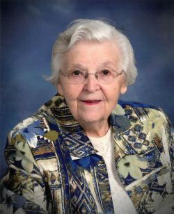
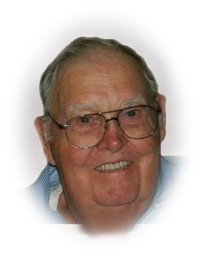
Veryle Irene Nichols Miller
| Birth | : | 10 Sep 1903 Giard, Clayton County, Iowa, USA |
| Death | : | 13 Dec 1996 Postville, Allamakee County, Iowa, USA |
| Burial | : | St. Mary's Churchyard, Capel-le-Ferne, Dover District, England |
| Coordinate | : | 51.1149650, 1.2235540 |
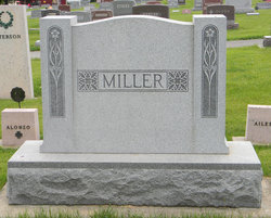
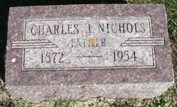
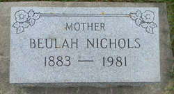
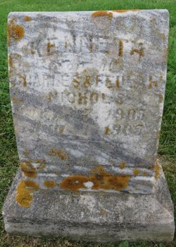
| Description | : | Veryle Miller Veryle Irene Miller was born September 10, 1903 at Giard, Iowa, daughter of Charles and Beulah (Loe) Nichols. She attended the Giard and Luana Schools, graduating in 1922. She also attended two summer session at Iowa State Teachers College, Cedar Falls. She taught rural school in the Luana area and two years at Castalia. Veryle married Harva Miller June 17, 1925 at Caledonia, MN. They kept their marriage a secret for one year as married women could not teach. Two children were born to this union, Jean and Marvin. Harva started farming on the Miller homestead in March... Read More |
frequently asked questions (FAQ):
-
Where is Veryle Irene Nichols Miller's memorial?
Veryle Irene Nichols Miller's memorial is located at: St. Mary's Churchyard, Capel-le-Ferne, Dover District, England.
-
When did Veryle Irene Nichols Miller death?
Veryle Irene Nichols Miller death on 13 Dec 1996 in Postville, Allamakee County, Iowa, USA
-
Where are the coordinates of the Veryle Irene Nichols Miller's memorial?
Latitude: 51.1149650
Longitude: 1.2235540
Family Members:
Parent
Spouse
Siblings
Children
Flowers:
Nearby Cemetories:
1. St. Mary's Churchyard
Capel-le-Ferne, Dover District, England
Coordinate: 51.1149650, 1.2235540
2. St Laurence the Martyr Churchyard
Church Hougham, Dover District, England
Coordinate: 51.1137180, 1.2536650
3. National Battle of Britain Memorial
Capel-le-Ferne, Dover District, England
Coordinate: 51.0984880, 1.2059130
4. St Anthony Churchyard
Alkham, Dover District, England
Coordinate: 51.1360930, 1.2226440
5. St Michael the Archangel Churchyard
Hawkinge, Shepway District, England
Coordinate: 51.1130600, 1.1819210
6. St. Peter's Church Cemetery
Swingfield, Shepway District, England
Coordinate: 51.1464500, 1.1908500
7. Folkestone Friends Burial Ground
Folkestone, Shepway District, England
Coordinate: 51.0825560, 1.1856030
8. St Peter Churchyard
Folkestone, Shepway District, England
Coordinate: 51.0813050, 1.1882080
9. Hawkinge Cemetery and Crematorium
Hawkinge, Shepway District, England
Coordinate: 51.1163710, 1.1578030
10. St John the Baptist Churchyard
Folkestone, Shepway District, England
Coordinate: 51.0858580, 1.1760900
11. St Michael & All Angels Churchyard
Folkestone, Shepway District, England
Coordinate: 51.0821600, 1.1820300
12. Bradstone Baptist Burial Ground
Folkestone, Shepway District, England
Coordinate: 51.0830220, 1.1803570
13. St Peter and St Paul Churchyard
River, Dover District, England
Coordinate: 51.1447480, 1.2733710
14. St. Mary and St. Eanswythe Churchyard
Folkestone, Shepway District, England
Coordinate: 51.0787740, 1.1817510
15. St. Peter and St. Paul's Churchyard
Temple Ewell, Dover District, England
Coordinate: 51.1515565, 1.2675213
16. Christ Church Graveyard
Folkestone, Shepway District, England
Coordinate: 51.0776520, 1.1735470
17. Cheriton Road Cemetery
Folkestone, Shepway District, England
Coordinate: 51.0846000, 1.1615100
18. St Andrew Churchyard
Buckland, Dover District, England
Coordinate: 51.1373749, 1.2937800
19. Saint Mary the Virgin Churchyard
Lydden, Dover District, England
Coordinate: 51.1658200, 1.2373050
20. Holy Trinity Church
Folkestone, Shepway District, England
Coordinate: 51.0767190, 1.1674100
21. Dover Priory (Defunct)
Dover, Dover District, England
Coordinate: 51.1258370, 1.3053770
22. St Peter and St Paul Churchyard
Dover, Dover District, England
Coordinate: 51.1331673, 1.3062360
23. Cowgate Cemetery
Dover, Dover District, England
Coordinate: 51.1237970, 1.3101560
24. Dover War Memorial
Dover, Dover District, England
Coordinate: 51.1277847, 1.3091190


