
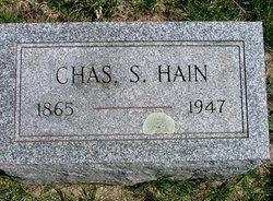

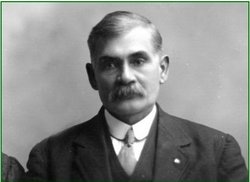
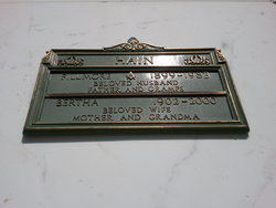
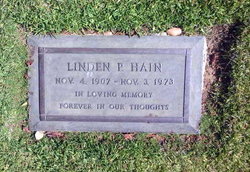
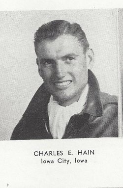
Charles Sterett Hain
| Birth | : | 7 Oct 1865 Cedar County, Iowa, USA |
| Death | : | 12 Jan 1947 Mount Pleasant, Henry County, Iowa, USA |
| Burial | : | Church Stretton Cemetery, Church Stretton, Shropshire Unitary Authority, England |
| Coordinate | : | 52.5365590, -2.8097950 |
frequently asked questions (FAQ):
-
Where is Charles Sterett Hain's memorial?
Charles Sterett Hain's memorial is located at: Church Stretton Cemetery, Church Stretton, Shropshire Unitary Authority, England.
-
When did Charles Sterett Hain death?
Charles Sterett Hain death on 12 Jan 1947 in Mount Pleasant, Henry County, Iowa, USA
-
Where are the coordinates of the Charles Sterett Hain's memorial?
Latitude: 52.5365590
Longitude: -2.8097950
Family Members:
Parent
Spouse

Siblings
Children


Flowers:


Nearby Cemetories:
1. St Laurence Churchyard
Church Stretton, Shropshire Unitary Authority, England
Coordinate: 52.5381750, -2.8087400
2. Greenhills Cemetery
Church Stretton, Shropshire Unitary Authority, England
Coordinate: 52.5310170, -2.8142480
3. St. Andrew's Churchyard
Hope Bowdler, Shropshire Unitary Authority, England
Coordinate: 52.5271160, -2.7739830
4. St Margaret's Churchyard
Acton Scott, Shropshire Unitary Authority, England
Coordinate: 52.5001670, -2.8060920
5. St. James's Churchyard
Cardington, Shropshire Unitary Authority, England
Coordinate: 52.5520200, -2.7296220
6. Eaton- under- Heywood St Edith
Eaton-under-Heywood, Shropshire Unitary Authority, England
Coordinate: 52.5056520, -2.7382880
7. Westhope Chapel Burial Ground
Diddlebury, Shropshire Unitary Authority, England
Coordinate: 52.4714690, -2.7818850
8. St. Edith's Churchyard
Church Pulverbatch, Shropshire Unitary Authority, England
Coordinate: 52.6210550, -2.8436610
9. St. Peter's Churchyard
Diddlebury, Shropshire Unitary Authority, England
Coordinate: 52.4640570, -2.7249740
10. St. Mark's Churchyard
Frodesley, Shropshire Unitary Authority, England
Coordinate: 52.6052775, -2.7166580
11. St Michael Churchyard
Edgton, Shropshire Unitary Authority, England
Coordinate: 52.4660500, -2.9044570
12. St. John the Baptist Churchyard
Church Preen, Shropshire Unitary Authority, England
Coordinate: 52.5792000, -2.6754000
13. St. Thomas' Churchyard
Craven Arms, Shropshire Unitary Authority, England
Coordinate: 52.4450630, -2.8306870
14. St. John’s Churchyard
Condover, Shropshire Unitary Authority, England
Coordinate: 52.6356110, -2.7833220
15. Habberley St Mary's Church
Atcham, Shropshire Unitary Authority, England
Coordinate: 52.6266060, -2.8897140
16. St Peter's Churchyard
Easthope, Shropshire Unitary Authority, England
Coordinate: 52.5522350, -2.6413020
17. Holy Trinity Churchyard
Holdgate, Shropshire Unitary Authority, England
Coordinate: 52.5024450, -2.6471900
18. St. Mary's Churchyard
Acton Burnell, Shropshire Unitary Authority, England
Coordinate: 52.6131390, -2.6907390
19. St Marys Churchyard
Hopesay, Shropshire Unitary Authority, England
Coordinate: 52.4440470, -2.8999020
20. St. John’s Churchyard
Hughley, Shropshire Unitary Authority, England
Coordinate: 52.5774550, -2.6435850
21. All Saints Churchyard
Culmington, Shropshire Unitary Authority, England
Coordinate: 52.4334800, -2.7463500
22. St. Mary & St. Andrew Churchyard
Condover, Shropshire Unitary Authority, England
Coordinate: 52.6474199, -2.7484076
23. St. John The Baptist Churchyard
Kenley, Shropshire Unitary Authority, England
Coordinate: 52.6030460, -2.6469840
24. Holy Trinity Churchyard
Hope, Shropshire Unitary Authority, England
Coordinate: 52.6070670, -2.9747750