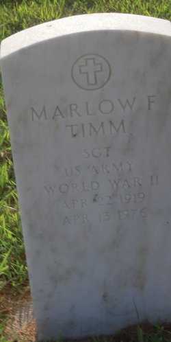
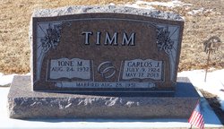
Clara Marie Manske Timm
| Birth | : | 10 Mar 1896 |
| Death | : | 21 Jun 1977 |
| Burial | : | St Andrew Churchyard, Great Cornard, Babergh District, England |
| Coordinate | : | 52.0304820, 0.7602450 |
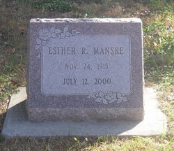
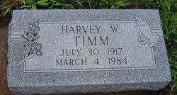
| Description | : | The Lincoln Star, June 23, 1977. Thurs. Page 25, Timm, Clara M. (Widow of Carl W.) Clara M. Timm, 81, Omaha, died Tuesday. Formerly of Ashland and Wann areas. Survivors: sons, Harvey, Carlos, both Omaha; daughters, Mrs. E. E. ( Dorothy) Hudson, Rogers, Ark; Mrs. Mervin (Clara) Davis, Wichita, Kans; brothers, Ernest Manske, Greenwood; Henry Manske, Ashland, sisters, Mrs. Meta Couzens, Ventura, CA; Miss Esther Manske, Wahoo; 15 grandchildren; ten great-grandchildren. Services: 11am United Methodist Church, Ithaca. The Rev. Charles W. Leypoldt. Indian Mound Cemetery, Ithaca. Ericson's - Hult Funeral Home, Wahoo. |
frequently asked questions (FAQ):
-
Where is Clara Marie Manske Timm's memorial?
Clara Marie Manske Timm's memorial is located at: St Andrew Churchyard, Great Cornard, Babergh District, England.
-
When did Clara Marie Manske Timm death?
Clara Marie Manske Timm death on 21 Jun 1977 in
-
Where are the coordinates of the Clara Marie Manske Timm's memorial?
Latitude: 52.0304820
Longitude: 0.7602450
Family Members:
Parent
Spouse
Siblings
Children
Flowers:
Nearby Cemetories:
1. St Andrew Churchyard
Great Cornard, Babergh District, England
Coordinate: 52.0304820, 0.7602450
2. Great Cornard Cemetery
Great Cornard, Babergh District, England
Coordinate: 52.0332410, 0.7450320
3. All Saints Churchyard
Little Cornard, Babergh District, England
Coordinate: 52.0175530, 0.7703720
4. Sudbury Cemetery
Sudbury, Babergh District, England
Coordinate: 52.0389500, 0.7404050
5. St. Mary's Churchyard
Chilton, Babergh District, England
Coordinate: 52.0146121, 0.7541590
6. St Peter Churchyard
Sudbury, Babergh District, England
Coordinate: 52.0386820, 0.7314680
7. Sudbury Blackfriars Priory
Sudbury, Babergh District, England
Coordinate: 52.0357180, 0.7257820
8. All Saints Churchyard
Middleton, Braintree District, England
Coordinate: 52.0238730, 0.7255760
9. All Saints Churchyard
Newton, Babergh District, England
Coordinate: 52.0364000, 0.7966500
10. St Gregory Churchyard
Sudbury, Babergh District, England
Coordinate: 52.0401820, 0.7260000
11. Sudbury Baptist Church
Sudbury, Babergh District, England
Coordinate: 52.0361870, 0.7235530
12. All Saints Churchyard
Sudbury, Babergh District, England
Coordinate: 52.0356470, 0.7232090
13. St. Mary the Virgin Churchyard
Great Henny, Braintree District, England
Coordinate: 52.0073800, 0.7191400
14. St Lawrence Churchyard
Great Waldingfield, Babergh District, England
Coordinate: 52.0606620, 0.7879070
15. World War I Memorial
Assington, Babergh District, England
Coordinate: 52.0138200, 0.8193504
16. St Edmund King and Martyr Churchyard
Assington, Babergh District, England
Coordinate: 52.0138120, 0.8194260
17. All Saints Churchyard
Acton, Babergh District, England
Coordinate: 52.0729650, 0.7598490
18. St Mary the Virgin Churchyard
Edwardstone, Babergh District, England
Coordinate: 52.0435300, 0.8283500
19. St. John the Evangelist Churchyard
Twinstead, Braintree District, England
Coordinate: 51.9974900, 0.7096940
20. St. Andrew's Churchyard
Bulmer, Braintree District, England
Coordinate: 52.0275300, 0.6865600
21. Borley Parish Churchyard
Borley, Braintree District, England
Coordinate: 52.0551490, 0.6932870
22. St Lawrence Churchyard
Little Waldingfield, Babergh District, England
Coordinate: 52.0715620, 0.8059600
23. St. Mary's Church of England
Milton Keynes Borough, England
Coordinate: 52.0769560, 0.7937130
24. Independent Chapel Cemetery
Long Melford, Babergh District, England
Coordinate: 52.0755010, 0.7157700


