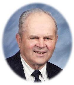
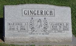
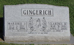
Clarence Dale “Pete” Gingerich
| Birth | : | 31 Mar 1924 |
| Death | : | 7 Apr 2008 |
| Burial | : | East Union Mennonite Cemetery, Sharon Center, Johnson County, USA |
| Coordinate | : | 41.5258179, -91.7049484 |
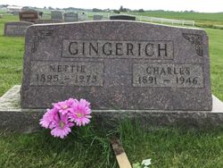
| Description | : | Clarence Dale ‘Pete' Gingerich was born near Kalona, the son of Charles and Nettie Miller Gingerich. He attended rural schools. Clarence was baptized in his youth and was an active member of East Union Mennonite Church. He was united in marriage to Marjorie Rhodes on September 17, 1950. Pete was a lifelong farmer, and especially enjoyed his cattle. He loved spending time with his granddaughters and also enjoyed gardening. He is survived by his wife, Marjorie of Wellman, his son and daughter-in-law, Ed and Mary Lou Gingerich of Parnell, and three granddaughters, Julie and husband Kyle Birky, Ranee and husband Justin... Read More |
frequently asked questions (FAQ):
-
Where is Clarence Dale “Pete” Gingerich's memorial?
Clarence Dale “Pete” Gingerich's memorial is located at: East Union Mennonite Cemetery, Sharon Center, Johnson County, USA.
-
When did Clarence Dale “Pete” Gingerich death?
Clarence Dale “Pete” Gingerich death on 7 Apr 2008 in
-
Where are the coordinates of the Clarence Dale “Pete” Gingerich's memorial?
Latitude: 41.5258179
Longitude: -91.7049484
Family Members:
Parent
Spouse
Siblings
Flowers:
Nearby Cemetories:
1. East Union Mennonite Cemetery
Sharon Center, Johnson County, USA
Coordinate: 41.5258179, -91.7049484
2. Peter Miller Cemetery
Johnson County, USA
Coordinate: 41.5214005, -91.6813965
3. South Gingerich Mennonite Cemetery
Kalona, Washington County, USA
Coordinate: 41.5076294, -91.7227936
4. Fairview Mennonite Cemetery
Johnson County, USA
Coordinate: 41.5396000, -91.6751000
5. Snider Cemetery
Kalona, Washington County, USA
Coordinate: 41.4997386, -91.7196131
6. North Gingerich Sharon Cemetery
Johnson County, USA
Coordinate: 41.5553017, -91.7024994
7. Sharon Bethel Cemetery
Williamstown, Johnson County, USA
Coordinate: 41.5558000, -91.7086000
8. Sharon Hill Cemetery
Kalona, Washington County, USA
Coordinate: 41.4928017, -91.7071991
9. Moses P Miller Cemetery
Kalona, Washington County, USA
Coordinate: 41.4929610, -91.6960140
10. Haven Cemetery
Johnson County, USA
Coordinate: 41.5558080, -91.7320500
11. John Helmuth Cemetery
Sharon Center, Johnson County, USA
Coordinate: 41.5583870, -91.6764660
12. Saint John Lutheran Cemetery
Sharon Center, Johnson County, USA
Coordinate: 41.5542000, -91.6678000
13. Brenneman Cemetery
Amish, Johnson County, USA
Coordinate: 41.5166702, -91.7611084
14. Sharon Center Cemetery
Johnson County, USA
Coordinate: 41.5543000, -91.6555000
15. Middleburg Cemetery
Kalona, Washington County, USA
Coordinate: 41.4907990, -91.6613998
16. Frytown Cemetery
Johnson County, USA
Coordinate: 41.5718000, -91.7355000
17. Sharon Cemetery
Johnson County, USA
Coordinate: 41.5402000, -91.6370000
18. Coffman Cemetery
English River Township, Washington County, USA
Coordinate: 41.4889045, -91.7585030
19. Yoder Family Cemetery
Sharon Center, Johnson County, USA
Coordinate: 41.5666832, -91.6460017
20. Pleasant Hill Cemetery
Johnson County, USA
Coordinate: 41.5346170, -91.7884060
21. Eash Cemetery
Johnson County, USA
Coordinate: 41.5800018, -91.6519012
22. Graper Farm Cemetery
Iowa City, Johnson County, USA
Coordinate: 41.5904360, -91.7317740
23. Shiloh Nutmeg Cemetery
Kalona, Washington County, USA
Coordinate: 41.4581300, -91.7020800
24. Wertz Cemetery
Amish, Johnson County, USA
Coordinate: 41.5486500, -91.7939000

