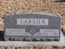
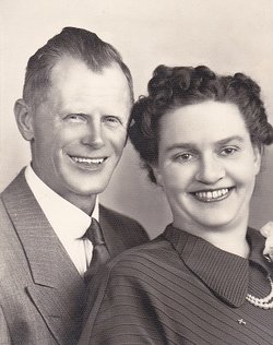
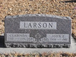
Clarinda Wiberg Larson
| Birth | : | 15 Aug 1911 Union County, South Dakota, USA |
| Death | : | 6 Jul 1976 Vermillion, Clay County, South Dakota, USA |
| Burial | : | Ahlsborg Lutheran Cemetery, Union County, USA |
| Coordinate | : | 42.8228000, -96.7612000 |
| Description | : | John attended Augustana College and worked in the Spink Store with Lincoln Twedt (Myrtle's husband). Myrtle is John's sister. During World War II John worked in the shipyards on the west coast, returning to Spink in 1949. He married Clarinda Wiberg in 1951 and farmed for 25 years. |
frequently asked questions (FAQ):
-
Where is Clarinda Wiberg Larson's memorial?
Clarinda Wiberg Larson's memorial is located at: Ahlsborg Lutheran Cemetery, Union County, USA.
-
When did Clarinda Wiberg Larson death?
Clarinda Wiberg Larson death on 6 Jul 1976 in Vermillion, Clay County, South Dakota, USA
-
Where are the coordinates of the Clarinda Wiberg Larson's memorial?
Latitude: 42.8228000
Longitude: -96.7612000
Family Members:
Parent
Spouse
Flowers:
Nearby Cemetories:
1. Ahlsborg Lutheran Cemetery
Union County, USA
Coordinate: 42.8228000, -96.7612000
2. Brule Creek Cemetery
Spink Township, Union County, USA
Coordinate: 42.8346510, -96.7324350
3. Saint Mary Cemetery
Union County, USA
Coordinate: 42.8520584, -96.7877502
4. Pleasant Hill Cemetery Old
Spink, Union County, USA
Coordinate: 42.8588462, -96.7215592
5. First Brule Creek Cemetery
Elk Point, Union County, USA
Coordinate: 42.7943993, -96.7069016
6. Dowlin Cemetery
Burbank, Clay County, USA
Coordinate: 42.7789001, -96.8107986
7. Union County Poor Farm Cemetery
Union County, USA
Coordinate: 42.7649210, -96.7077580
8. Saint Paul Cemetery
Elk Point, Union County, USA
Coordinate: 42.7641983, -96.7061005
9. Saint Agnes Cemetery
Vermillion, Clay County, USA
Coordinate: 42.7872009, -96.8499985
10. Pleasant Hill Cemetery
Spink, Union County, USA
Coordinate: 42.8741000, -96.6876000
11. Saint Peter Greenfield Cemetery
Vermillion, Clay County, USA
Coordinate: 42.8608017, -96.8644028
12. Richland Cemetery
Richland, Union County, USA
Coordinate: 42.7682991, -96.6624985
13. Gores Bluff Cemetery
Union County, USA
Coordinate: 42.8035069, -96.6260468
14. Olbue Lerseth Cemetery
Beresford, Union County, USA
Coordinate: 42.9281100, -96.7516100
15. Nora Cemetery
Union County, USA
Coordinate: 42.9314003, -96.7061005
16. Roseni Lutheran Church Cemetery
Beresford, Union County, USA
Coordinate: 42.9388000, -96.7639000
17. Bluff View Cemetery
Vermillion, Clay County, USA
Coordinate: 42.7714000, -96.9056000
18. Saint Agnes Calvary Cemetery
Vermillion, Clay County, USA
Coordinate: 42.7715900, -96.9072100
19. Rockfield Cemetery
Clay County, USA
Coordinate: 42.9397011, -96.8302994
20. Clay Point Cemetery
Prairie Center Township, Clay County, USA
Coordinate: 42.8987700, -96.9065600
21. Gibb's Cemetery
Newcastle, Dixon County, USA
Coordinate: 42.6985100, -96.8518400
22. Ionia Cemetery
Newcastle, Dixon County, USA
Coordinate: 42.6893997, -96.8300018
23. Westfield Township Cemetery
Westfield, Plymouth County, USA
Coordinate: 42.7510986, -96.5914001
24. Union Creek Cemetery
Union County, USA
Coordinate: 42.8911018, -96.5863037

