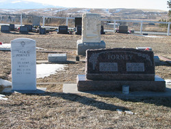
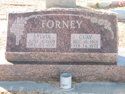
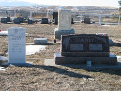
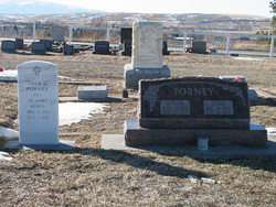
Clay Vallette Forney
| Birth | : | 18 Aug 1901 Park County, Montana, USA |
| Death | : | 14 Feb 1973 Red Lodge, Carbon County, Montana, USA |
| Burial | : | Crawford County Memory Gardens, Crestline, Crawford County, USA |
| Coordinate | : | 40.8081128, -82.8037923 |
| Description | : | Clay V. Forney,l 71, former Livingston resident, died Wednesday in Carbon County Hospiral in Red Lodge. Services will be held Saturday at 2 p.m. in the Olcott Funeral Chapel in Red Lodge. Burial will be in the Roberts Cemetery. Mr. Forney was born August 18, 1901, in Livingston, son of Mr. and Mrs. Robert B. Forney. He spent his early live and received his education in Livingston and moved to Hardin in 1928. He moved to Carbon County in 1927 where he ranched on Willow Creek, seven miles west of Roberts. He had been a cowboy and cattle... Read More |
frequently asked questions (FAQ):
-
Where is Clay Vallette Forney's memorial?
Clay Vallette Forney's memorial is located at: Crawford County Memory Gardens, Crestline, Crawford County, USA.
-
When did Clay Vallette Forney death?
Clay Vallette Forney death on 14 Feb 1973 in Red Lodge, Carbon County, Montana, USA
-
Where are the coordinates of the Clay Vallette Forney's memorial?
Latitude: 40.8081128
Longitude: -82.8037923
Family Members:
Parent
Spouse
Siblings
Children
Nearby Cemetories:
1. Crawford County Memory Gardens
Crestline, Crawford County, USA
Coordinate: 40.8081128, -82.8037923
2. Leesville Cemetery
Crawford County, USA
Coordinate: 40.7942940, -82.7914940
3. Saint Paul Reformed Cemetery
Crawford County, USA
Coordinate: 40.8207880, -82.7859740
4. Biddle Cemetery
Crestline, Crawford County, USA
Coordinate: 40.8272018, -82.8088989
5. Dapper Cemetery
Crawford County, USA
Coordinate: 40.8278008, -82.7891998
6. Gledhill Cemetery
Middletown, Crawford County, USA
Coordinate: 40.7751350, -82.7940420
7. Loss Creek Cemetery
Galion, Crawford County, USA
Coordinate: 40.8445280, -82.8164860
8. Middletown Cemetery
Middletown, Crawford County, USA
Coordinate: 40.7701090, -82.7915850
9. Windfall Cemetery
North Robinson, Crawford County, USA
Coordinate: 40.7696991, -82.8199997
10. Luke Cemetery
Crawford County, USA
Coordinate: 40.8363991, -82.8553009
11. Barnes-Talbot Cemetery
Galion, Crawford County, USA
Coordinate: 40.7698000, -82.7592500
12. Liberty Cemetery
North Robinson, Crawford County, USA
Coordinate: 40.8577995, -82.7821594
13. John Smith Family Farm Cemetery
Galion, Crawford County, USA
Coordinate: 40.7570100, -82.8186320
14. Sandusky Cemetery
Bucyrus, Crawford County, USA
Coordinate: 40.8654728, -82.8175378
15. Fairview Cemetery
Galion, Crawford County, USA
Coordinate: 40.7508908, -82.7793469
16. Mount Calvary Catholic Cemetery
Galion, Crawford County, USA
Coordinate: 40.7498660, -82.7811778
17. Galion Mausoleum
Galion, Crawford County, USA
Coordinate: 40.7490980, -82.7810380
18. Greenlawn Cemetery
East Crestline, Richland County, USA
Coordinate: 40.7850571, -82.7226782
19. Saint Joseph Cemetery
Sandusky Township, Richland County, USA
Coordinate: 40.7871600, -82.7215628
20. Sacred Heart Cemetery
Shelby, Richland County, USA
Coordinate: 40.8384552, -82.7230606
21. Salem Cemetery
North Robinson, Crawford County, USA
Coordinate: 40.7985992, -82.8977966
22. Tustison Cemetery
Dekalb, Crawford County, USA
Coordinate: 40.8787130, -82.8220330
23. Union Green Cemetery
Galion, Crawford County, USA
Coordinate: 40.7359860, -82.7919280
24. Blowers Cemetery
Bucyrus, Crawford County, USA
Coordinate: 40.8282040, -82.8964160


