

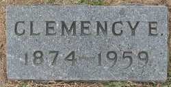
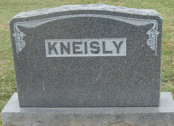
Clemency Elizabeth Roark Kneisly
| Birth | : | 1 Aug 1874 Olean, Miller County, Missouri, USA |
| Death | : | 14 Jan 1959 Enon, Moniteau County, Missouri, USA |
| Burial | : | Olean Cemetery, Olean, Miller County, USA |
| Coordinate | : | 38.4131012, -92.5413971 |
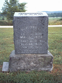
| Description | : | The Sedalia Democrat Sedalia, Missouri 16 Jan 1959 Mrs. Clemency Elizabeth Kneisly, 84, died at 1055 am Wednesday at her farm home two miles south of High Point on Enon RFD Route, where she had resided since 1910. Mrs. Kneisly was born Aug. 1, 1874, in Miller County, daughter of the late Benjamin David Roark and Rachel Margaret Gilleland Roark. On Feb. 23, 1893, she was married to George Blue Kneisly. Nine children were born to them - Roy T. Kneisly, Enon, RFD, Virgie May Kneisly, Myrtle, now Mrs. C.D. Yarnell, Clarksburg, Mrs. Oscar C. (Ruby) Porter, California, Mo., Stanley Kneisly, Long Beach, Calif.,... Read More |
frequently asked questions (FAQ):
-
Where is Clemency Elizabeth Roark Kneisly's memorial?
Clemency Elizabeth Roark Kneisly's memorial is located at: Olean Cemetery, Olean, Miller County, USA.
-
When did Clemency Elizabeth Roark Kneisly death?
Clemency Elizabeth Roark Kneisly death on 14 Jan 1959 in Enon, Moniteau County, Missouri, USA
-
Where are the coordinates of the Clemency Elizabeth Roark Kneisly's memorial?
Latitude: 38.4131012
Longitude: -92.5413971
Family Members:
Parent
Spouse
Siblings
Children


Nearby Cemetories:
1. Olean Cemetery
Olean, Miller County, USA
Coordinate: 38.4131012, -92.5413971
2. Green Ridge Baptist Church Cemetery
Eldon, Miller County, USA
Coordinate: 38.4116200, -92.5645700
3. Etter-Walker Cemetery
Burris Fork, Moniteau County, USA
Coordinate: 38.4333700, -92.5525400
4. Walker Cemetery
Moniteau County, USA
Coordinate: 38.4338989, -92.5522003
5. Farris Cemetery
Moniteau County, USA
Coordinate: 38.4369900, -92.5380000
6. Allen Cemetery
Olean, Miller County, USA
Coordinate: 38.4150009, -92.5008011
7. Jackson Chapel Methodist Church Cemetery
California, Moniteau County, USA
Coordinate: 38.4447900, -92.5286500
8. Gray Cemetery
Moniteau County, USA
Coordinate: 38.4536018, -92.5456009
9. Hite Cemetery
Miller County, USA
Coordinate: 38.4039001, -92.5935974
10. Mount Pleasant Cemetery
Eldon, Miller County, USA
Coordinate: 38.3667700, -92.5300800
11. Salem Cemetery
Saline Township, Miller County, USA
Coordinate: 38.3691232, -92.5697260
12. Salem Cemetery
Eldon, Miller County, USA
Coordinate: 38.3697014, -92.5714035
13. Mount Vernon Cemetery
Eldon, Miller County, USA
Coordinate: 38.3624992, -92.5606003
14. Bruce-Lewis-McGahan Cemetery
Enon, Moniteau County, USA
Coordinate: 38.4667500, -92.5172100
15. Rock Enon Cemetery
Miller County, USA
Coordinate: 38.4668400, -92.5170700
16. Eldon Cemetery
Eldon, Miller County, USA
Coordinate: 38.3642006, -92.5868988
17. Phillips Cemetery
High Point, Moniteau County, USA
Coordinate: 38.4430300, -92.6125300
18. Colburn Cemetery
Eldon, Miller County, USA
Coordinate: 38.4246300, -92.6275500
19. Depp Cemetery
High Point, Moniteau County, USA
Coordinate: 38.4776400, -92.5818500
20. High Point Cemetery
High Point, Moniteau County, USA
Coordinate: 38.4817009, -92.5757980
21. Phillips Cemetery
Barnett, Morgan County, USA
Coordinate: 38.4227982, -92.6367035
22. Matheis Cemetery
Russellville, Cole County, USA
Coordinate: 38.4571800, -92.4491600
23. United Baptist Church Cemetery
High Point, Moniteau County, USA
Coordinate: 38.4962200, -92.5856800
24. Karnes-Carney-Henderson Cemetery
Burris Fork, Moniteau County, USA
Coordinate: 38.4992100, -92.5007510