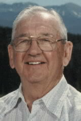
CPL Horace Edward “Howard” Greenwood
| Birth | : | 13 Mar 1926 Emerson, Mills County, Iowa, USA |
| Death | : | 23 Jan 2005 Shenandoah, Page County, Iowa, USA |
| Burial | : | St. Germain Churchyard, Marske-by-the-Sea, Redcar and Cleveland Unitary Authority, England |
| Coordinate | : | 54.5946000, -1.0115200 |
| Plot | : | 2nd Addition #195 |
| Inscription | : | CPL US MARINE CORPS WORLD WAR II |
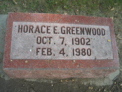
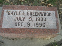
| Description | : | Horace Edward Greenwood, age 79, of Shenandoah formerly of Emerson passed away January 23, 2005 in Shenandoah, Iowa. Ed was born March 13, 1926 in Emerson, IA the son of Horace and Gayle (Cramer) Greenwood. He was a 1944 graduate of Emerson High School and joined the U. S. Marines immediately following graduation. Ed spent his 19th birthday in a foxhole on Iwo Jima. He was honorably discharged in June of 1946. After serving in the Marines, Ed then returned to the family business in Emerson, Greenwood Lumber. He was united in marriage to Ruth Grahn on October 10, 1950... Read More |
frequently asked questions (FAQ):
-
Where is CPL Horace Edward “Howard” Greenwood's memorial?
CPL Horace Edward “Howard” Greenwood's memorial is located at: St. Germain Churchyard, Marske-by-the-Sea, Redcar and Cleveland Unitary Authority, England.
-
When did CPL Horace Edward “Howard” Greenwood death?
CPL Horace Edward “Howard” Greenwood death on 23 Jan 2005 in Shenandoah, Page County, Iowa, USA
-
Where are the coordinates of the CPL Horace Edward “Howard” Greenwood's memorial?
Latitude: 54.5946000
Longitude: -1.0115200
Family Members:
Parent
Spouse
Flowers:
Nearby Cemetories:
1. St. Germain Churchyard
Marske-by-the-Sea, Redcar and Cleveland Unitary Authority, England
Coordinate: 54.5946000, -1.0115200
2. Saltburn by the Sea Cemetery
Saltburn-by-the-Sea, Redcar and Cleveland Unitary Authority, England
Coordinate: 54.5808780, -0.9880640
3. St. Andrew's Old Churchyard
Upleatham, Redcar and Cleveland Unitary Authority, England
Coordinate: 54.5656900, -1.0164700
4. Redcar Cemetery
Redcar, Redcar and Cleveland Unitary Authority, England
Coordinate: 54.6105800, -1.0609200
5. All Saints Old Churchyard
Skelton, Redcar and Cleveland Unitary Authority, England
Coordinate: 54.5623500, -0.9927600
6. St. Peter's Churchyard
Redcar, Redcar and Cleveland Unitary Authority, England
Coordinate: 54.6163250, -1.0594380
7. Kirkleatham Memorial Park and Crematorium
Yearby, Redcar and Cleveland Unitary Authority, England
Coordinate: 54.5866300, -1.0753800
8. Skelton Cemetery
Skelton, Redcar and Cleveland Unitary Authority, England
Coordinate: 54.5604320, -0.9736353
9. St Cuthbert Churchyard
Kirkleatham, Redcar and Cleveland Unitary Authority, England
Coordinate: 54.5881700, -1.0825600
10. Christ Church Churchyard
Coatham, Redcar and Cleveland Unitary Authority, England
Coordinate: 54.6170000, -1.0806600
11. St Margaret of Antioch Churchyard
Brotton, Redcar and Cleveland Unitary Authority, England
Coordinate: 54.5691380, -0.9358330
12. Guisborough Cemetery
Guisborough, Redcar and Cleveland Unitary Authority, England
Coordinate: 54.5448330, -1.0430940
13. St Peter Churchyard
Brotton, Redcar and Cleveland Unitary Authority, England
Coordinate: 54.5679900, -0.9316200
14. Brotton Cemetery
Brotton, Redcar and Cleveland Unitary Authority, England
Coordinate: 54.5670800, -0.9310100
15. Boosbeck Cemetery
Boosbeck, Redcar and Cleveland Unitary Authority, England
Coordinate: 54.5434900, -0.9779200
16. St. Margaret of Antioch Church Cemetery
Brotton, Redcar and Cleveland Unitary Authority, England
Coordinate: 54.5662700, -0.9305900
17. St Aidan Churchyard
Boosbeck, Redcar and Cleveland Unitary Authority, England
Coordinate: 54.5428560, -0.9786800
18. St Cuthbert Churchyard
Wilton, Redcar and Cleveland Unitary Authority, England
Coordinate: 54.5694200, -1.0992400
19. St. Nicholas Churchyard
Guisborough, Redcar and Cleveland Unitary Authority, England
Coordinate: 54.5366500, -1.0482800
20. Guisborough Priory
Guisborough, Redcar and Cleveland Unitary Authority, England
Coordinate: 54.5361700, -1.0489500
21. Quakers Burial Ground
Guisborough, Redcar and Cleveland Unitary Authority, England
Coordinate: 54.5355100, -1.0569760
22. St Helen's
Carlin How, Redcar and Cleveland Unitary Authority, England
Coordinate: 54.5673410, -0.9024120
23. St Leonard Churchyard
Loftus, Redcar and Cleveland Unitary Authority, England
Coordinate: 54.5532560, -0.8855250
24. St Mary Churchyard
Moorsholm, Redcar and Cleveland Unitary Authority, England
Coordinate: 54.5207800, -0.9375800


