
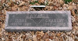
| Birth | : | 11 Jun 1892 Shell Rock, Butler County, Iowa, USA |
| Death | : | 25 Apr 1986 Shell Rock, Butler County, Iowa, USA |
| Burial | : | Lancaster Priory, Lancaster, City of Lancaster, England |
| Coordinate | : | 54.0507360, -2.8057850 |
| Plot | : | Lot 480 |
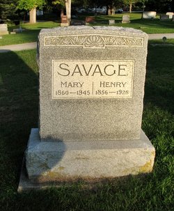
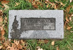
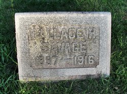
| Description | : | Daughter of Henry Savage & Mary Bowen.She had 5 sisters and 5 brothers. Eva Savage, Evva Savage, Marble Savage, Nettie Savage, Jessie Savage, Charlie Savage, Terry Savage, Ray Savage, Wallace H. Savage, Gary H. Savage. Daisy married Stephen C. Barr on Sep 12, 1912. They had two children Lucille Jeannette Barr Hill, and Henry Wallace Barr. |
frequently asked questions (FAQ):
-
Where is Daisy Fern Savage Barr's memorial?
Daisy Fern Savage Barr's memorial is located at: Lancaster Priory, Lancaster, City of Lancaster, England.
-
When did Daisy Fern Savage Barr death?
Daisy Fern Savage Barr death on 25 Apr 1986 in Shell Rock, Butler County, Iowa, USA
-
Where are the coordinates of the Daisy Fern Savage Barr's memorial?
Latitude: 54.0507360
Longitude: -2.8057850
Family Members:
Parent

Spouse

Siblings
Children
Flowers:


Nearby Cemetories:
1. Lancaster Priory
Lancaster, City of Lancaster, England
Coordinate: 54.0507360, -2.8057850
2. Lancaster Castle Cemetery
Lancaster, City of Lancaster, England
Coordinate: 54.0494330, -2.8047890
3. Friends Meeting House Burial Ground
Lancaster, City of Lancaster, England
Coordinate: 54.0482500, -2.8058025
4. St. John the Evangelist Churchyard
Lancaster, City of Lancaster, England
Coordinate: 54.0504000, -2.7990000
5. Mount Street Congregational Chapel
Lancaster, City of Lancaster, England
Coordinate: 54.0468260, -2.8027430
6. St. Nicholas Street Chapel Churchyard
Lancaster, City of Lancaster, England
Coordinate: 54.0486900, -2.7987900
7. Saint Luke's Parish Churchyard
Skerton, City of Lancaster, England
Coordinate: 54.0564700, -2.7982600
8. Cathedral Cemetery of Lancaster
Lancaster, City of Lancaster, England
Coordinate: 54.0471170, -2.7942920
9. Skerton Cemetery
Lancaster, City of Lancaster, England
Coordinate: 54.0651430, -2.7951140
10. Lancaster and Morecambe Crematorium
Lancaster, City of Lancaster, England
Coordinate: 54.0650890, -2.8198420
11. Lancaster Cemetery
Lancaster, City of Lancaster, England
Coordinate: 54.0504210, -2.7768760
12. Scotforth Cemetery
Scotforth, City of Lancaster, England
Coordinate: 54.0282250, -2.8007170
13. Torrisholme Cemetery
Morecambe, City of Lancaster, England
Coordinate: 54.0638980, -2.8409800
14. St Wilfrid's Churchyard
Halton, City of Lancaster, England
Coordinate: 54.0759400, -2.7672600
15. Slyne Cemetery
Slyne, City of Lancaster, England
Coordinate: 54.0868185, -2.7969423
16. Holy Trinity Church Poulton-le-Sands
Morecambe, City of Lancaster, England
Coordinate: 54.0744769, -2.8569331
17. Morecambe Cemetery
Morecambe, City of Lancaster, England
Coordinate: 54.0759090, -2.8572610
18. St Peter's Churchyard
Quernmore, City of Lancaster, England
Coordinate: 54.0367200, -2.7375400
19. Hale Carr Lane Cemetery
Morecambe, City of Lancaster, England
Coordinate: 54.0520500, -2.8833940
20. Quernmore Methodist Churchyard
Quernmore, City of Lancaster, England
Coordinate: 54.0259440, -2.7361400
21. St. Helen's Churchyard
Overton, City of Lancaster, England
Coordinate: 54.0111620, -2.8552950
22. Christ Church United Reform Church
Bolton-le-Sands, City of Lancaster, England
Coordinate: 54.1015860, -2.7929000
23. Holy Trinity Churchyard
Bolton-le-Sands, City of Lancaster, England
Coordinate: 54.1027700, -2.7911700
24. St John’s Church Graveyard
Ellel, City of Lancaster, England
Coordinate: 53.9990010, -2.7846660