
| Birth | : | 8 Jan 1932 Arkoe, Nodaway County, Missouri, USA |
| Death | : | 17 Nov 2010 Saint Joseph, Buchanan County, Missouri, USA |
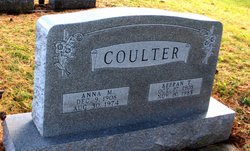
| Burial | : | Saint Joseph Memorial Park, Saint Joseph, Buchanan County, USA |
| Coordinate | : | 39.7796249, -94.7824707 |
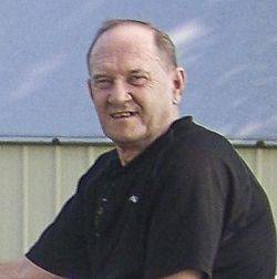
| Description | : | Dale L. Coulter Sr. 1932-2010 Dale L. Coulter Sr., 78, St. Joseph, died Wednesday, November 17, 2010, at his daughter's home. Born January 8, 1932, in Arkoe, Mo., he had been a resident of St. Joseph since 1960. On December 8, 1951, he married Alilda Faye Brewer, who preceded him in death on March 20, 1989. He then married Charlene Ruth Heller on September 16, 1989, who also preceded him in death on July 13, 1998. Mr. Coulter worked as a beef boner and fabricator for Swift & Company for more than 18 years and Seitz for more than 23 years. He loved to fish and hunt.... Read More |
frequently asked questions (FAQ):
-
Where is Dale L Coulter Sr.'s memorial?
Dale L Coulter Sr.'s memorial is located at: Saint Joseph Memorial Park, Saint Joseph, Buchanan County, USA.
-
When did Dale L Coulter Sr. death?
Dale L Coulter Sr. death on 17 Nov 2010 in Saint Joseph, Buchanan County, Missouri, USA
-
Where are the coordinates of the Dale L Coulter Sr.'s memorial?
Latitude: 39.7796249
Longitude: -94.7824707
Family Members:
Parent

Spouse
Siblings

Children
Flowers:


Nearby Cemetories:
1. Saint Joseph Memorial Park
Saint Joseph, Buchanan County, USA
Coordinate: 39.7796249, -94.7824707
2. State Hospital Cemetery
Saint Joseph, Buchanan County, USA
Coordinate: 39.7717209, -94.8067780
3. Mount Auburn Cemetery
Saint Joseph, Buchanan County, USA
Coordinate: 39.7859497, -94.8156281
4. Adath Joseph Cemetery
Saint Joseph, Buchanan County, USA
Coordinate: 39.7860718, -94.8164215
5. Ashland Cemetery
Saint Joseph, Buchanan County, USA
Coordinate: 39.7881813, -94.8218002
6. Shaare Sholem Cemetery
Saint Joseph, Buchanan County, USA
Coordinate: 39.7889404, -94.8234482
7. Leanord Cemetery
Buchanan County, USA
Coordinate: 39.7459989, -94.7832187
8. Ozenberger Cemetery
Buchanan County, USA
Coordinate: 39.8050003, -94.7461014
9. Mount Olivet Cemetery
Saint Joseph, Buchanan County, USA
Coordinate: 39.7953262, -94.8294296
10. Bnai Sholem Cemetery
Buchanan County, USA
Coordinate: 39.8191986, -94.7988968
11. Buchanan County Poor Farm Cemetery
Saint Joseph, Buchanan County, USA
Coordinate: 39.8170160, -94.8113140
12. Mount Mora Cemetery
Saint Joseph, Buchanan County, USA
Coordinate: 39.7743225, -94.8418808
13. Fairview Cumberland Presbyterian Cemetery
Country Club Village, Andrew County, USA
Coordinate: 39.8283005, -94.7857971
14. Courtney Cemetery
Buchanan County, USA
Coordinate: 39.7722015, -94.7136002
15. Maxwell Cemetery
Saint Joseph, Buchanan County, USA
Coordinate: 39.8065948, -94.8490295
16. Sunbridge Cemetery
Saint Joseph, Buchanan County, USA
Coordinate: 39.8053818, -94.8513336
17. Nelson Cemetery
Buchanan County, USA
Coordinate: 39.7201614, -94.8059692
18. Green Valley Cemetery
Andrew County, USA
Coordinate: 39.8211594, -94.8477020
19. Oak Ridge Cemetery
Andrew County, USA
Coordinate: 39.8394012, -94.7444000
20. Todd Cemetery
Country Club Village, Andrew County, USA
Coordinate: 39.8342018, -94.8424988
21. Felix Cemetery
Saint Joseph, Buchanan County, USA
Coordinate: 39.8090330, -94.8673600
22. Blakely Cemetery
Easton, Buchanan County, USA
Coordinate: 39.7407990, -94.7031021
23. Elwood Cemetery
Elwood, Doniphan County, USA
Coordinate: 39.7652300, -94.8760500
24. Samuel Ball Green Cemetery
Andrew County, USA
Coordinate: 39.8264400, -94.8586500