
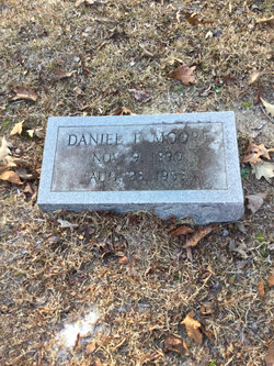
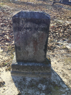
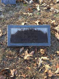
Daniel E. Moore
| Birth | : | 9 Nov 1890 |
| Death | : | 23 Aug 1953 |
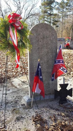
| Burial | : | Mount Carmel Cemetery, Missouri Valley, Harrison County, USA |
| Coordinate | : | 41.5675011, -95.8897018 |
frequently asked questions (FAQ):
-
Where is Daniel E. Moore's memorial?
Daniel E. Moore's memorial is located at: Mount Carmel Cemetery, Missouri Valley, Harrison County, USA.
-
When did Daniel E. Moore death?
Daniel E. Moore death on 23 Aug 1953 in
-
Where are the coordinates of the Daniel E. Moore's memorial?
Latitude: 41.5675011
Longitude: -95.8897018
Family Members:
Parent
Spouse
Siblings
Children

Flowers:


Nearby Cemetories:
1. Mount Carmel Cemetery
Missouri Valley, Harrison County, USA
Coordinate: 41.5675011, -95.8897018
2. Rose Hill Memorial Gardens
Missouri Valley, Harrison County, USA
Coordinate: 41.5656000, -95.8897000
3. Champan Frazier Cemetery
Harrison County, USA
Coordinate: 41.5773500, -95.8933500
4. Hurleys Evergreen Cemetery
Harrison County, USA
Coordinate: 41.5700989, -95.8618698
5. Frazier Cemetery
Missouri Valley, Harrison County, USA
Coordinate: 41.5932999, -95.8375015
6. Oak Grove Cemetery
Missouri Valley, Harrison County, USA
Coordinate: 41.5167007, -95.8649979
7. Calhoun Cemetery
Calhoun, Harrison County, USA
Coordinate: 41.6391983, -95.8938980
8. Branson Cemetery
Loveland, Pottawattamie County, USA
Coordinate: 41.4846992, -95.8606033
9. Linnwood Cemetery
Harrison County, USA
Coordinate: 41.5589200, -95.7502100
10. Crook Cemetery
Honey Creek, Pottawattamie County, USA
Coordinate: 41.4581330, -95.8737000
11. Saint Bridgets Cemetery
Honey Creek, Pottawattamie County, USA
Coordinate: 41.4664001, -95.8289032
12. Logan Cemetery
Logan, Harrison County, USA
Coordinate: 41.6487579, -95.7843170
13. Harris Grove Cemetery
Beebeetown, Harrison County, USA
Coordinate: 41.5782928, -95.7262192
14. Magnolia Cemetery
Magnolia, Harrison County, USA
Coordinate: 41.6903000, -95.8799973
15. Saint Bridgets Cemetery
Magnolia, Harrison County, USA
Coordinate: 41.6915660, -95.8812480
16. Allen Cemetery
Pottawattamie County, USA
Coordinate: 41.4427986, -95.8550034
17. Grange Cemetery
Honey Creek, Pottawattamie County, USA
Coordinate: 41.4446678, -95.8034668
18. Hauger-Rumbaugh Cemetery
Modale, Harrison County, USA
Coordinate: 41.6388797, -96.0502906
19. Silver Hill Cemetery
Harrison County, USA
Coordinate: 41.6897011, -95.7919006
20. Yutesler Cemetery
Harrison County, USA
Coordinate: 41.6684000, -96.0373000
21. Reels Cemetery
Crescent, Pottawattamie County, USA
Coordinate: 41.4234100, -95.8321700
22. Bethel Cemetery
Logan, Harrison County, USA
Coordinate: 41.6239014, -95.6999969
23. Fort Calhoun Cemetery
Fort Calhoun, Washington County, USA
Coordinate: 41.4581375, -96.0352020
24. Greenwood Cemetery
Harrison County, USA
Coordinate: 41.6729660, -95.7257690